File:Provincetown, MA.jpg
Jump to navigation
Jump to search
Size of this preview: 800 × 468 pixels. Other resolutions: 320 × 187 pixels | 640 × 374 pixels | 1,024 × 598 pixels | 1,280 × 748 pixels | 2,560 × 1,496 pixels | 5,722 × 3,344 pixels.
Original file (5,722 × 3,344 pixels, file size: 1.71 MB, MIME type: image/jpeg)
Captions
Captions
Provincetown, MA
Summary[edit]
| Description |
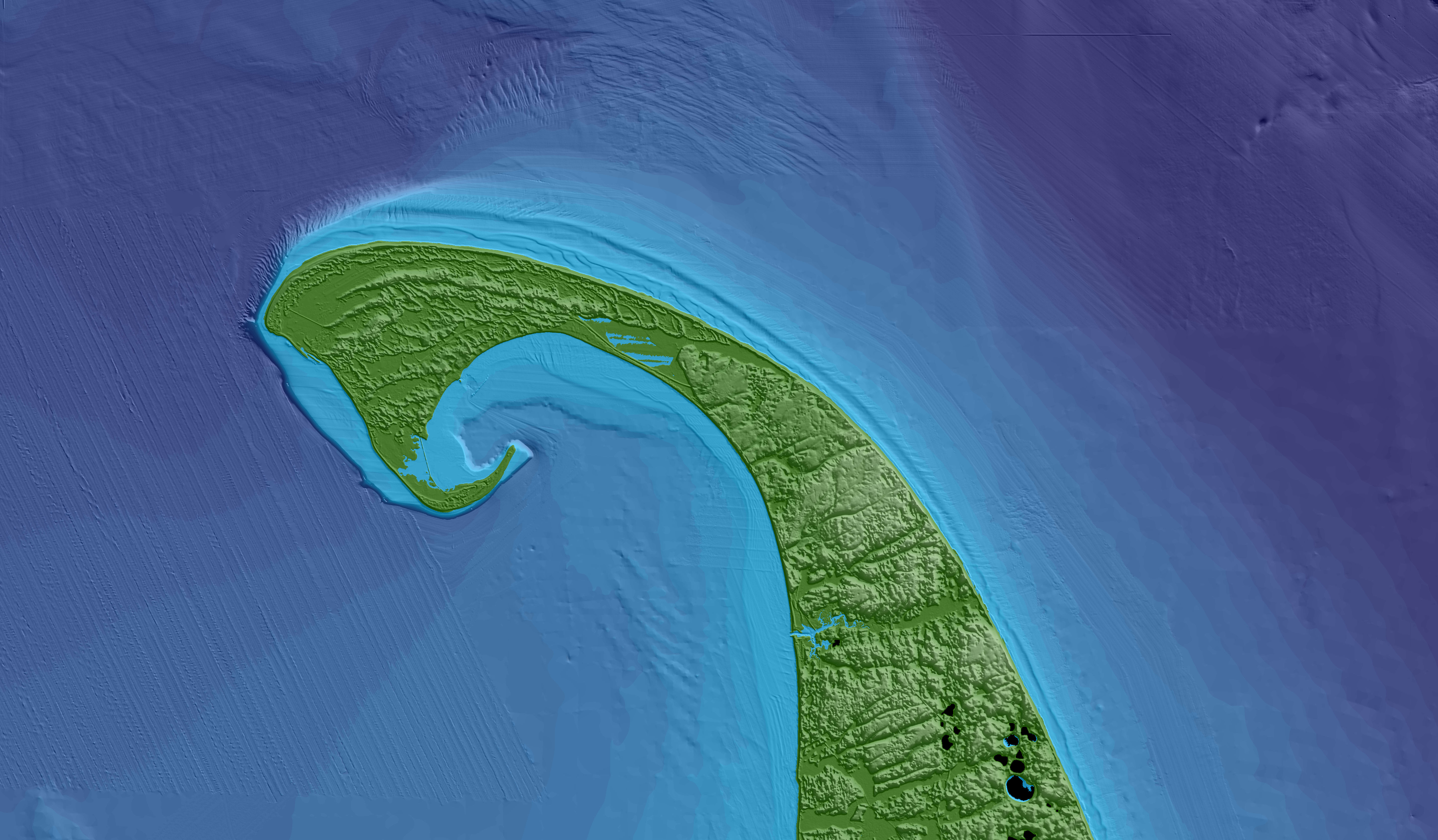
English: This image was created using the Continuous Bathymetry and Elevation Models of the Massachusetts Coastal Zone and Continental Shelf, shows Provincetown, MA and the northern section of the Cape Cod National Seashore. |
| Date | |
| Source | U.S. Geological Survey |
| Author | Brian Andrews, Woods Hole Coastal and Marine Science Center. Public domain. |
Licensing[edit]
This image is in the public domain in the United States because it only contains materials that originally came from the United States Geological Survey, an agency of the United States Department of the Interior. For more information, see the official USGS copyright policy.
|
File history
Click on a date/time to view the file as it appeared at that time.
| Date/Time | Thumbnail | Dimensions | User | Comment | |
|---|---|---|---|---|---|
| current | 22:35, 16 April 2020 | | 5,722 × 3,344 (1.71 MB) | MartinB29 (talk | contribs) | Uploaded a work by Brian Andrews, Woods Hole Coastal and Marine Science Center. Public domain. from [https://www.usgs.gov/media/images/elizabeth-islands-vineyard-sound-and-martha-s-vineyard U.S. Geological Survey] with UploadWizard |
You cannot overwrite this file.
File usage on Commons
The following 2 pages use this file: