File:Przemysl Map WWI.png
跳转到导航
跳转到搜索
本预览的尺寸:800 × 502像素。 其他分辨率:320 × 201像素 | 640 × 402像素 | 1,024 × 643像素 | 1,324 × 831像素。
原始文件 (1,324 × 831像素,文件大小:156 KB,MIME类型:image/png)
说明
说明
添加一行文字以描述该文件所表现的内容
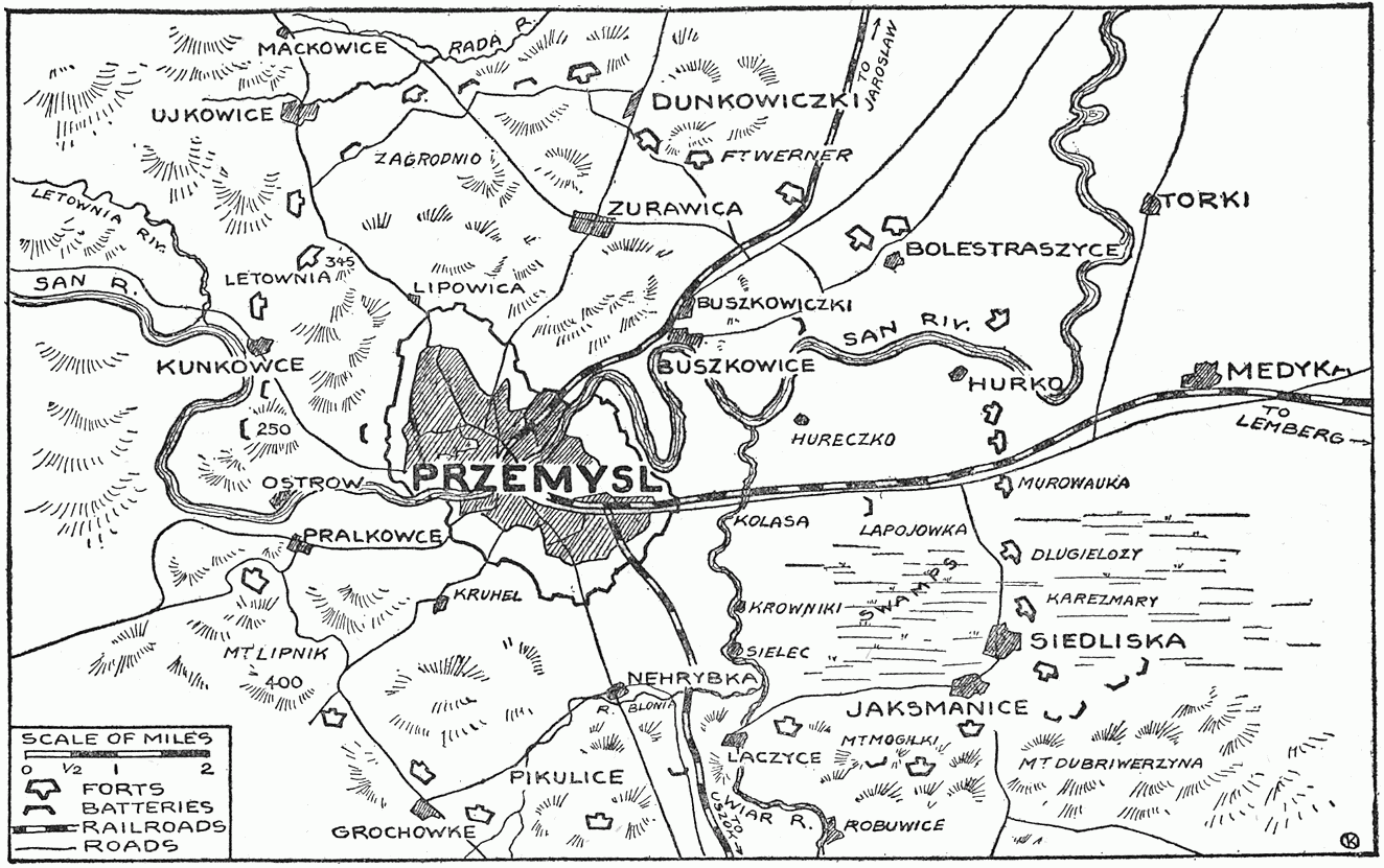
| 描述 | Map showing forts of Przemysl and surroundings, 1914 - 1915 | ||||||
| 日期 | |||||||
| 来源 |
"The Story of the Great War, Volume V (of 12)", published by P. F. COLLIER & SONS, NEW YORK. Downloaded from http://www.gutenberg.org/etext/23861 |
||||||
| 作者 | Francis Trevelyan Miller, Francis J. Reynolds, Allen L. Churchill editors. | ||||||
| 授权 (二次使用本文件) |
|


文件历史
点击某个日期/时间查看对应时刻的文件。
| 日期/时间 | 缩略图 | 大小 | 用户 | 备注 | |
|---|---|---|---|---|---|
| 当前 | 2009年1月2日 (五) 09:24 | | 1,324 × 831(156 KB) | Rcbutcher(留言 | 贡献) | {{Information |Description=Map showing forts of Przemysl and surroundings, 1914 - 1915 |Source="The Story of the Great War, Volume V (of 12)", published by P. F. COLLIER & SONS, NEW YORK. <br>Downloaded from http://www.gutenberg.org/etext/23861 |Date=191 |
您不可以覆盖此文件。
文件用途
没有页面使用本文件。
全域文件用途
以下其他wiki使用此文件:
- be.wikipedia.org上的用途
- cs.wikipedia.org上的用途
- da.wikipedia.org上的用途
- de.wikipedia.org上的用途
- en.wikipedia.org上的用途
- es.wikipedia.org上的用途
- fr.wikipedia.org上的用途
- hu.wikipedia.org上的用途
- ja.wikipedia.org上的用途
- nl.wikipedia.org上的用途
- ro.wikipedia.org上的用途
- ru.wikipedia.org上的用途
- zh.wikipedia.org上的用途