File:Red River, Louisiana Cross Section1.jpg
Jump to navigation
Jump to search

Size of this preview: 488 × 599 pixels. Other resolutions: 195 × 240 pixels | 391 × 480 pixels | 626 × 768 pixels | 834 × 1,024 pixels | 1,669 × 2,048 pixels | 5,487 × 6,734 pixels.
Original file (5,487 × 6,734 pixels, file size: 1.75 MB, MIME type: image/jpeg)
Captions
Captions
Add a one-line explanation of what this file represents
Summary
[edit]
| Description |
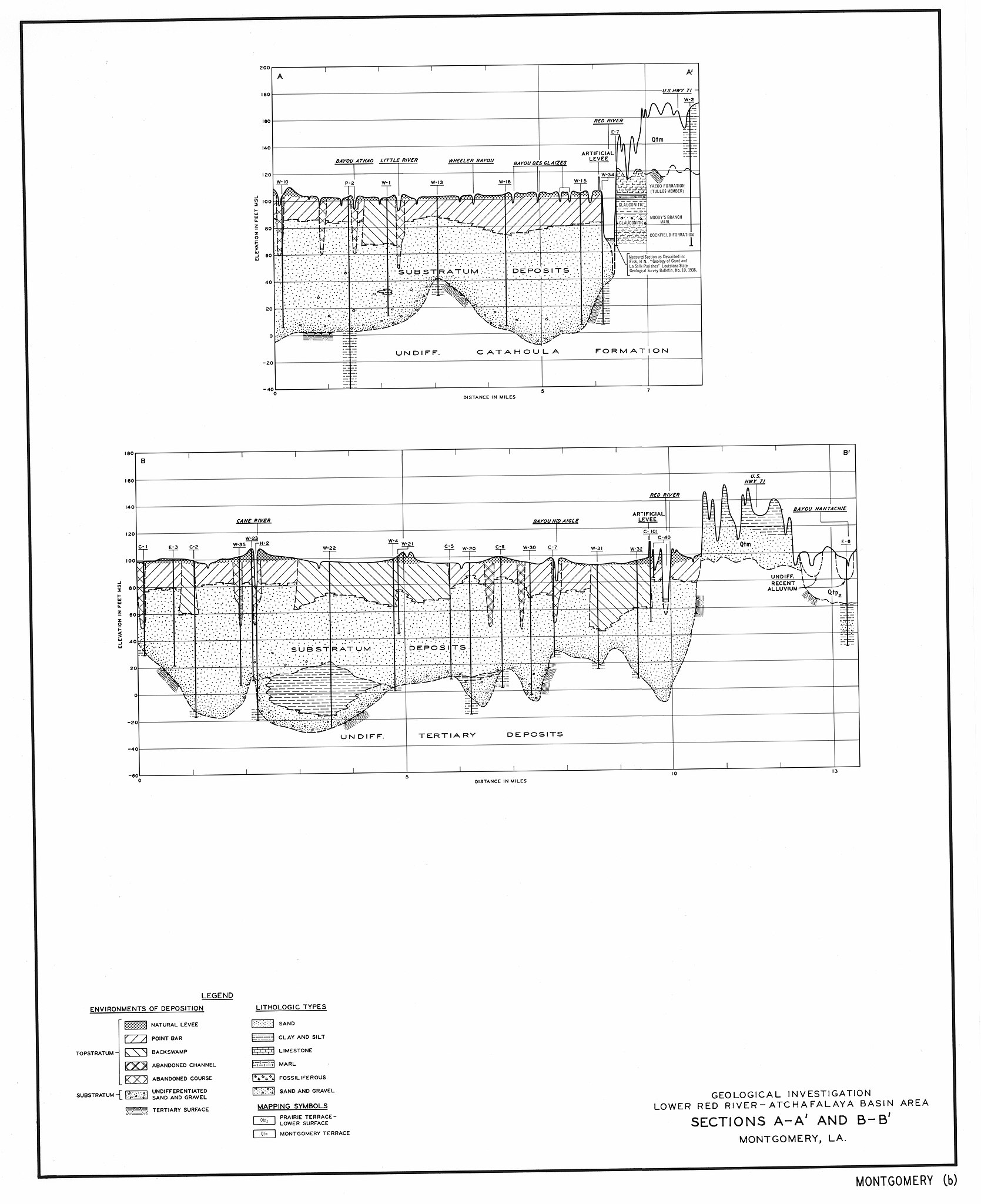
English: Geological section of Red River of the South meander belt deposits within the Montgomery, Louisiana, 15-minute quadrangle.
|
| Date | |
| Source | US Army COE Technical Report No. S-74-5 |
| Author | F. L. Smith and D. P. Russ, |
Licensing
[edit]
This file is a work of a U.S. Army soldier or employee, taken or made as part of that person's official duties. As a work of the U.S. federal government, it is in the public domain in the United States.
|
 |
File history
Click on a date/time to view the file as it appeared at that time.
| Date/Time | Thumbnail | Dimensions | User | Comment | |
|---|---|---|---|---|---|
| current | 16:14, 5 June 2011 | | 5,487 × 6,734 (1.75 MB) | Cristellaria (talk | contribs) |
You cannot overwrite this file.
File usage on Commons
There are no pages that use this file.