File:Relief Map of Germany.svg
ナビゲーションに移動
検索に移動

この SVG ファイルのこの PNG プレビューのサイズ: 506 × 600 ピクセル. その他の解像度: 202 × 240 ピクセル | 405 × 480 ピクセル | 648 × 768 ピクセル | 864 × 1,024 ピクセル | 1,728 × 2,048 ピクセル | 1,073 × 1,272 ピクセル。
元のファイル (SVG ファイル、1,073 × 1,272 ピクセル、ファイルサイズ: 6.54メガバイト)
キャプション
キャプション
このファイルの内容を1行で記述してください
概要[編集]
| 解説 |
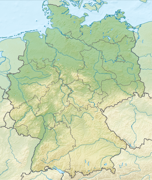
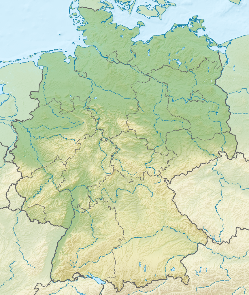
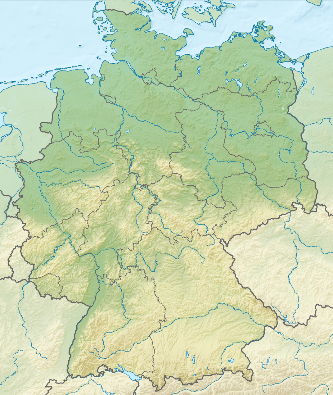
Deutsch: Positionskarte von Deutschland mit Gewässern
Quadratische Plattkarte, N-S-Streckung 150 %. Geographische Begrenzung der Karte:
English: Location map of Germany with waterbodies
Equirectangular projection, N/S stretching 150 %. Geographic limits of the map:
|
| 日付 | |
| 原典 |
投稿者自身による著作物 |
| 作者 |
TUBS |
| その他のバージョン |
Bundesrepublik Deutschland (vor 1990 nur West-Deutschland):
Deutsche Demokratische Republik (mit BRD im Ausschnitt):
Ostdeutschland (vor 1990 Deutsche Demokratische Republik):
Deutschland zwischen Mai 1945 und Oktober 1949:
Thematisch:
Deutsches Reich (1918–1945) (best used with this template (de)):
|
| SVG 開発 |


_23_May_1949_-_6_Oct_1949.svg)


_location_map.svg)
_location_map_2013.svg)


ライセンス[編集]
この作品の著作権者である私は、この作品を以下のライセンスで提供します。
このファイルはクリエイティブ・コモンズ 表示-継承 3.0 非移植ライセンスのもとに利用を許諾されています。
- あなたは以下の条件に従う場合に限り、自由に
- 共有 – 本作品を複製、頒布、展示、実演できます。
- 再構成 – 二次的著作物を作成できます。
- あなたの従うべき条件は以下の通りです。
- 表示 – あなたは適切なクレジットを表示し、ライセンスへのリンクを提供し、変更があったらその旨を示さなければなりません。これらは合理的であればどのような方法で行っても構いませんが、許諾者があなたやあなたの利用行為を支持していると示唆するような方法は除きます。
- 継承 – もしあなたがこの作品をリミックスしたり、改変したり、加工した場合には、あなたはあなたの貢献部分を元の作品とこれと同一または互換性があるライセンスの下に頒布しなければなりません。

|
私は、このメディアファイルがウィキペディアやコモンズの外で使用される場合は、ウィキメディア・コモンズに帰属させることを強く希望します。書籍、新聞、ブログ、ウェブサイトなどの出版物に使用する場合は、こちらに以下の行を入れてください。
|
ファイルの履歴
過去の版のファイルを表示するには、その版の日時をクリックしてください。
| 日付と時刻 | サムネイル | 寸法 | 利用者 | コメント | |
|---|---|---|---|---|---|
| 現在の版 | 2011年12月1日 (木) 14:00 | | 1,073 × 1,272 (6.54メガバイト) | TUBS (トーク | 投稿記録) |
このファイルは上書きできません。
ファイルの使用状況
以下の 43 ページがこのファイルを使用しています:
- Commons:Files used on RegiowikiAT/9
- Commons:Files used on Wikimedia Österreich Mitglieder/2
- File:Deutschland Autobahnen.svg
- File:East-West-Germany-October 1949-July 1952.svg
- File:East Germany location map.svg
- File:Germany, Federal Republic of location map 23 May 1949 - 6 Oct 1949.svg
- File:Germany, Federal Republic of location map April 1952 - August 1955.svg
- File:Germany, Federal Republic of location map December 1950 - April 1952.svg
- File:Germany, Federal Republic of location map January 1957 - October 1990.svg
- File:Germany, Federal Republic of location map October 1949 - November 1950.svg
- File:Germany, Federal Republic of location map September 1955 - December 1956.svg
- File:Germany, German Democratic Republic location map January 1957 - October 1990.svg
- File:Germany, German Democratic Republic location map July 1952 - January 1957.svg
- File:Germany, German Democratic Republic location map October 1949 - July 1952.svg
- File:Germany, German Democratic Republic location map w·o FRG July 1952 - October 1990.svg
- File:Germany, German Democratic Republic location map w·o FRG October 1949 - June 1952.svg
- File:Germany, location map (SBZ perspective) 23 May 1949 - 6 Oct 1949.svg
- File:Germany2 location map.svg
- File:Germany location map.svg
- File:Germany location map 23 April 1949 - 22 May 1949.svg
- File:Germany location map 8 Jun 1947 - 22 Apr 1949.svg
- File:Germany location map April 1992 - July 1992.svg
- File:Germany location map August 1992 - June 1993.svg
- File:Germany location map July 1993 - December 2009.svg
- File:Germany location map October 1990 - March 1992.svg
- File:Germany location map labeled 8 Jun 1947 - 22 Apr 1949.svg
- File:Lage Freiberg in Deutschland.png
- File:Map Artemia Germany Uwe Manzke.jpg
- File:Map Branchipus schaefferi Germany Uwe Manzke.jpg
- File:Map Chirocephalus diaphanus Germany Uwe Manzke.jpg
- File:Map Eubranchipus grubii Germany Uwe Manzke.jpg
- File:Map Lepidurus apus Germany Uwe Manzke.jpg
- File:Map Leptestheria dahalacensis Germany Uwe Manzke.jpg
- File:Map Limnadia lenticularis Germany Uwe Manzke.jpg
- File:Map Lynceus brachyurus Germany Uwe Manzke.jpg
- File:Map Streptocephalus torvicornis Germany Uwe Manzke.jpg
- File:Map Tanymastix stagnalis Germany Uwe Manzke.jpg
- File:Map Triops cancriformis Germany Uwe Manzke.jpg
- File:Relief Map of Germany.png
- File:Relief Map of Germany.svg
- File:Spielbanken Deutschland.png
- File:Westphalia in Germany FMue.png
- Template:Germany location map/other versions
グローバルなファイル使用状況
以下に挙げる他のウィキがこの画像を使っています:
- an.wikipedia.org での使用状況
- ar.wikipedia.org での使用状況
- ast.wikipedia.org での使用状況
- az.wikipedia.org での使用状況
- ban.wikipedia.org での使用状況
- Taman Nasional Swiss Saxon
- Taman Nasional Hunsrück-Hochwald
- Taman Nasional Eifel
- Taman Nasional Hainich
- Taman Nasional Kellerwald-Edersee
- Taman Nasional Harz
- Taman Nasional Lebah Oder Sor
- Taman Nasional Müritz
- Taman Nasional Wawengkon Laguna Pomerania Kawan
- Taman Nasional Jasmund
- Taman Nasional Segara Wadden Saxon Sor
- Danu Laacher
- ba.wikipedia.org での使用状況
- be.wikipedia.org での使用状況
このファイルのグローバル使用状況を表示する。