File:Rio de la Plata (MODIS 2021-09-22).jpg
Original file (2,093 × 1,679 pixels, file size: 1.43 MB, MIME type: image/jpeg)
Captions
Captions
Summary
[edit].jpg&action=edit§ion=1)
| Description |
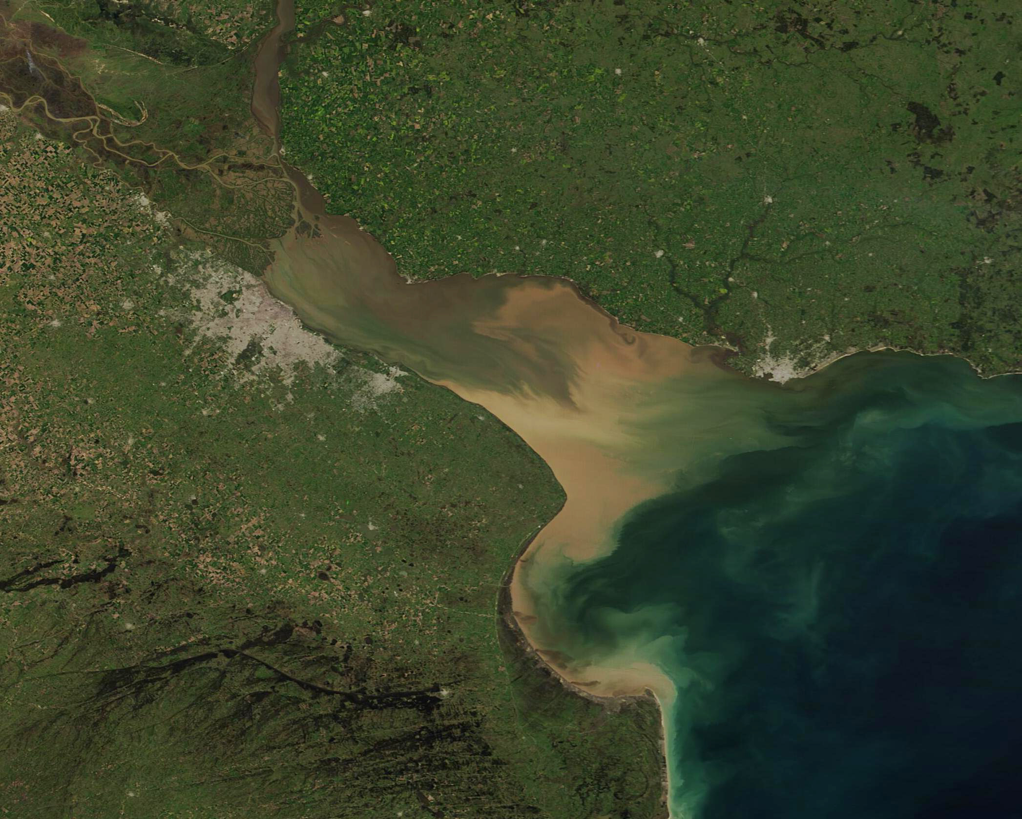
English: This stunning true-color image captures the dramatic colors created by the mixing of muddy river water with the clear, but saline water of the South Atlantic Ocean. This mixing occurs in Rio de la Plata, the muddy estuary of the Paraná and Uruguay Rivers, which forms part of the border between Argentina and Uruguay. The rich estuary supports both capital cities of Buenos Aires, Argentina and Montevideo, Uruguay. These cities appear as gray pixels on the south shore and the north shore of Rio de la Plata. Buenos Aires is the larger city.
The Paraná is South America’s second longest river and drains much of the southeastern part of the continent. The extensive delta of the Paraná nearly reaches across the mouth of the Uruguay River. The rivers’ fertile soils support extensive agriculture, including livestock, in the region surrounding the cities. As the rivers course through the landscape, they accumulate large amounts of sediment, which dumps into the estuary along with fresh water. The complex mixing pattern creates beautiful colors, with sediment floating near the surface appearing in shades of tan. As sediment sinks below the surface, the reflectivity changes and this causes the color to trend towards green when seen from space. The Moderate Resolution Imaging Spectroradiometer (MODIS) on board NASA’s Terra satellite acquired this true-color image on September 16, 2021, in the waning days of winter. |
||
| Date | Taken on 16 September 2021 | ||
| Source |
|
||
| Author | MODIS Land Rapid Response Team, NASA GSFC |
| This media is a product of the Terra mission Credit and attribution belongs to the mission team, if not already specified in the "author" row |
Licensing
[edit].jpg&action=edit§ion=2)
| This file is in the public domain in the United States because it was solely created by NASA. NASA copyright policy states that "NASA material is not protected by copyright unless noted". (See Template:PD-USGov, NASA copyright policy page or JPL Image Use Policy.) | ||
 |
Warnings:
|
File history
Click on a date/time to view the file as it appeared at that time.
| Date/Time | Thumbnail | Dimensions | User | Comment | |
|---|---|---|---|---|---|
| current | 18:46, 29 January 2024 | | 2,093 × 1,679 (1.43 MB) | OptimusPrimeBot (talk | contribs) | #Spacemedia - Upload of http://modis.gsfc.nasa.gov/gallery/images/image09222021_250m.jpg via Commons:Spacemedia |
You cannot overwrite this file.
File usage on Commons
There are no pages that use this file.
.jpg&oldid=846896623)