File:Roma Plan bw.jpg

Original file (1,840 × 1,463 pixels, file size: 773 KB, MIME type: image/jpeg)
Captions
Captions
| Description |
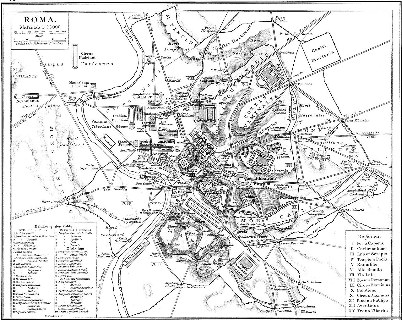
Deutsch: Plan Roms im Altertum
English: Map of Rome during Antiquity
Français : Plan de Rome dans l'Antiquité. Carte issue de l'Allgemeiner Historischer Handatlas de Gustav Droysen dirigé par Richard Andree, 1886. |
| Date | (UTC) |
| Source | |
| Author |
|
| This is a retouched picture, which means that it has been digitally altered from its original version. Modifications: Changed to greyscale. The original can be viewed here: Roma Plan.jpg:
|
|
This work is in the public domain in its country of origin and other countries and areas where the copyright term is the author's life plus 70 years or fewer.
| |
| This file has been identified as being free of known restrictions under copyright law, including all related and neighboring rights. | |
Original upload log
[edit]
This image is a derivative work of the following images:
- File:Roma_Plan.jpg licensed with PD-old
- 2008-07-27T06:40:37Z Amadscientist 1840x1463 (3542454 Bytes) {{Information |Description= |Source= |Date= |Author= |Permission= |other_versions= }}
- 2008-07-27T04:57:10Z Amadscientist 4000x3180 (12799554 Bytes) {{Information |Description= |Source= |Date= |Author= |Permission= |other_versions= }}
- 2006-08-28T19:01:08Z Nikephoros 1840x1463 (2624427 Bytes) {{Information |Description=Plan Roms im Altertum / Map of Rome during Antiquity |Source=G. Droysens Allgemeiner Historischer Handatlas |Date=1886 |Author=? |Permission= not needed |other_versions= no }}
Uploaded with derivativeFX
File history
Click on a date/time to view the file as it appeared at that time.
| Date/Time | Thumbnail | Dimensions | User | Comment | |
|---|---|---|---|---|---|
| current | 20:00, 20 July 2010 | | 1,840 × 1,463 (773 KB) | ChrisO (talk | contribs) | {{Information |Description=Plan Roms im Altertum / Map of Rome during Antiquity |Source=*File:Roma_Plan.jpg |Date=2010-07-20 19:59 (UTC) |Author=*File:Roma_Plan.jpg: ? *derivative work: ~~~ |Permission= |other_versions= }} {{RetouchedPicture| |
You cannot overwrite this file.
File usage on Commons
The following page uses this file: