File:RuruferwegMap.jpg
Jump to navigation
Jump to search
Size of this preview: 800 × 600 pixels. Other resolutions: 320 × 240 pixels | 640 × 480 pixels | 1,024 × 768 pixels | 1,280 × 960 pixels | 2,048 × 1,536 pixels.
Original file (2,048 × 1,536 pixels, file size: 998 KB, MIME type: image/jpeg)
Captions
Captions
Add a one-line explanation of what this file represents
Summary
[edit]
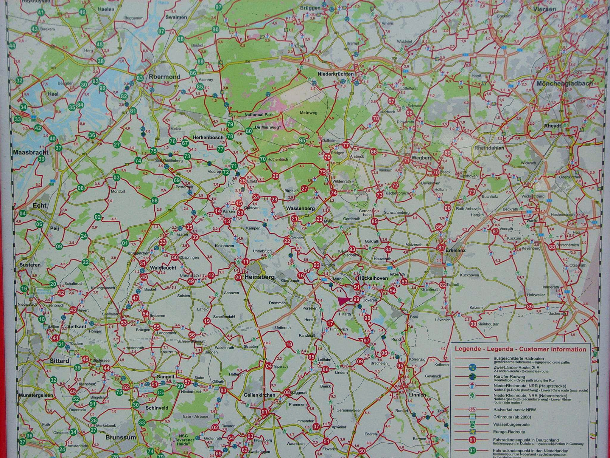
| Description | Fahrradkarte Kreis Heinsberg und Nachbarkreise |
| Date | |
| Source | öffentliche dauerhafte Schautafel, Linnich |
| Author |
Licensing
[edit]

|
The copyright holder of this file allows anyone to use it for any purpose, provided that the copyright holder is properly attributed. Redistribution, derivative work, commercial use, and all other use is permitted. |
|
|
File history
Click on a date/time to view the file as it appeared at that time.
| Date/Time | Thumbnail | Dimensions | User | Comment | |
|---|---|---|---|---|---|
| current | 09:41, 12 June 2021 | | 2,048 × 1,536 (998 KB) | Noxbis (talk | contribs) | White balance |
| 17:11, 11 April 2007 |  | 2,048 × 1,536 (483 KB) | Bodoklecksel (talk | contribs) | == Summary == {{Information |Description=Fahrradkarte Kreis Heinsberg und Nachbarkreise|Source=öffentliche dauerhafte Schautafel, Linnich |Date= 2007|Author= |Permission= |other_versions= }} == Licensing == {{Attribution}} |
You cannot overwrite this file.
File usage on Commons
The following 2 pages use this file:
File usage on other wikis
The following other wikis use this file:
- Usage on en.wikipedia.org
- Usage on fr.wikipedia.org