File:Russian Empire 1745 (Map IV).jpg
Jump to navigation
Jump to search

Size of this preview: 680 × 600 pixels. Other resolutions: 272 × 240 pixels | 544 × 480 pixels | 871 × 768 pixels | 1,161 × 1,024 pixels | 2,168 × 1,912 pixels.
Original file (2,168 × 1,912 pixels, file size: 2.7 MB, MIME type: image/jpeg)
Captions
Captions
Add a one-line explanation of what this file represents
Summary[edit]
| Description |
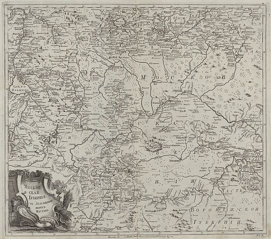
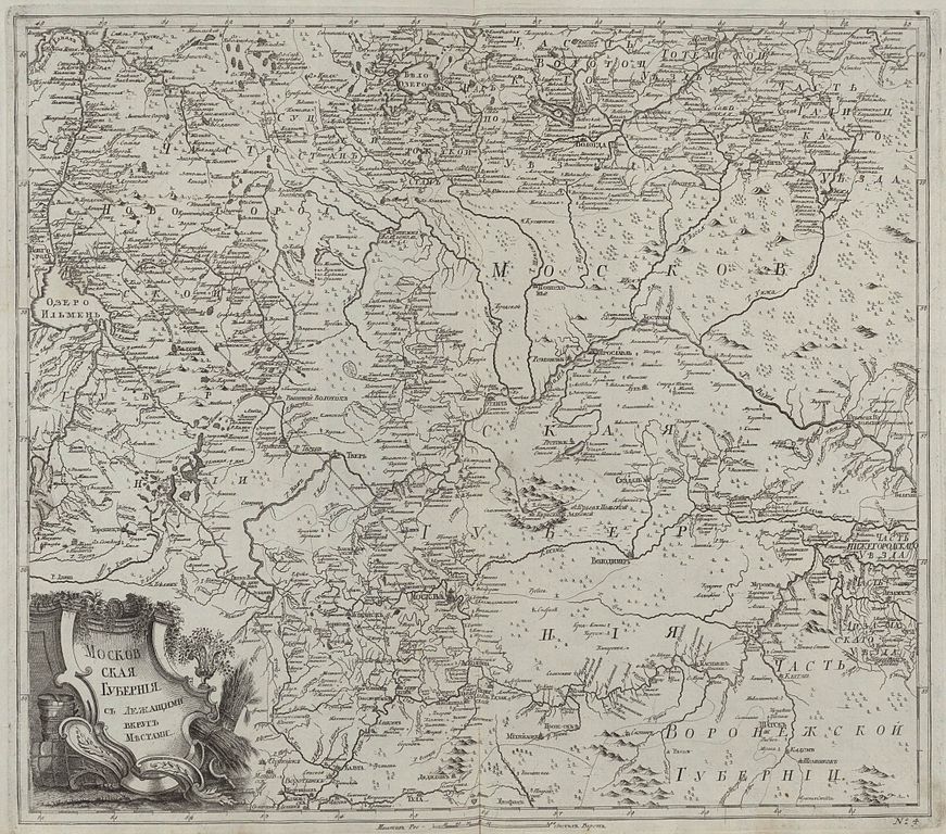
Русский: Первый официальный атлас Российской империи (1745). Карта Московской губернии и частей соседних провинций.
English: First official geographic atlas of the Russian Empire (1745). Map of Moscow governorate and parts of nearest provinces. |
| Date | |
| Source |
Русский: Атлас Российский (1745)
English: Geographic atlas of the Russian Empire (1745) |
| Author | РАН (Russian Academy of Science) |
| Other versions |
|
.jpg)
.jpg)
.jpg)
.jpg)
.jpg&action=edit§ion=1)
Licensing[edit]
.jpg&action=edit§ion=2)
|
This work is in the public domain in its country of origin and other countries and areas where the copyright term is the author's life plus 100 years or fewer. | |
| This file has been identified as being free of known restrictions under copyright law, including all related and neighboring rights. | |
File history
Click on a date/time to view the file as it appeared at that time.
| Date/Time | Thumbnail | Dimensions | User | Comment | |
|---|---|---|---|---|---|
| current | 18:33, 4 November 2009 | | 2,168 × 1,912 (2.7 MB) | Transcend (rus) (talk | contribs) | == {{int:filedesc}} == {{Information |Description= {{ru|1=Первый официальный атлас Российской империи (1745). Карта Московской губернии и частей соседних провинций.}} {{ |
You cannot overwrite this file.
File usage on Commons
The following 2 pages use this file:
.jpg&oldid=508179212)