File:Salm-Delamarche-1784.jpg
Jump to navigation
Jump to search
Size of this preview: 753 × 600 pixels. Other resolutions: 301 × 240 pixels | 603 × 480 pixels | 964 × 768 pixels | 1,180 × 940 pixels.
Original file (1,180 × 940 pixels, file size: 1.07 MB, MIME type: image/jpeg)
Captions
Captions
Add a one-line explanation of what this file represents
Summary
[edit]
| Description |
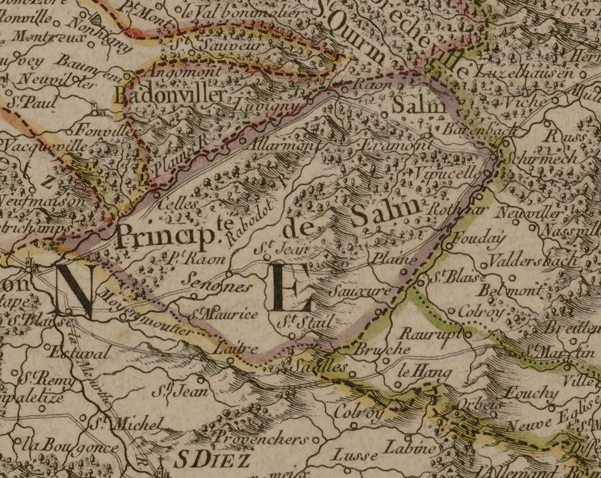
Français : Carte de la Principauté de Salm (Charles-François Delamarche, 1784). Détail de la Carte de la Lorraine où l’on a distingué le Pays Messin, le Verdunois et le Toulois, le Barrois et l’Alsace. Gravure à l'eau-forte réhaussée à l'aquarelle sur papier vergé ; 528 x 568 mm (feuille). Numérisation de l'exemplaire conservé à la bibliothèque municipale de Nancy, cote G-FG-ES-00074. |
| Date | |
| Source | https://galeries.limedia.fr/ark:/31124/dmmz6cjg9llgkd9d/?fbclid=IwAR30zMdi61ijKDB2F1Iczjaeo3LdNZMvQ3JKiNVE0VhuUgHL6efKlsRxEM4 |
| Author | Charles-François Delamarche |
Licensing
[edit]
| This file is licensed under the Licence Ouverte 1.0 (License text, English license text).
|
File history
Click on a date/time to view the file as it appeared at that time.
| Date/Time | Thumbnail | Dimensions | User | Comment | |
|---|---|---|---|---|---|
| current | 12:07, 14 November 2022 | | 1,180 × 940 (1.07 MB) | Damdamdidilolo (talk | contribs) | Uploaded a work by Charles-François Delamarche from https://galeries.limedia.fr/ark:/31124/dmmz6cjg9llgkd9d/?fbclid=IwAR30zMdi61ijKDB2F1Iczjaeo3LdNZMvQ3JKiNVE0VhuUgHL6efKlsRxEM4 with UploadWizard |
You cannot overwrite this file.
File usage on Commons
There are no pages that use this file.
File usage on other wikis
The following other wikis use this file:
- Usage on de.wikipedia.org
- Usage on fr.wikipedia.org