File:Saxony anhalt boe.png
Jump to navigation
Jump to search
No higher resolution available.
Saxony_anhalt_boe.png (197 × 245 pixels, file size: 9 KB, MIME type: image/png)
Captions
Captions
Add a one-line explanation of what this file represents
Summary
[edit]
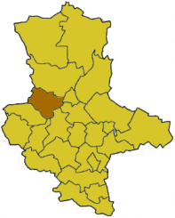
Karte Landkreis Börde
Karten sind selbst erstellt, durch Ausmalen der Vorlage Image:Rhineland p template.png.
Moved from de.wikipedia.org, first uploaded by de:Benutzer:Head, colored by de:Benutzer:AHoerstemeier.
Licensing
[edit]

|
Permission is granted to copy, distribute and/or modify this document under the terms of the GNU Free Documentation License, Version 1.2 or any later version published by the Free Software Foundation; with no Invariant Sections, no Front-Cover Texts, and no Back-Cover Texts. A copy of the license is included in the section entitled GNU Free Documentation License. |
| This file is licensed under the Creative Commons Attribution-Share Alike 3.0 Unported license. | ||
| ||
| This licensing tag was added to this file as part of the GFDL licensing update. |
File history
Click on a date/time to view the file as it appeared at that time.
| Date/Time | Thumbnail | Dimensions | User | Comment | |
|---|---|---|---|---|---|
| current | 12:10, 2 July 2007 | | 197 × 245 (9 KB) | Rauenstein (talk | contribs) | Auf eine alte Version zurückgesetzt |
| 09:27, 1 July 2007 |  | 197 × 245 (48 KB) | Rauenstein (talk | contribs) | Version 2007 | |
| 12:20, 28 February 2006 |  | 197 × 245 (9 KB) | Tsca.bot (talk | contribs) | Karte Bördekreis aus der englischen Wikipedia Diese Karte basiert auf en:Wikipedia:WikiProject German districts/Maptemplates von en:User:Baldhur. Eingefärbt wurde sie von en:User:Ahoerstemeier. {{GFDL}} [[Category:Maps of Germany] |
You cannot overwrite this file.
File usage
There are no pages that use this file.
Global file usage
The following other wikis use this file:
- Usage on de.wikipedia.org
- Usage on en.wikipedia.org
- Usage on eo.wikipedia.org
- Usage on es.wikipedia.org
- Usage on fa.wikipedia.org
- Usage on id.wikipedia.org
- Usage on ka.wikipedia.org
- Usage on kk.wikipedia.org
- Usage on mk.wikipedia.org
- Usage on nl.wikipedia.org
- Usage on no.wikipedia.org
- Usage on pl.wikipedia.org
- Usage on pt.wikipedia.org
- Usage on vi.wikipedia.org