File:Schouten Islands (Papua New Guinea) txu-oclc-6552576-sa55-13.jpg
Jump to navigation
Jump to search

Size of this preview: 795 × 599 pixels. Other resolutions: 319 × 240 pixels | 637 × 480 pixels | 1,019 × 768 pixels | 1,280 × 965 pixels | 2,560 × 1,930 pixels | 5,000 × 3,769 pixels.
Original file (5,000 × 3,769 pixels, file size: 2.67 MB, MIME type: image/jpeg)
Captions
Captions
Add a one-line explanation of what this file represents
Summary[edit]
_txu-oclc-6552576-sa55-13.jpg&action=edit§ion=1)
| Description |
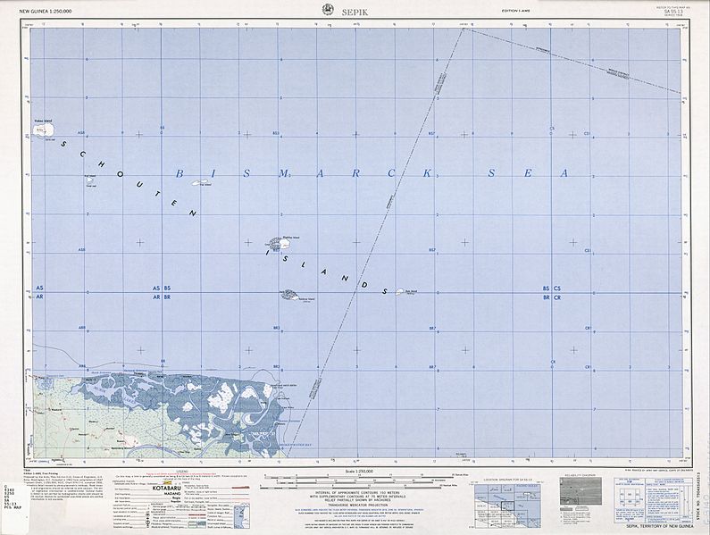
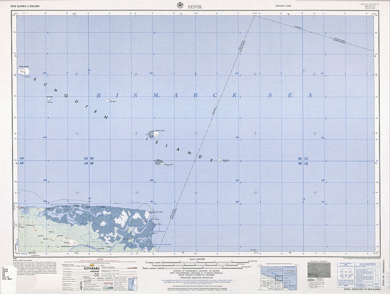
English: sheet map 1:250,000 showing Schouten Islands, Papua New Guinea, off north coast |
| Date | |
| Source | http://www.lib.utexas.edu/maps/ams/new_guinea/ |
| Author | Army Map Service (LU), Corps of Engineers, U.S. Army, |
Licensing[edit]
_txu-oclc-6552576-sa55-13.jpg&action=edit§ion=2)
This file is a work of a U.S. Army soldier or employee, taken or made as part of that person's official duties. As a work of the U.S. federal government, it is in the public domain in the United States.
|
 |
File history
Click on a date/time to view the file as it appeared at that time.
| Date/Time | Thumbnail | Dimensions | User | Comment | |
|---|---|---|---|---|---|
| current | 21:43, 23 June 2012 | | 5,000 × 3,769 (2.67 MB) | Ratzer (talk | contribs) | {{Information |Description ={{en|1=sheet map 1:250,000 showing Schouten Islands, Papua New Guinea, off north coast}} |Source =http://www.lib.utexas.edu/maps/ams/new_guinea/ |Author =Army Map Service (LU), Corps of Engineers, U.S. Arm... |
You cannot overwrite this file.
File usage on Commons
There are no pages that use this file.
File usage on other wikis
The following other wikis use this file:
- Usage on de.wikipedia.org
_txu-oclc-6552576-sa55-13.jpg&oldid=508597597)