File:Scotia Plaza and Trump International Hotel and Tower, Toronto, Ontario (21814376496).jpg
Original file (4,000 × 3,000 pixels, file size: 2.84 MB, MIME type: image/jpeg)
Captions
Captions
Summary
[edit].jpg&action=edit§ion=1)
| Description |
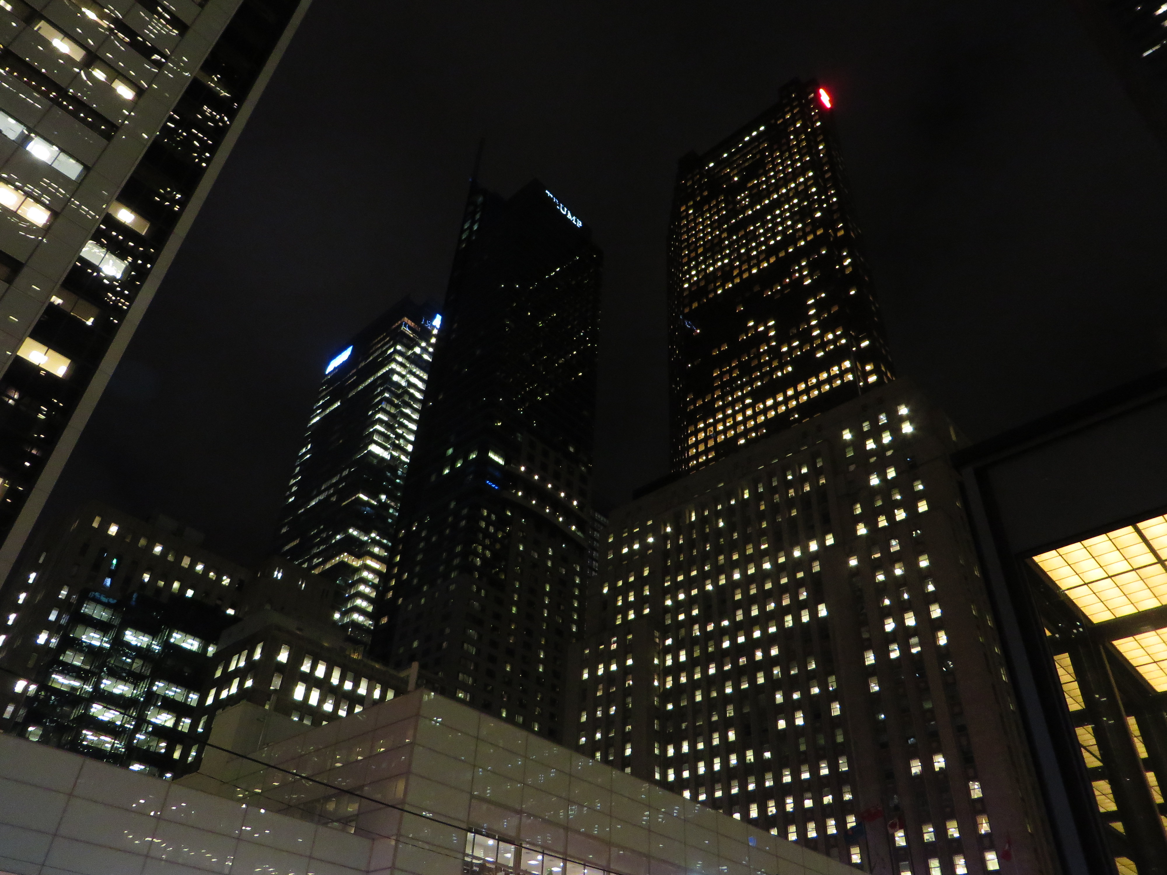
Scotia Plaza is a commercial office complex in the city of Toronto, Ontario, Canada. The complex is situated in the financial district of the downtown core bordered by Yonge Street on the east, King Street West on the south, Bay Street on the west, and Adelaide Street West on the north. At 275 m (902 ft), Scotia Plaza is Canada's third tallest building and the 22nd tallest building in North America. It is connected to the PATH network, and contains 190,000 m2 (2,045,143 sq ft) of office space on 68 floors and 40 retail stores. The complex was developed by Olympia and York as an expansion of the adjacent headquarters of Scotiabank and the bank continues to occupy approximately 24-floors of the structure. Olympia and York owned the complex from its completion until the company was liquidated due to overwhelming debt in 1993. Scotiabank led a consortium of banks to purchase the mortgage for Scotia Plaza and over the next five years, it purchased additional shares from its partners until it was majority owner of the property. On January 19, 2012, Scotiabank announced it would sell the iconic building[8] and on May 22, announced a final agreement with Dundee Real Estate Investment Trust and H&R Real Estate Investment Trust for $1.27 billion, making it the last of Canada's major banks to divest ownership of its Toronto headquarters property. en.wikipedia.org/wiki/Scotia_Plaza Trump International Hotel and Tower, Toronto is a mixed-use skyscraper in Toronto, Ontario, Canada. It was built by Markham-based Talon International Development Inc., which is owned by Val Levitan and Canadian businessman Alex Shnaider. It is named for real estate developer Donald Trump, a minority shareholder in the project. The tower is located in the Financial District, at 311 Bay Street, on the southeast corner of Bay and Adelaide. Construction began with the removal of the sales centre in September 2007, but the official groundbreaking was Friday, October 12, 2007. The planned completion date for the hotel portion of the tower was fall 2011, with the official completion of the tower projected to be in early 2012. The building topped out in early September 2011, and the spire was raised on September 24, 2011. Trump tower is the second tallest skyscraper in Canada (including spire), the tallest mixed-use building in the city and fourth tallest structure in the city. The hotel opened for business on January 31, 2012, and its grand opening occurred on April 16, 2012. Work on the top of the building continued until completion in July 2012 with the activation of two high intensity aircraft warning lights. en.wikipedia.org/wiki/Trump_International_Hotel_and_Tower_(Toronto) en.wikipedia.org/wiki/Wikipedia:Text_of_Creative_Commons_... |
| Date | Taken on 28 September 2015, 17:02 |
| Source | Scotia Plaza and Trump International Hotel and Tower, Toronto, Ontario |
| Author | Ken Lund from Reno, Nevada, USA |
| Camera location | | View this and other nearby images on: OpenStreetMap |
|---|
.jpg¶ms=043.649088_N_-079.380181_E_globe:Earth_type:camera_source:Flickr_&language=en)
Licensing
[edit].jpg&action=edit§ion=2)
- You are free:
- to share – to copy, distribute and transmit the work
- to remix – to adapt the work
- Under the following conditions:
- attribution – You must give appropriate credit, provide a link to the license, and indicate if changes were made. You may do so in any reasonable manner, but not in any way that suggests the licensor endorses you or your use.
- share alike – If you remix, transform, or build upon the material, you must distribute your contributions under the same or compatible license as the original.
| This image was originally posted to Flickr by Ken Lund at https://flickr.com/photos/75683070@N00/21814376496. It was reviewed on 19 December 2016 by FlickreviewR and was confirmed to be licensed under the terms of the cc-by-sa-2.0. |
File history
Click on a date/time to view the file as it appeared at that time.
| Date/Time | Thumbnail | Dimensions | User | Comment | |
|---|---|---|---|---|---|
| current | 15:40, 19 December 2016 | | 4,000 × 3,000 (2.84 MB) | Mindmatrix (talk | contribs) | Transferred from Flickr via Flickr2Commons |
You cannot overwrite this file.
File usage on Commons
There are no pages that use this file.
.jpg&oldid=861042389)