File:Scotland, Raasay, Hallaig and Dùn Caan (2).jpg
Jump to navigation
Jump to search
Size of this preview: 800 × 531 pixels. Other resolutions: 320 × 213 pixels | 640 × 425 pixels | 1,024 × 680 pixels | 1,280 × 850 pixels | 2,560 × 1,700 pixels | 4,288 × 2,848 pixels.
Original file (4,288 × 2,848 pixels, file size: 3.01 MB, MIME type: image/jpeg)
Captions
Captions
Add a one-line explanation of what this file represents
Summary
[edit].jpg&action=edit§ion=1)
| Description |
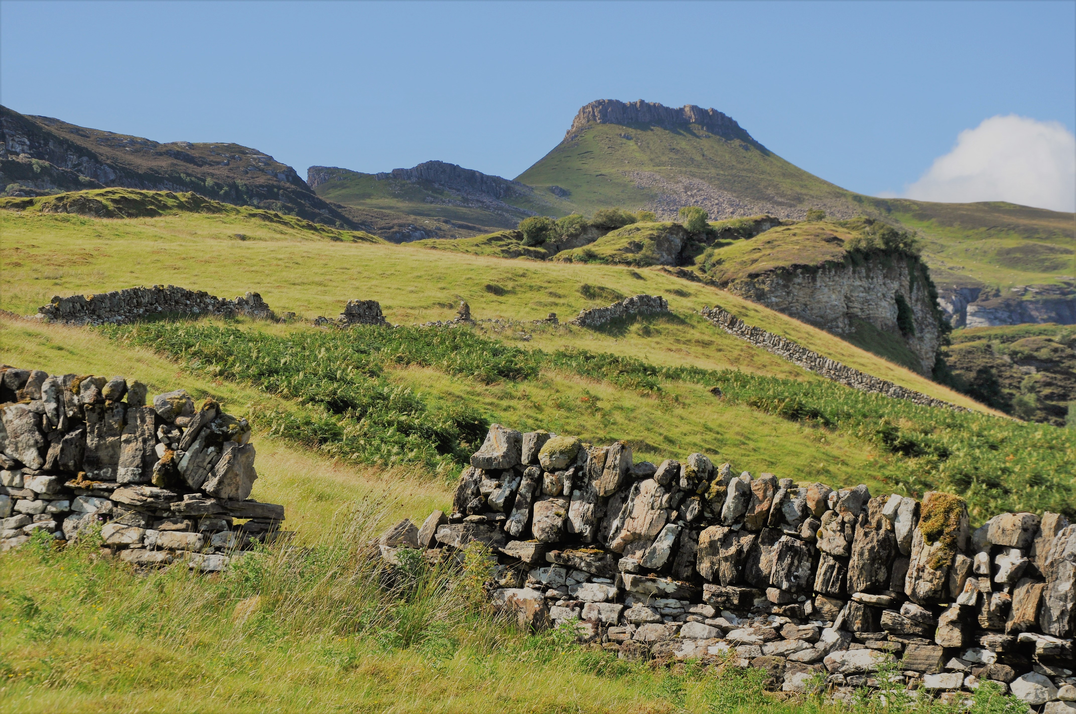
English: Scene on the eastern side of the Isle of Raasay (Scotland) with its highest mountain, Dùn Caan (443 m.). In the foreground some ruined walls of the abandoned village of Hallaig. |
| Date | |
| Source | Own work |
| Author | Vincent van Zeijst |
Looking to the Northwest from:
| Camera location | | View this and other nearby images on: OpenStreetMap |
|---|
.jpg¶ms=057.372161_N_-006.006569_E_globe:Earth_type:camera__&language=en)
Licensing
[edit].jpg&action=edit§ion=2)
I, the copyright holder of this work, hereby publish it under the following licenses:
This file is licensed under the Creative Commons Attribution-Share Alike 4.0 International license.
- You are free:
- to share – to copy, distribute and transmit the work
- to remix – to adapt the work
- Under the following conditions:
- attribution – You must give appropriate credit, provide a link to the license, and indicate if changes were made. You may do so in any reasonable manner, but not in any way that suggests the licensor endorses you or your use.
- share alike – If you remix, transform, or build upon the material, you must distribute your contributions under the same or compatible license as the original.

|
Permission is granted to copy, distribute and/or modify this document under the terms of the GNU Free Documentation License, Version 1.2 or any later version published by the Free Software Foundation; with no Invariant Sections, no Front-Cover Texts, and no Back-Cover Texts. A copy of the license is included in the section entitled GNU Free Documentation License. |
You may select the license of your choice.
File history
Click on a date/time to view the file as it appeared at that time.
| Date/Time | Thumbnail | Dimensions | User | Comment | |
|---|---|---|---|---|---|
| current | 10:59, 28 June 2020 | | 4,288 × 2,848 (3.01 MB) | Loranchet (talk | contribs) | {{Information |description ={{en|1=Scene on the eastern side of the Isle of Raasay (Scotland) with its highest mountain, Dùn Caan (443 m.). <br> In the foreground some ruined walls of the abandoned village of Hallaig.}} |date =2018-08-07 |source ={{own}} |author =Vincent van Zeijst }} Looking to the Northwest from: {{Location|57|22|19.78|N|6|0|23.65|W}} Category:Isle of Raasay Category:Hallaig Category:Dùn Caan Category:Abandoned villages in Scotland |
You cannot overwrite this file.
File usage on Commons
There are no pages that use this file.
File usage on other wikis
The following other wikis use this file:
- Usage on es.wikipedia.org
.jpg&oldid=732963141)