File:ScotlandMoray.png
跳至導覽
跳至搜尋
預覽大小:480 × 599 像素。 其他解析度:192 × 240 像素 | 384 × 480 像素 | 615 × 768 像素 | 820 × 1,024 像素 | 1,641 × 2,048 像素 | 2,733 × 3,411 像素。
原始檔案 (2,733 × 3,411 像素,檔案大小:216 KB,MIME 類型:image/png)
說明
說明
添加單行說明來描述出檔案所代表的內容

|
File:ScotlandMoray.svg是本檔案的向量版本。 如果品質不低,就應該優先使用該檔案,而非PNG檔案。
File:ScotlandMoray.png → File:ScotlandMoray.svg
更多資訊請參閱Help:SVG/zh。 |
 |
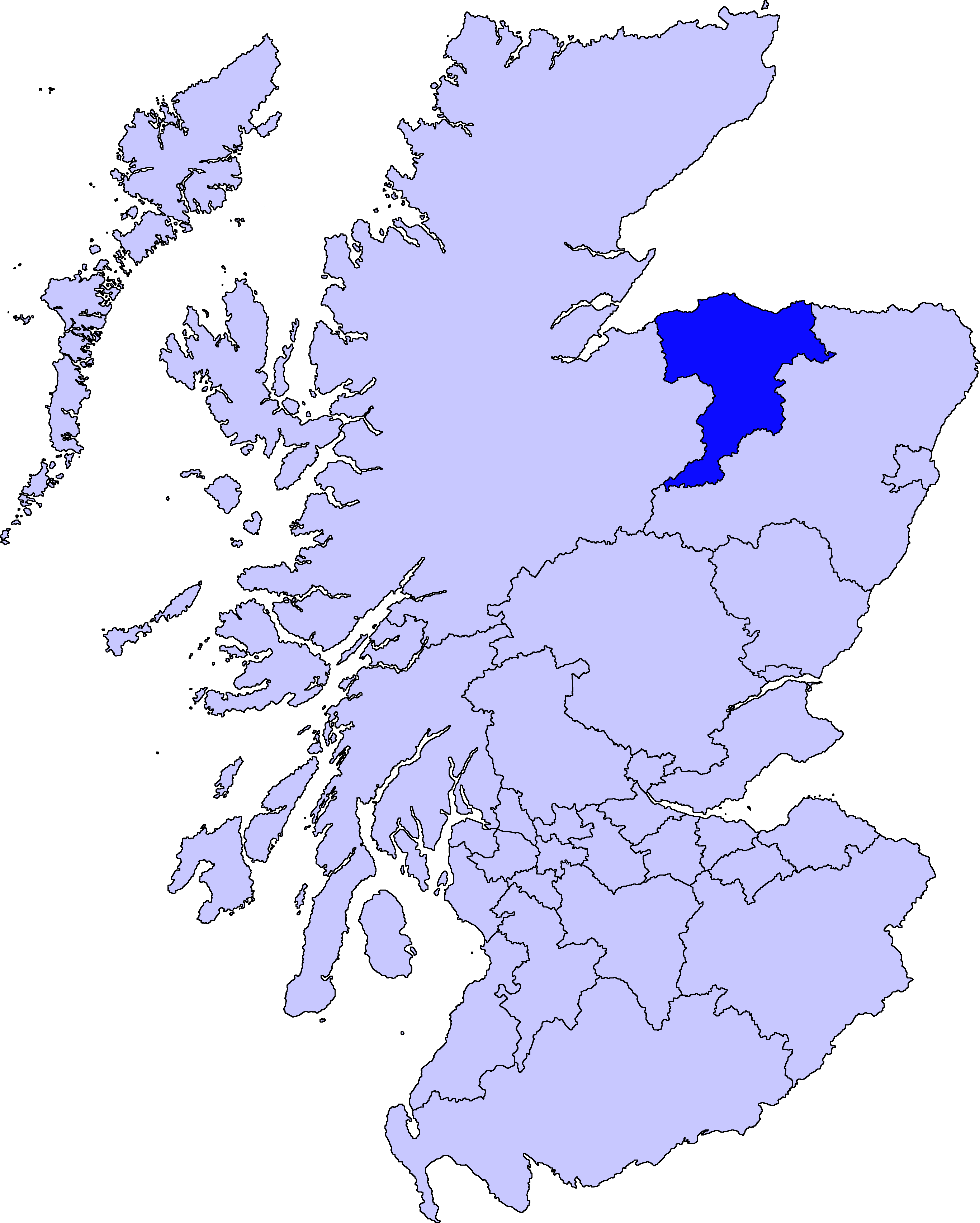
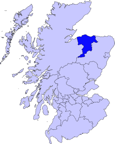
Moray unitary council
Slightly edited version of a map drawn by Morwen

|
已授權您依據自由軟體基金會發行的無固定段落、封面文字和封底文字GNU自由文件授權條款1.2版或任意後續版本,對本檔進行複製、傳播和/或修改。該協議的副本列在GNU自由文件授權條款中。 |
| 此檔案採用共享創意 姓名標示-相同方式分享 3.0 未在地化版本授權條款。 | ||
| ||
| 已新增授權條款標題至此檔案,作為GFDL授權更新的一部份。 |
檔案歷史
點選日期/時間以檢視該時間的檔案版本。
| 日期/時間 | 縮圖 | 尺寸 | 用戶 | 備註 | |
|---|---|---|---|---|---|
| 目前 | 2010年8月11日 (三) 01:46 | | 2,733 × 3,411(216 KB) | Alphathon(對話 | 貢獻) | New, larger, transparent background version based on the Angus map |
| 2005年5月17日 (二) 21:38 |  | 200 × 230(4 KB) | Voyager(對話 | 貢獻) | Moray unitary council Slightly edited version of a map drawn by Morwen {{GFDL}} Category:Maps of Scottish unitary councils |
無法覆蓋此檔案。
檔案用途
下列頁面有用到此檔案:
全域檔案使用狀況
以下其他 wiki 使用了這個檔案:
- bg.wikipedia.org 的使用狀況
- cy.wikipedia.org 的使用狀況
- de.wikipedia.org 的使用狀況
- en.wikipedia.org 的使用狀況
- Maggieknockater
- Moray
- Elgin, Moray
- Dufftown
- Forres
- Lossiemouth
- Burghead
- Talk:Moray
- Buckie
- Findochty
- Fochabers
- Aberlour
- Cullen, Moray
- Tomintoul
- Keith, Moray
- Mosstodloch
- Archiestown
- Rothes
- Findhorn
- Kinloss, Scotland
- Portknockie
- Achnastank
- Drummuir
- Rathven
- Dallas, Moray
- Longmorn
- Kingston, Moray
- Auchindoun, Moray
- Fogwatt
- Craigellachie, Moray
- Newmill
- Cummingston
- Hopeman
- Duffus
- Ballindalloch
- Urquhart, Moray
- Lhanbryde
- Spey Bay
- Rafford
- Findhorn Ecovillage
- Ianstown
- Strathlene
- Alves, Moray
- Ashgrove, Moray
- Auchbreck
檢視此檔案的更多全域使用狀況。