File:Sea Ice off Sakhalin Island (MODIS 2022-02-04).jpg
Jump to navigation
Jump to search

Size of this preview: 764 × 600 pixels. Other resolutions: 306 × 240 pixels | 611 × 480 pixels | 978 × 768 pixels | 1,280 × 1,005 pixels | 2,244 × 1,762 pixels.
Original file (2,244 × 1,762 pixels, file size: 736 KB, MIME type: image/jpeg)
Captions
Captions
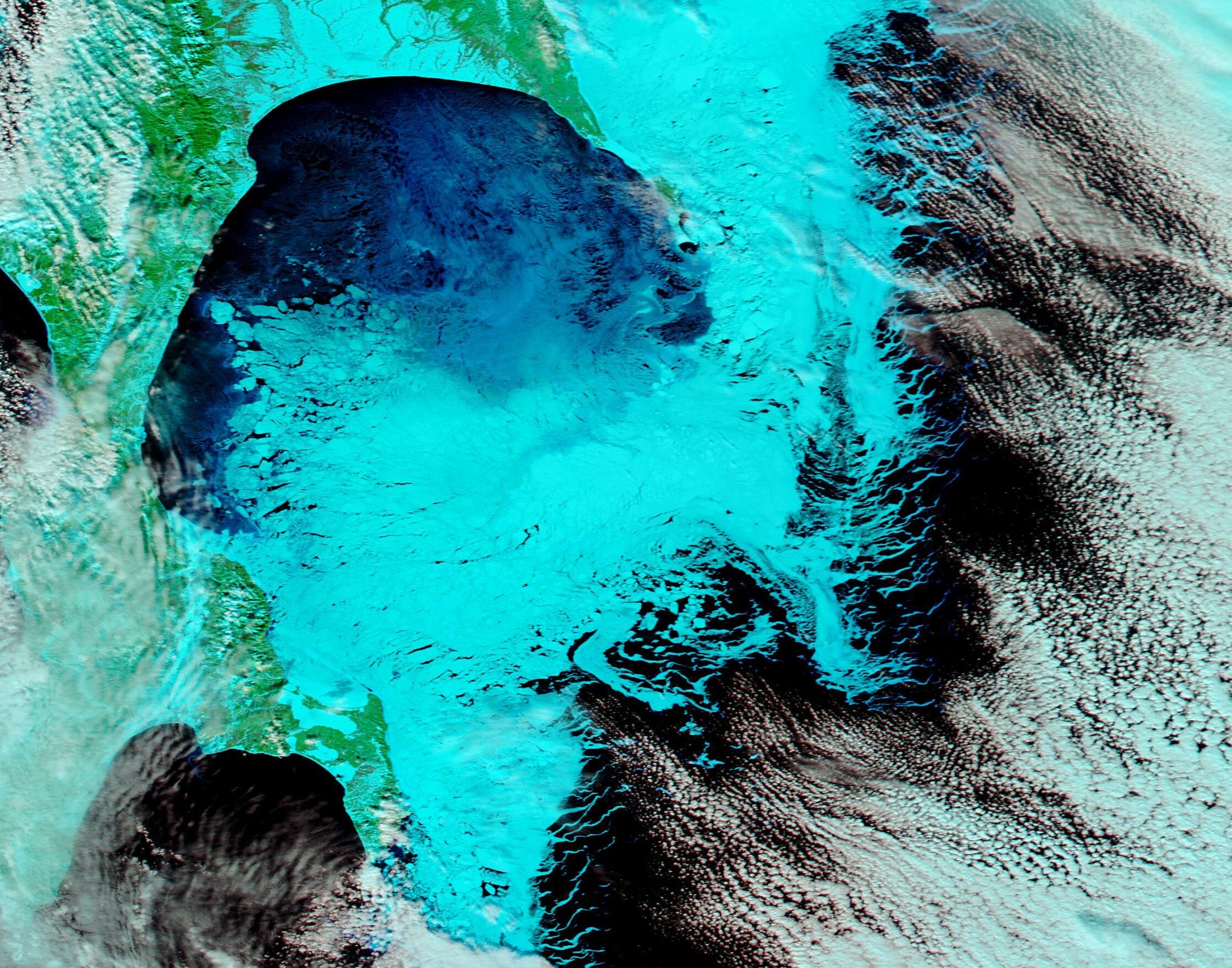
The Moderate Resolution Imaging Spectroradiometer (MODIS) on board NASA’s Aqua satellite acquired a stunning false-color image of sea ice east of Sakhalin Island on February 2.
Summary
[edit].jpg&action=edit§ion=1)
| Description |
English: Frigid temperatures across Russia’s Far East helped sea ice form and thicken on the Sea of Okhotsk off the coast of Sakhalin Island by early February 2022. Although sea ice forms across most of the area above the Arctic Circle each winter, seas near and south of that landmark can also become frosted in ice. The Sea of Okhotsk is one of the lowest latitudes in the Northern Hemisphere (about 44˚N) where substantial amounts of sea ice can be expected each year. This winter, satellite imagery showed light ice beginning to form in mid-December and thickening through early February.
The Moderate Resolution Imaging Spectroradiometer (MODIS) on board NASA’s Aqua satellite acquired a stunning false-color image of sea ice east of Sakhalin Island on February 2. This type of image, using near-infrared and visible light, is especially helpful to separate snow (bright electric blue) from cloud (white or very light blue when ice crystals are present in the cloud). Deep water appears black, and vegetation looks green. Where sea ice is thin and moist, it often appears in various tones of blue depending on the moisture content. This view shows that ice has begun to cling to the eastern-most shores of the curved island, both in the north and south, to create a frigid bridge between. Open water remains between this bridge and the more westward-lying edge of Sakhalin Island. |
||
| Date | Taken on 2 February 2022 | ||
| Source |
Sea Ice off Sakhalin Island (direct link)
|
||
| Author | MODIS Land Rapid Response Team, NASA GSFC |
| This media is a product of the Aqua mission Credit and attribution belongs to the mission team, if not already specified in the "author" row |
Licensing
[edit].jpg&action=edit§ion=2)
| This file is in the public domain in the United States because it was solely created by NASA. NASA copyright policy states that "NASA material is not protected by copyright unless noted". (See Template:PD-USGov, NASA copyright policy page or JPL Image Use Policy.) | ||
 |
Warnings:
|
File history
Click on a date/time to view the file as it appeared at that time.
| Date/Time | Thumbnail | Dimensions | User | Comment | |
|---|---|---|---|---|---|
| current | 22:18, 9 January 2024 | | 2,244 × 1,762 (736 KB) | OptimusPrimeBot (talk | contribs) | #Spacemedia - Upload of http://modis.gsfc.nasa.gov/gallery/images/image02042022_250m.jpg via Commons:Spacemedia |
You cannot overwrite this file.
File usage on Commons
There are no pages that use this file.
.jpg&oldid=840278575)