File:Sediment in Bristol Channel and the Irish Sea (MODIS 2020-03-26).jpg

Original file (2,945 × 2,268 pixels, file size: 585 KB, MIME type: image/jpeg)
Captions
Captions
Summary[edit]
.jpg&action=edit§ion=1)
| Description |
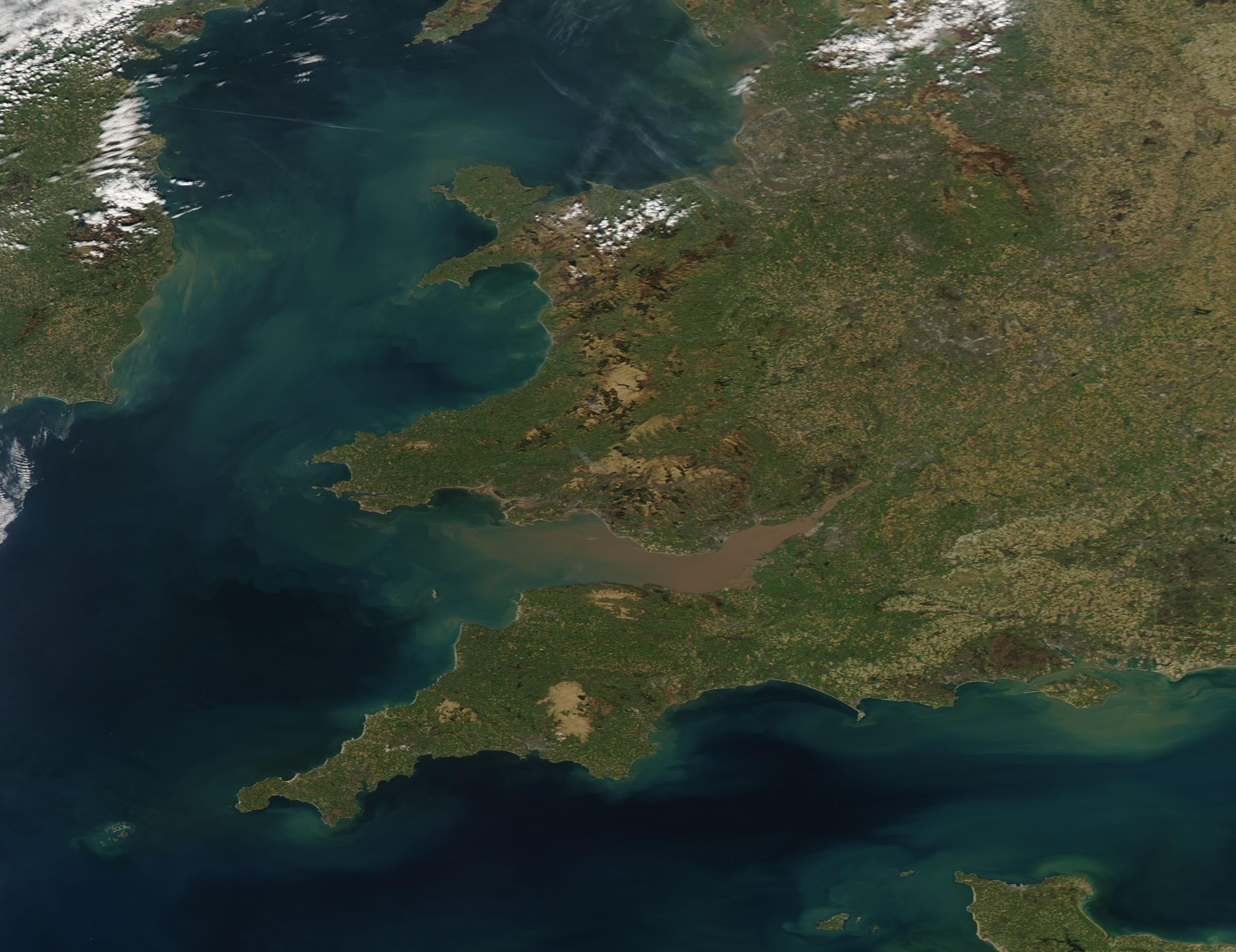
English: A winter and spring filled with storms brought flooding to much of the United Kingdom, with sediment sweeping out to the sea through rivers and runoff. According to the United Kingdom’s Flood Information Service, ongoing local groundwater flooding is expected to continue in part of the south of England from March 25- 29. The report states that land, roads and some properties will continue to be expected to be affected.
On March 25 the Moderate Resolution Imaging Spectroradiometer (MODIS) on board NASA’s Aqua satellite acquired a true-color image of sediment swirling in the Bristol Channel and Irish Sea. The Irish Sea sits between the islands of Ireland and Great Britain and the Bristol Channel is located between South Wales from Devon and Somerset in southwest England. Both are shallow waterways, with the average depth of the Irish Sea only about 52 meters (170 feet). Heavy tides and currents stir sediment from the bottom of the waterways, creating swirls of suspended sediment. Substantial rains and flooding sweep additional sediment from the land and fill rivers, such as the River Severn, which flows into Bristol Bay. All of these sources add to the swirling colors seen in this image. |
||
| Date | Taken on 25 March 2020 | ||
| Source |
Sediment in Bristol Channel and the Irish Sea (direct link)
|
||
| Author | MODIS Land Rapid Response Team, NASA GSFC |
| This media is a product of the Aqua mission Credit and attribution belongs to the mission team, if not already specified in the "author" row |
Licensing[edit]
.jpg&action=edit§ion=2)
| This file is in the public domain in the United States because it was solely created by NASA. NASA copyright policy states that "NASA material is not protected by copyright unless noted". (See Template:PD-USGov, NASA copyright policy page or JPL Image Use Policy.) | ||
 |
Warnings:
|
File history
Click on a date/time to view the file as it appeared at that time.
| Date/Time | Thumbnail | Dimensions | User | Comment | |
|---|---|---|---|---|---|
| current | 03:14, 17 February 2024 | | 2,945 × 2,268 (585 KB) | OptimusPrimeBot (talk | contribs) | #Spacemedia - Upload of http://modis.gsfc.nasa.gov/gallery/images/image03262020_250m.jpg via Commons:Spacemedia |
You cannot overwrite this file.
File usage on Commons
There are no pages that use this file.
.jpg&oldid=852802504)