File:Sgurr Dubh Mhor and Sgurr Dubh an Da Bheinn - geograph.org.uk - 850382.jpg
Jump to navigation
Jump to search
Nyns eus klerder ughella kavadow.
Sgurr_Dubh_Mhor_and_Sgurr_Dubh_an_Da_Bheinn_-_geograph.org.uk_-_850382.jpg (500 × 375 piksel, myns an restren: 66 KB, eghen MIME: image/jpeg)
Captions
Captions
Add a one-line explanation of what this file represents
Berrskrif[golegi]
| Deskrifans |
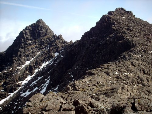
English: Sgurr Dubh Mhor & Sgurr Dubh an Da Bheinn View of the Munro and Top taken from the ridge |
| Dedhyans | |
| Pennfenten | From geograph.org.uk |
| Awtour | trevor willis |
| Askrifans (required by the license) | trevor willis / Sgurr Dubh Mhor & Sgurr Dubh an Da Bheinn / |
| Camera location | | View this and other nearby images on: OpenStreetMap |
|---|
_heading:90.00&language=kw)
| Object location | | View this and other nearby images on: OpenStreetMap |
|---|
_heading:90.00&language=kw)
Leshyans[golegi]

|
This image was taken from the Geograph project collection. See this photograph's page on the Geograph website for the photographer's contact details. The copyright on this image is owned by trevor willis and is licensed for reuse under the Creative Commons Attribution-ShareAlike 2.0 license.
|
This file is licensed under the Creative Commons Attribution-Share Alike 2.0 Generic license.
Askrifans: trevor willis
- Yma'n gwir dhywgh:
- a ranna – a dhasskrifa, lesranna ha treuskorra an ober
- a gemyska – a aswiwa an ober
- Yn-dann an ragselyow a syw:
- askrifans – Res yw dhywgh ri askrifans gwiw, provia kevren dhe'n lecyans, ha meneges mar peu chanjyow gwrys. Hwi a yll gul hemma yn fordh resonus a vynnowgh, mes ny yllir y wul yn fordh a broffo synser an lecyans dh'agas skoodhya po agas devnydh.
- ranna kehaval – Mar kwrewgh hwi chanjya, treusfurvya po drehevel war an ober ma, res yw dhywgh lesranna agas kevrohow yn-dann an keth lecyans hag an derowel, po lecyans kesplegadow.
Istori an restren
Klyckyewgh war dhedhyans/eur rag gweles an folen dell o an termyn na.
| Dedhyans/Eur | Skeusennik | Mynsow | Devnydhyer | Kampol | |
|---|---|---|---|---|---|
| a-lemmyn | 03:15, 21 Hwevrer 2011 | | 500 × 375 (66 KB) | GeographBot (keskows | kevrohow) | == {{int:filedesc}} == {{Information |description={{en|1=Sgurr Dubh Mhor & Sgurr Dubh an Da Bheinn View of the Munro and Top taken from the ridge}} |date=2004-04-10 |source=From [http://www.geograph.org.uk/photo/850382 geograph.org.uk] |author=[http://www |
Ny yllowgh gorskrifa an restren ma.
Devnydh an restren
Nyns eus folen vyth owth usya an restren ma.
Devnydh ollvysel an restren
Yma an wikis erel a syw ow tevnydhya an restren ma:
- Devnydh war de.wikipedia.org
- Devnydh war en.wikipedia.org
- Devnydh war kw.wikipedia.org