File:Slanted plains and mountainous background in Padjelanta National Park (DSCF1225).jpg
Original file (4,781 × 2,699 pixels, file size: 7.21 MB, MIME type: image/jpeg)
Captions
Summary
[edit]DescriptionSlanted plains and mountainous background in Padjelanta National Park (DSCF1225).jpg |
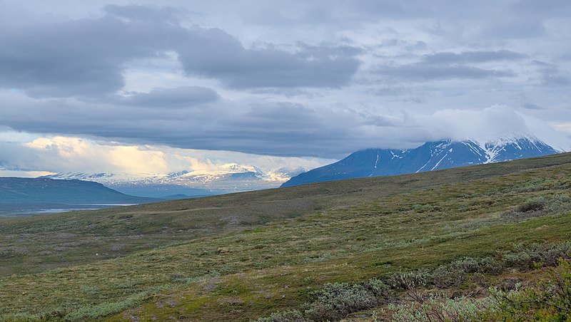
English: Slanty plains and mountainous background in Padjelanta National Park
|
||
Date | |||
Source | Own work | ||
Author | Trougnouf (Benoit Brummer) |
Camera location | 67° 31′ 09.81″ N, 16° 53′ 24.27″ E | View this and other nearby images on: OpenStreetMap | 67.519391; 16.890075 |
---|
Licensing
[edit]- You are free:
- to share – to copy, distribute and transmit the work
- to remix – to adapt the work
- Under the following conditions:
- attribution – You must give appropriate credit, provide a link to the license, and indicate if changes were made. You may do so in any reasonable manner, but not in any way that suggests the licensor endorses you or your use.
This image was uploaded as part of Wiki Loves Earth 2020.
aragonés ∙ العربية ∙ asturianu ∙ azərbaycanca ∙ беларуская (тарашкевіца) ∙ български ∙ বাংলা ∙ brezhoneg ∙ català ∙ čeština ∙ Cymraeg ∙ Deutsch ∙ Ελληνικά ∙ English ∙ español ∙ eesti ∙ euskara ∙ فارسی ∙ français ∙ galego ∙ עברית ∙ hrvatski ∙ հայերեն ∙ Bahasa Indonesia ∙ italiano ∙ 日本語 ∙ ქართული ∙ 한국어 ∙ latviešu ∙ македонски ∙ മലയാളം ∙ मराठी ∙ Bahasa Melayu ∙ norsk bokmål ∙ नेपाली ∙ Nederlands ∙ norsk ∙ polski ∙ português ∙ português do Brasil ∙ română ∙ русский ∙ sicilianu ∙ shqip ∙ slovenščina ∙ српски / srpski ∙ svenska ∙ ไทย ∙ Türkçe ∙ українська ∙ اردو ∙ 简体中文 ∙ 繁體中文 ∙ +/− |
This image has been assessed using the Quality image guidelines and is considered a Quality image.
العربية ∙ جازايرية ∙ беларуская ∙ беларуская (тарашкевіца) ∙ български ∙ বাংলা ∙ català ∙ čeština ∙ Cymraeg ∙ Deutsch ∙ Schweizer Hochdeutsch ∙ Zazaki ∙ Ελληνικά ∙ English ∙ Esperanto ∙ español ∙ eesti ∙ euskara ∙ فارسی ∙ suomi ∙ français ∙ galego ∙ עברית ∙ हिन्दी ∙ hrvatski ∙ magyar ∙ հայերեն ∙ Bahasa Indonesia ∙ italiano ∙ 日本語 ∙ Jawa ∙ ქართული ∙ 한국어 ∙ kurdî ∙ Lëtzebuergesch ∙ lietuvių ∙ македонски ∙ മലയാളം ∙ मराठी ∙ Bahasa Melayu ∙ Nederlands ∙ Norfuk / Pitkern ∙ polski ∙ português ∙ português do Brasil ∙ rumantsch ∙ română ∙ русский ∙ sicilianu ∙ slovenčina ∙ slovenščina ∙ shqip ∙ српски / srpski ∙ svenska ∙ தமிழ் ∙ తెలుగు ∙ ไทย ∙ Tagalog ∙ Türkçe ∙ toki pona ∙ українська ∙ vèneto ∙ Tiếng Việt ∙ 中文 ∙ 中文(简体) ∙ 中文(繁體) ∙ +/− |
File history
Click on a date/time to view the file as it appeared at that time.
Date/Time | Thumbnail | Dimensions | User | Comment | |
---|---|---|---|---|---|
current | 15:03, 31 May 2020 | 4,781 × 2,699 (7.21 MB) | Trougnouf (talk | contribs) | Uploaded with dtMediaWiki 45 |
You cannot overwrite this file.
File usage on Commons
The following 8 pages use this file:
- User:Apalsola/recent uploads/Lapland, Finland/2020 May 21-31
- User:Apalsola/recent uploads/Roads in Finland/2020 May 21-31
- User:Chumwa/OgreBot/Transport Maps/2020 May 21-31
- User:Chumwa/OgreBot/Travel and communication maps/2020 May 21-31
- User talk:Trougnouf/Archive 2021
- Commons:Quality images/Subject/Places/Natural structures/archive 2021
- Commons:Quality images candidates/Archives February 23 2021
- Commons:Wikimedia Sverige/recent uploads/2020 May
Metadata
This file contains additional information such as Exif metadata which may have been added by the digital camera, scanner, or software program used to create or digitize it. If the file has been modified from its original state, some details such as the timestamp may not fully reflect those of the original file. The timestamp is only as accurate as the clock in the camera, and it may be completely wrong.
Camera manufacturer | FUJIFILM |
---|---|
Camera model | X-T1 |
Author | Trougnouf (Benoit Brummer) |
Copyright holder |
|
Exposure time | 1/85 sec (0.011764705882353) |
F-number | f/11 |
ISO speed rating | 200 |
Date and time of data generation | 20:09, 3 July 2019 |
Lens focal length | 52.7 mm |
Latitude | 67° 31′ 9.81″ N |
Longitude | 16° 53′ 24.27″ E |
Altitude | 637.6 meters above sea level |
Short title |
|
Orientation | Normal |
Horizontal resolution | 300 dpi |
Vertical resolution | 300 dpi |
Software used | darktable 2.5.0+5649~gc0098b38e |
File change date and time | 17:03, 31 May 2020 |
Y and C positioning | Co-sited |
Exposure Program | Aperture priority |
Exif version | 2.3 |
Date and time of digitizing | 20:09, 3 July 2019 |
Meaning of each component |
|
Image compression mode | 2.5 |
APEX shutter speed | 6.45 |
APEX aperture | 6.9 |
APEX brightness | 7.74 |
APEX exposure bias | −0.67 |
Maximum land aperture | 3 APEX (f/2.83) |
Metering mode | Pattern |
Light source | Unknown |
Flash | Flash did not fire |
Supported Flashpix version | 1 |
Color space | sRGB |
Focal plane X resolution | 820 |
Focal plane Y resolution | 820 |
Focal plane resolution unit | 3 |
Sensing method | One-chip color area sensor |
File source | Digital still camera |
Scene type | A directly photographed image |
Custom image processing | Normal process |
Exposure mode | Auto exposure |
White balance | Auto white balance |
Focal length in 35 mm film | 79 mm |
Scene capture type | Standard |
Sharpness | Normal |
Subject distance range | Unknown |
GPS tag version | 0.0.2.2 |
Rating (out of 5) | 3 |
Keywords |
|
Structured data
Items portrayed in this file
depicts
some value
3 July 2019
67°31'9.8069"N, 16°53'24.2689"E
0.01176470588235294117 second
11
52.7 millimetre
200
image/jpeg
285e2cc44b5360beeceef79067d6c81ad3e994ee
7,556,141 byte
2,699 pixel
4,781 pixel
- Protected areas of Sweden with known IDs
- CC-BY-4.0
- Self-published work
- Images from Wiki Loves Earth 2020
- Images from Wiki Loves Earth 2020 in Sweden
- Content made available through Wikimedia Sverige competitions
- Images from Wiki Loves Earth missing SDC depicts
- Quality images
- Quality images missing SDC depicts
- Photographs by Trougnouf/Laponia 2019
- Taken with Fujifilm X-T1 and XF18-55mmF2.8-4 R LM OIS
- F-number f/11
- Lens focal length 52.7 mm
- ISO speed rating 200
- Uploaded with dtMediaWiki
- Quality images from Wiki Loves Earth 2020 in Sweden
- Quality images of national parks
- Quality images of Norrbotten County
- Quality images of Sweden by User:Trougnouf
- Quality images of mountains
- Photographs by Trougnouf in 2019
- Pages with maps