File:Somerset UK locator map 2010.svg
Salta a la navegació
Salta a la cerca

Mida d'aquesta previsualització PNG del fitxer SVG: 494 × 600 píxels. Altres resolucions: 198 × 240 píxels | 395 × 480 píxels | 633 × 768 píxels | 843 × 1.024 píxels | 1.687 × 2.048 píxels | 1.108 × 1.345 píxels.
Fitxer original (fitxer SVG, nominalment 1.108 × 1.345 píxels, mida del fitxer: 302 Ko)
Llegendes
Llegendes
Afegeix una explicació d'una línia del que representa aquest fitxer
Larissa
Resum[modifica]
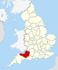
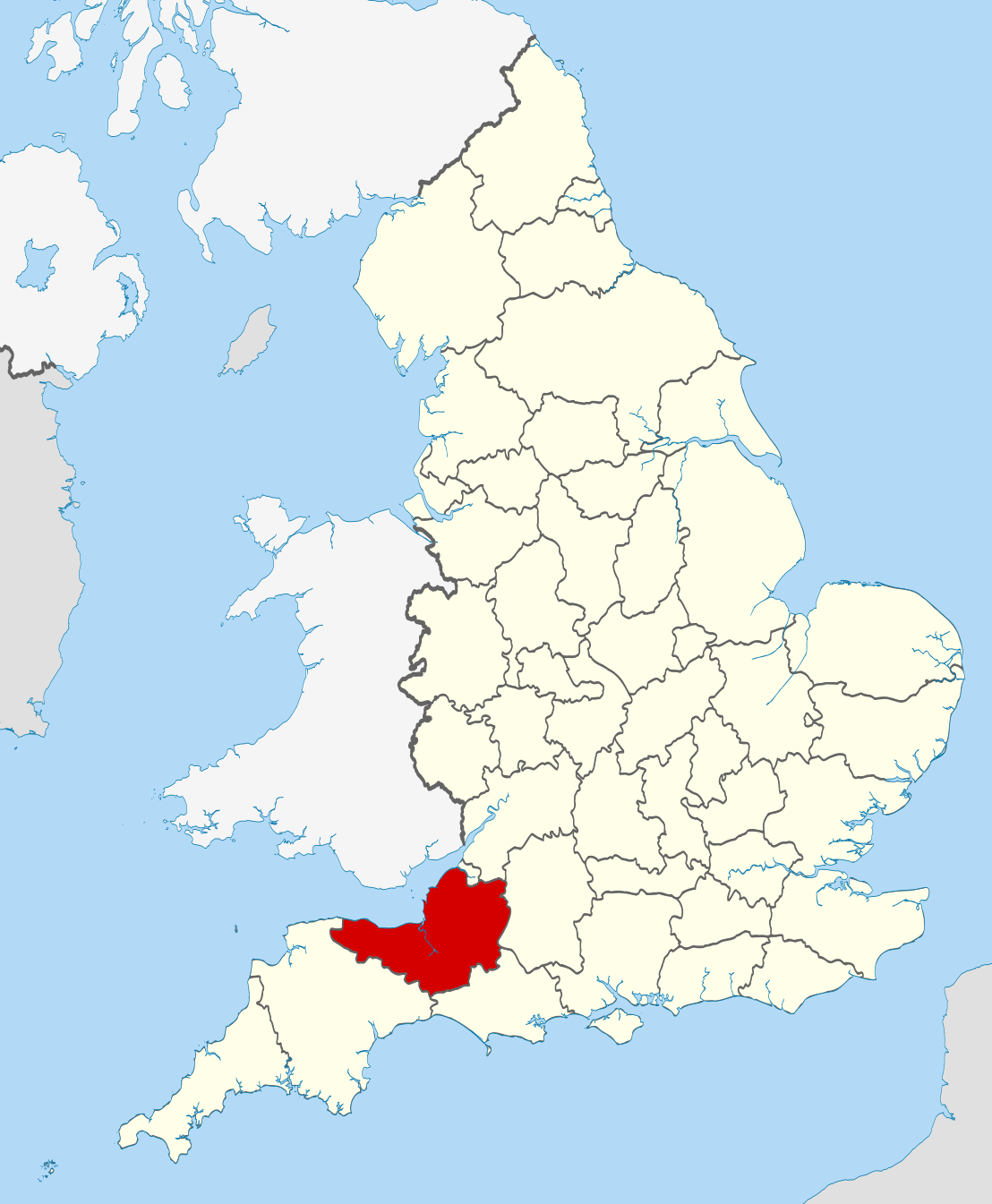
| Descripció | Location of the ceremonial county of Somerset within England. |
| Data | |
| Font |
National Geospatial-Intelligence Agency
|
| Autor | Nilfanion |
Llicència[modifica]
Jo, el titular dels drets d'autor d'aquest treball, el public sota les següents llicències:
Aquest fitxer està subjecte a la llicència de Creative Commons Reconeixement i Compartir Igual 3.0 No adaptada.
- Sou lliure de:
- compartir – copiar, distribuir i comunicar públicament l'obra
- adaptar – fer-ne obres derivades
- Amb les condicions següents:
- reconeixement – Heu de donar la informació adequada sobre l'autor, proporcionar un enllaç a la llicència i indicar si s'han realitzat canvis. Podeu fer-ho amb qualsevol mitjà raonable, però de cap manera no suggereixi que l'autor us dóna suport o aprova l'ús que en feu.
- compartir igual – Si modifiqueu, transformeu, o generareu amb el material, haureu de distribuir les vostres contribucions sota una llicència similar o una de compatible com l'original

|
S'autoritza la còpia, la distribució i la modificació d'aquest document sota els termes de la llicència de documentació lliure GNU versió 1.2 o qualsevol altra versió posterior que publiqui la Free Software Foundation; sense seccions invariants, ni textos de portada, ni textos de contraportada. S'inclou una còpia d'aquesta llicència en la secció titulada GNU Free Documentation License. |
Podeu seleccionar la llicència que vulgueu.

|
This is one of the images forming part of the Valued image set: Locator maps of the Ceremonial counties of England on Wikimedia Commons. The image set has been assessed under the valued image set criteria and is considered the most valued set on Commons within the scope:
Locator maps of the Ceremonial counties of England
You can see its nomination at Commons:Valued image candidates/Locator maps of English ceremonial counties. |
Historial del fitxer
Cliqueu una data/hora per veure el fitxer tal com era aleshores.
| Data/hora | Miniatura | Dimensions | Usuari/a | Comentari | |
|---|---|---|---|---|---|
| actual | 22:43, 23 nov 2010 | | 1.108 × 1.345 (302 Ko) | Nilfanion (discussió | contribucions) | == Summary == {{Information |Description=Location of the ceremonial county of Somerset within England. |Source=Ordnance Survey [https://www.ordnancesurvey.co.uk/opendatadownload/products.html OpenData]: *County boundar |
No podeu sobreescriure aquest fitxer.
Ús del fitxer
Les 37 pàgines següents utilitzen aquest fitxer:
- Valued image set: Locator maps of the Ceremonial counties of England
- Commons:Valued image candidates/Locator maps of English ceremonial counties
- Category:Alumni by school in Somerset
- Category:Births in Somerset
- Category:Bridges in Somerset
- Category:Canals in Somerset
- Category:Cemeteries in Somerset
- Category:Cycling in Somerset
- Category:Deaths in Somerset
- Category:Headlands of Somerset
- Category:Hospitals in Somerset
- Category:Lighthouses in Somerset
- Category:Local government in Somerset
- Category:Maps of Somerset
- Category:Meadows in Somerset
- Category:People of Somerset
- Category:Piers in Somerset
- Category:Populated places in Somerset
- Category:Rail transport in Somerset
- Category:Railway viaducts in Somerset
- Category:Rivers of Somerset
- Category:Roads in Somerset
- Category:Somerset
- Category:Somerset in the 18th century
- Category:Somerset in the 1990s
- Category:Somerset in the 19th century
- Category:Somerset in the 2000s
- Category:Somerset in the 20th century
- Category:Somerset in the 21st century
- Category:Thatched roofs in Somerset
- Category:Towers in Somerset
- Category:Towns in Somerset
- Category:Tunnels in Somerset
- Category:Views of Somerset
- Category:Villages in Somerset
- Category:Visitor attractions in Somerset
- Category:Windmills in Somerset
Ús global del fitxer
Utilització d'aquest fitxer en altres wikis:
- Utilització a af.wikipedia.org
- Utilització a an.wikipedia.org
- Utilització a ar.wikipedia.org
- Utilització a arz.wikipedia.org
- Utilització a ast.wikipedia.org
- Utilització a az.wikipedia.org
- Utilització a be-tarask.wikipedia.org
- Utilització a bg.wikipedia.org
- Utilització a bn.wikipedia.org
- Utilització a br.wikipedia.org
- Utilització a ca.wikipedia.org
- Utilització a ceb.wikipedia.org
- Utilització a cs.wikipedia.org
- Utilització a de.wikipedia.org
- Utilització a en.wikipedia.org
- Somerset
- Exmoor Horn
- Staple Hill (Somerset)
- Two Moors Way
- Weston-super-Mare (UK Parliament constituency)
- Keynsham Humpy Tumps
- Bath (UK Parliament constituency)
- Bathwick
- North East Somerset (UK Parliament constituency)
- Claverton Down
- Template:Somerset-geo-stub
- Quants Reserve
- Lansdown, Bath
- North Somerset (UK Parliament constituency)
- Lulsgate Plateau
- Bristol Reservoirs
- Bowlditch Quarry
- Brockley Hall Stables
- Hartcliff Rocks Quarry
- Ham Green SSSI
- Hinton Charterhouse Field
- Hinton Charterhouse Pit
- Hinton Hill, Wellow
- Holly Lane SSSI
- Huish Colliery Quarry
- Lulsgate Quarry
- Kenn Church, Kenn Pier & Yew Tree Farm SSSI
- Tickenham, Nailsea and Kenn Moors SSSI
- Hobbs Quarry SSSI, Shepton Mallet
- Ben Knowle
- Doulting Railway Cutting
- Viaduct Quarry
Vegeu més usos globals d'aquest fitxer.