File:South end of US 1.jpg
Jump to navigation
Jump to search
Size of this preview: 450 × 600 pixels. Other resolutions: 180 × 240 pixels | 360 × 480 pixels | 576 × 768 pixels | 768 × 1,024 pixels | 1,536 × 2,048 pixels | 2,736 × 3,648 pixels.
Original file (2,736 × 3,648 pixels, file size: 3.24 MB, MIME type: image/jpeg)
Captions
Captions
Add a one-line explanation of what this file represents
Summary
[edit]
| Description |
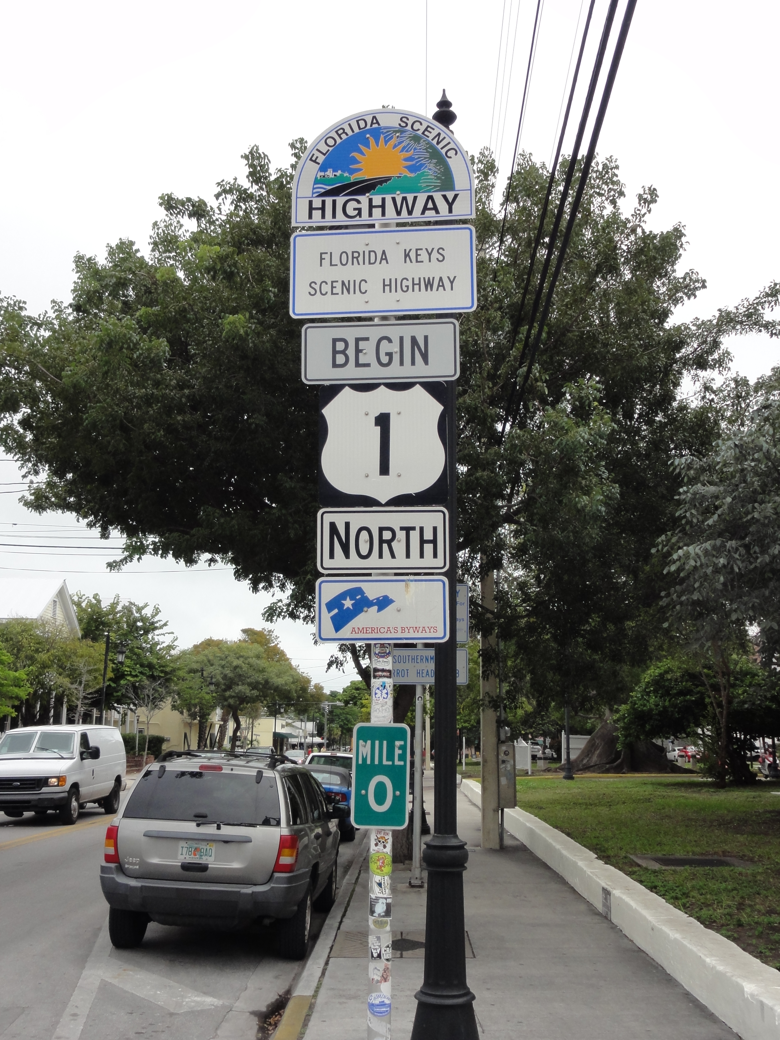
Now you know the origin of those Mile 0 stickers. The other end is at Fort Kent, ME, 2390 miles away (or 2376, depending on if you are using historical or current routings). Florida used to have its own color scheme for US Routes, with US 1 having a white number on an all-red shield. See? |
| Date | |
| Source | Key West |
| Author | Don Kasak from St. Louis, MO, US |
| Object location | | View this and other nearby images on: OpenStreetMap |
|---|
Licensing
[edit]
This file is licensed under the Creative Commons Attribution 2.0 Generic license.
- You are free:
- to share – to copy, distribute and transmit the work
- to remix – to adapt the work
- Under the following conditions:
- attribution – You must give appropriate credit, provide a link to the license, and indicate if changes were made. You may do so in any reasonable manner, but not in any way that suggests the licensor endorses you or your use.
| This image was originally posted to Flickr by stannate at https://www.flickr.com/photos/24164603@N00/1283252682. It was reviewed on 27 October 2007 by FlickreviewR and was confirmed to be licensed under the terms of the cc-by-2.0. |
File history
Click on a date/time to view the file as it appeared at that time.
| Date/Time | Thumbnail | Dimensions | User | Comment | |
|---|---|---|---|---|---|
| current | 03:56, 19 March 2012 | | 2,736 × 3,648 (3.24 MB) | Sirkan (talk | contribs) | {{subst:Upload marker added by en.wp UW}} {{Information |Description = {{en|The mile zero signage on US Route 1 at the intersection of Whitehead and Fleming Street in Key West, Florida.}} |Source = I took this photo in Key West, Florida while visiting ... |
| 03:57, 19 March 2012 |  | 1,024 × 768 (543 KB) | Sirkan (talk | contribs) | {{subst:Upload marker added by en.wp UW}} {{Information |Description = {{en|The mile zero signage on US Route 1 at the intersection of Whitehead and Fleming Street in Key West, Florida.}} |Source = I took this photo in Key West, Florida while visiting ... | |
| 22:54, 26 October 2007 |  | 2,736 × 3,648 (3.24 MB) | NE2 (talk | contribs) | {{Information |Description= Now you know the origin of those Mile 0 stickers. The other end is at Fort Kent, ME, 2390 miles away (or 2376, depending on if you are using historical or current routings). Florida used to have its own color scheme for US |
You cannot overwrite this file.
File usage on Commons
The following 2 pages use this file:
File usage on other wikis
The following other wikis use this file:
- Usage on en.wikiquote.org
- Usage on en.wikivoyage.org
- Usage on es.wikipedia.org
- Usage on hu.wikipedia.org
- Usage on nl.wikipedia.org
- Usage on www.wikidata.org