File:SouthernCaribbeanIslands.PNG
跳转到导航
跳转到搜索
本预览的尺寸:800 × 405像素。 其他分辨率:320 × 162像素 | 840 × 425像素。
原始文件 (840 × 425像素,文件大小:175 KB,MIME类型:image/png)
说明
说明
添加一行文字以描述该文件所表现的内容
摘要[编辑]
| 描述 |
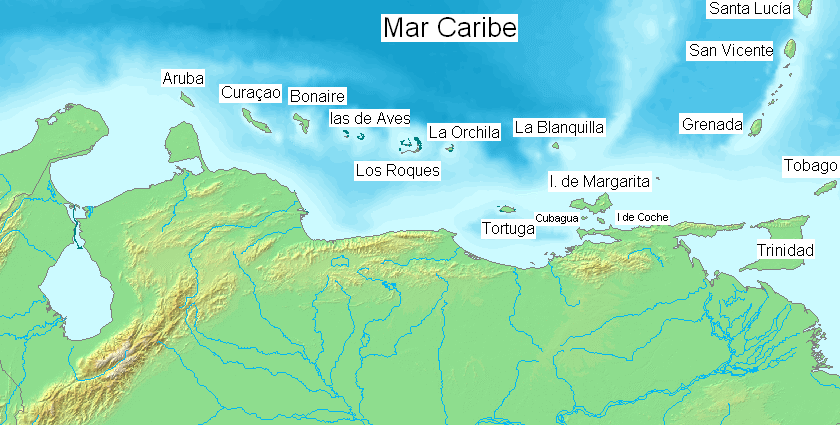
English: Major islands of the southern Caribbean Sea. Español: Pricipales islas en el mar Caribe sur. |
| 日期 | |
| 来源 | 自己的作品 ( Edited over former map File:Map of Venezuela Demis.png ) |
| 作者 | Claudio Elias |
This image is in the public domain because it came from the site https://www.demis.nl/products/web-map-server/examples/ and was released by the copyright holder. Permission is granted to copy, distribute and/or modify this map since it is based on free of copyright images from: www.demis.nl. See also approval email on de.wp and its clarification.
|
| This work has been released into the public domain by its copyright holder, www.demis.nl. This applies worldwide. 在一些国家这可能不合法;如果是这样的话,那么: www.demis.nl无条件地授予任何人以任何目的使用本作品的权利,除非这些条件是法律规定所必需的。
|
许可协议[编辑]
| 我,本作品著作权人,释出本作品至公有领域。这适用于全世界。 在一些国家这可能不合法;如果是这样的话,那么: 我无条件地授予任何人以任何目的使用本作品的权利,除非这些条件是法律规定所必需的。 |
文件历史
点击某个日期/时间查看对应时刻的文件。
| 日期/时间 | 缩略图 | 大小 | 用户 | 备注 | |
|---|---|---|---|---|---|
| 当前 | 2018年4月9日 (一) 07:46 | | 840 × 425(175 KB) | ديفيد عادل وهبة خليل 2(留言 | 贡献) | Cropped 1 % horizontally, 1 % vertically using CropTool with precise mode. Removed border. |
| 2014年4月6日 (日) 00:32 |  | 846 × 431(173 KB) | Capmo(留言 | 贡献) | Orchilla > Orchila | |
| 2007年8月23日 (四) 18:50 |  | 846 × 431(129 KB) | Claudio Elias(留言 | 贡献) | {{Information |Description=EN: Mayors islands on southern Caribbean sea. ES: pricipales islas en en el mar Caribe sur. ( Edited over former map Map of Venezuela Demis.png . |Source=self-made |Date=august 2007 |Author= [[User:Claudio Elias|Claudio Eli |
您不可以覆盖此文件。
文件用途
以下页面使用本文件:
全域文件用途
以下其他wiki使用此文件:
- el.wikipedia.org上的用途
- en.wikipedia.org上的用途
- es.wikipedia.org上的用途
- es.wikibooks.org上的用途
- fa.wikipedia.org上的用途
- gl.wikipedia.org上的用途
- hr.wikipedia.org上的用途
- hu.wikipedia.org上的用途
- it.wikipedia.org上的用途
- ja.wikipedia.org上的用途
- ms.wikipedia.org上的用途
- pt.wikipedia.org上的用途
- zh.wikipedia.org上的用途