File:Srirangapatnam, Sri Ranganathaswamy Temple, gopuram (9881613636).jpg
Original file (3,456 × 5,184 pixels, file size: 7 MB, MIME type: image/jpeg)
Captions
Captions
Summary
[edit].jpg&action=edit§ion=1)
| Description |
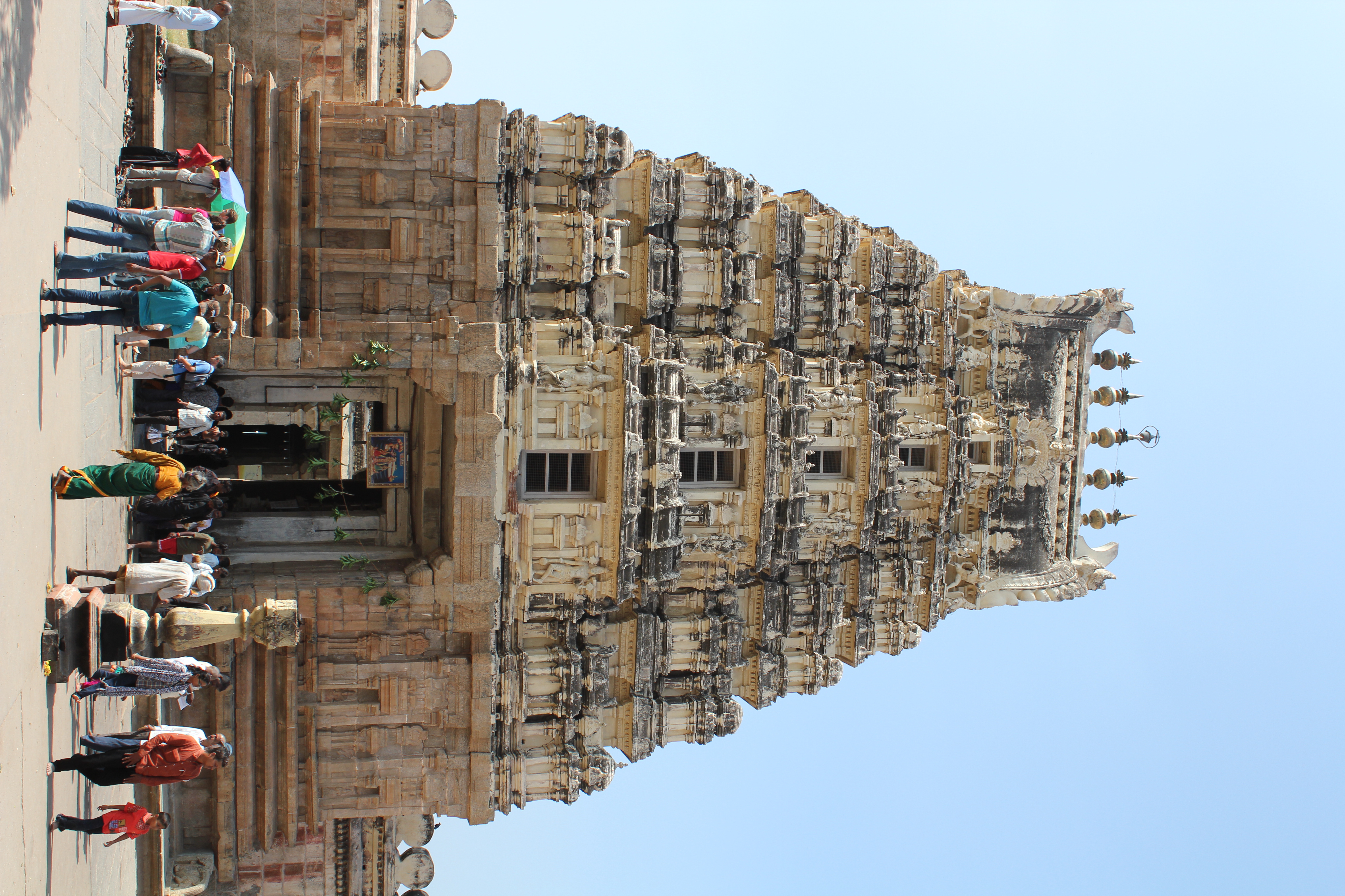
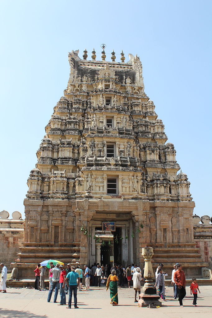
Srirangapatnam, Sri Ranganathaswamy Temple, eastern gopuram Srirangapatna (also spelled Shrirangapattana; anglicized to Seringapatam during the British Raj) is a town in the Indian state of Karnataka. It is of religious, cultural and historic importance. Srirangapattana became the de facto capital of Mysore under Hyder Ali and Tipu Sultan. When Tipu finally dispensed with the charade of deference to the legitimate Wodeyar Maharaja who was actually his captive, and proclaimed the "Khudadad State" under his own kingship, Srirangapattana became de jure the capital of that short-lived political entity. In that heady period, the state ruled by Tipu extended its frontiers in every direction, encompassing a major portion of South India. Srirangapattana flourished as the cosmopolitan capital of this powerful state. Various Indo-Islamic monuments that dot the town, such as Tipu Sultan's palaces, the Darya Daulat and the Jumma Maseedi (Friday congregational mosque), date from this period. The Ranganthaswamy temple (usually referred to as "Sri Ranganathaswamy") in Srirangapatina, is dedicated to the Hindu god Ranganatha (a manifestation of the god Vishnu). It is one of the five important pilgrimage sites along the river Kaveri for devotees of Ranganatha. These five sacred sites are together known as Pancharanga Kshetrams in Southern India. Since Srirangapatna is the first temple starting from upstream, the deity is known as Adi Ranga (lit; "first Ranga"). The town of Srirangapatna, which derives its name from the temple, is located on an island in the river Kaveri. (source: en.wikipedia.org/wiki/Srirangapatna and en.wikipedia.org/wiki/Ranganathaswamy_Temple,_Srirangapatna) |
| Date | |
| Source | Srirangapatnam, Sri Ranganathaswamy Temple, gopuram |
| Author | Arian Zwegers from Brussels, Belgium |
| Camera location | | View this and other nearby images on: OpenStreetMap |
|---|
.jpg¶ms=012.424905_N_0076.679978_E_globe:Earth_type:camera_source:Flickr_&language=en)
Licensing
[edit].jpg&action=edit§ion=2)
- You are free:
- to share – to copy, distribute and transmit the work
- to remix – to adapt the work
- Under the following conditions:
- attribution – You must give appropriate credit, provide a link to the license, and indicate if changes were made. You may do so in any reasonable manner, but not in any way that suggests the licensor endorses you or your use.
| This image was originally posted to Flickr by Arian Zwegers at https://flickr.com/photos/67769030@N07/9881613636. It was reviewed on 8 March 2016 by FlickreviewR and was confirmed to be licensed under the terms of the cc-by-2.0. |
File history
Click on a date/time to view the file as it appeared at that time.
| Date/Time | Thumbnail | Dimensions | User | Comment | |
|---|---|---|---|---|---|
| current | 20:24, 8 March 2016 | | 3,456 × 5,184 (7 MB) | Shipjustgotreal (talk | contribs) | Transferred from Flickr via Flickr2Commons |
You cannot overwrite this file.
File usage on Commons
There are no pages that use this file.
.jpg&oldid=896454745)