File:Staffordshire UK locator map 2010.svg
Salta a la navegació
Salta a la cerca

Mida d'aquesta previsualització PNG del fitxer SVG: 494 × 600 píxels. Altres resolucions: 198 × 240 píxels | 395 × 480 píxels | 633 × 768 píxels | 843 × 1.024 píxels | 1.687 × 2.048 píxels | 1.108 × 1.345 píxels.
Fitxer original (fitxer SVG, nominalment 1.108 × 1.345 píxels, mida del fitxer: 302 Ko)
Llegendes
Llegendes
Afegeix una explicació d'una línia del que representa aquest fitxer
Resum[modifica]
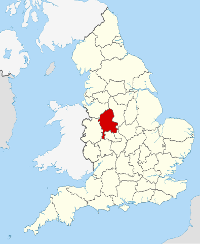
| Descripció | Location of the ceremonial county of Staffordshire within England. |
| Data | |
| Font |
National Geospatial-Intelligence Agency
|
| Autor | Nilfanion |
Llicència[modifica]
Jo, el titular dels drets d'autor d'aquest treball, el public sota les següents llicències:
Aquest fitxer està subjecte a la llicència de Creative Commons Reconeixement i Compartir Igual 3.0 No adaptada.
- Sou lliure de:
- compartir – copiar, distribuir i comunicar públicament l'obra
- adaptar – fer-ne obres derivades
- Amb les condicions següents:
- reconeixement – Heu de donar la informació adequada sobre l'autor, proporcionar un enllaç a la llicència i indicar si s'han realitzat canvis. Podeu fer-ho amb qualsevol mitjà raonable, però de cap manera no suggereixi que l'autor us dóna suport o aprova l'ús que en feu.
- compartir igual – Si modifiqueu, transformeu, o generareu amb el material, haureu de distribuir les vostres contribucions sota una llicència similar o una de compatible com l'original

|
S'autoritza la còpia, la distribució i la modificació d'aquest document sota els termes de la llicència de documentació lliure GNU versió 1.2 o qualsevol altra versió posterior que publiqui la Free Software Foundation; sense seccions invariants, ni textos de portada, ni textos de contraportada. S'inclou una còpia d'aquesta llicència en la secció titulada GNU Free Documentation License. |
Podeu seleccionar la llicència que vulgueu.

|
This is one of the images forming part of the Valued image set: Locator maps of the Ceremonial counties of England on Wikimedia Commons. The image set has been assessed under the valued image set criteria and is considered the most valued set on Commons within the scope:
Locator maps of the Ceremonial counties of England
You can see its nomination at Commons:Valued image candidates/Locator maps of English ceremonial counties. |
Historial del fitxer
Cliqueu una data/hora per veure el fitxer tal com era aleshores.
| Data/hora | Miniatura | Dimensions | Usuari/a | Comentari | |
|---|---|---|---|---|---|
| actual | 22:44, 23 nov 2010 | | 1.108 × 1.345 (302 Ko) | Nilfanion (discussió | contribucions) | == Summary == {{Information |Description=Location of the ceremonial county of Staffordshire within England. |Source=Ordnance Survey [https://www.ordnancesurvey.co.uk/opendatadownload/products.html OpenData]: *Coun |
No podeu sobreescriure aquest fitxer.
Ús del fitxer
Les 26 pàgines següents utilitzen aquest fitxer:
- Valued image set: Locator maps of the Ceremonial counties of England
- Commons:Valued image candidates/Locator maps of English ceremonial counties
- Category:Almshouses in Staffordshire
- Category:Alumni by school in Staffordshire
- Category:Births in Staffordshire
- Category:Bridges in Staffordshire
- Category:Canals in Staffordshire
- Category:Country parks in Staffordshire
- Category:Hospitals in Staffordshire
- Category:Local government in Staffordshire
- Category:Maps of Staffordshire
- Category:Meadows in Staffordshire
- Category:People of Staffordshire
- Category:Populated places in Staffordshire
- Category:Rivers of Staffordshire
- Category:Sports in Staffordshire
- Category:Staffordshire
- Category:Staffordshire in the 19th century
- Category:Staffordshire in the 20th century
- Category:Staffordshire in the 21st century
- Category:Towers in Staffordshire
- Category:Tunnels in Staffordshire
- Category:Views of Staffordshire
- Category:Villages in Staffordshire
- Category:Visitor attractions in Staffordshire
- Category:Windmills in Staffordshire
Ús global del fitxer
Utilització d'aquest fitxer en altres wikis:
- Utilització a af.wikipedia.org
- Utilització a ar.wikipedia.org
- Utilització a ast.wikipedia.org
- Utilització a be-tarask.wikipedia.org
- Utilització a bg.wikipedia.org
- Utilització a ca.wikipedia.org
- Utilització a ceb.wikipedia.org
- Utilització a cs.wikipedia.org
- Utilització a dag.wikipedia.org
- Utilització a de.wikipedia.org
- Utilització a en.wikipedia.org
- Staffordshire
- Croxden
- Swinfen
- Beacon Way
- Coombes Valley RSPB reserve
- RAF Stafford
- Hopwas
- Spath
- Admaston, Staffordshire
- Armitage
- Knighton, Stafford
- Pye Green
- Whitmore, Staffordshire
- Maer, Staffordshire
- Kings Bromley
- Brindley Heath
- Stretton, East Staffordshire
- Norbury, Staffordshire
- Knightley, Staffordshire
- Loynton
- Abbey Green, Staffordshire Moorlands
- Lower Penn
- Above Church
- Great Bridgeford
- Weston-under-Lizard
- Midlands Plateau
- Template:Staffordshire-geo-stub
- Keele (ward)
- Stonydelph
- Chasetown
- Acton Trussell and Bednall
- Anglesey, Staffordshire
- Alrewas and Fradley
- Alstonefield
- Armitage with Handsacre
- Merryton Low
- Quarnford
- Upper Hulme
Vegeu més usos globals d'aquest fitxer.