File:Stolper-turm-02.jpg
Jump to navigation
Jump to search

Size of this preview: 576 × 599 pixels. Other resolutions: 231 × 240 pixels | 461 × 480 pixels | 738 × 768 pixels | 984 × 1,024 pixels | 1,479 × 1,539 pixels.
Original file (1,479 × 1,539 pixels, file size: 475 KB, MIME type: image/jpeg)
Captions
Captions
Add a one-line explanation of what this file represents
Summary[edit]
| Description | |
| Source |
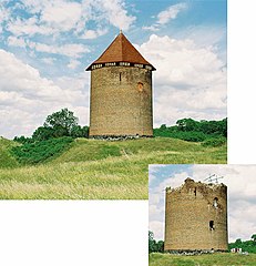
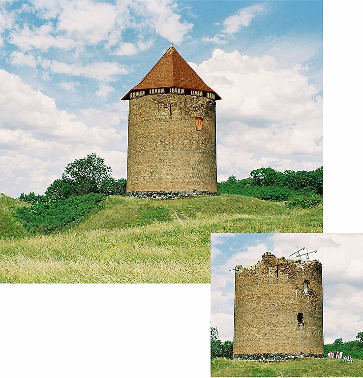
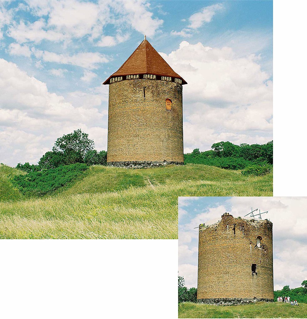
Deutsch: Für den Bilderwettbewerb wurden hier die Bilder der Rekonstruktion und des Originalzustands von Ralf Roletschek zusammenmontiert.
Die Einschüsse des 2. Weltkrieges habe ich beseitigt, ebenso die nachträglich angebrachte Tür, die Mitte des 19. Jahrhunderts eingebaut wurde. Die Rekonstruktion stellt eine mögliche Ansicht des Turmes kurz vor seiner Erstürmung 1445 dar. Das Dach war mit Ziegeln Mönch/Nonne gedeckt, davon habe ich aber kein Bild, deshalb habe ich das Dach einer uralten spanischen Kathedrale draufgesetzt. Die Touristen wurden nach Hause geschickt, das Mauerwerk habe ich weitgehend neu verfugt. Es gibt keine gesicherten Hinweise, welche Form das Dach hatte, ein hohes Spitzdach ist für die Romanik unwahrscheinlich. Der Turm hatte Zinnen, welche Form und Ausmaße diese hatten, ist unbekannt. Die Ruine blieb von 1445 bis 1990 unberührt, die Reste des Daches wurden unfachmännisch entsorgt, was eine korrekte Rekonstruktion erschwert. Die eingebaute Tür war zu Zeiten der Nutzung des Turms wirklich der einzige Eingang! Wie die Bewohner des Turmes dorthingelangten, ist unbekannt. |
| Author | Ralf Roletschek |
Licensing[edit]
This file is licensed under the Creative Commons Attribution-Share Alike 2.0 Germany license.
- You are free:
- to share – to copy, distribute and transmit the work
- to remix – to adapt the work
- Under the following conditions:
- attribution – You must give appropriate credit, provide a link to the license, and indicate if changes were made. You may do so in any reasonable manner, but not in any way that suggests the licensor endorses you or your use.
- share alike – If you remix, transform, or build upon the material, you must distribute your contributions under the same or compatible license as the original.

| Camera location | | View this and other nearby images on: OpenStreetMap |
|---|
File history
Click on a date/time to view the file as it appeared at that time.
| Date/Time | Thumbnail | Dimensions | User | Comment | |
|---|---|---|---|---|---|
| current | 21:50, 23 August 2006 | | 1,479 × 1,539 (475 KB) | Ralf Roletschek (talk | contribs) | eigene Bilder, zusammenmontiert für Bilderwettbewerb |
You cannot overwrite this file.
File usage on Commons
There are no pages that use this file.
File usage on other wikis
The following other wikis use this file: