File:Straßenbrunnen092 Staaken Südekumzeile (4).jpg
Jump to navigation
Jump to search
Size of this preview: 450 × 600 pixels. Other resolutions: 180 × 240 pixels | 360 × 480 pixels | 576 × 768 pixels | 768 × 1,024 pixels | 1,536 × 2,048 pixels | 3,137 × 4,181 pixels.
Original file (3,137 × 4,181 pixels, file size: 3.02 MB, MIME type: image/jpeg)
Captions
Captions
Add a one-line explanation of what this file represents
Summary[edit]
.jpg&action=edit§ion=1)
| Description |
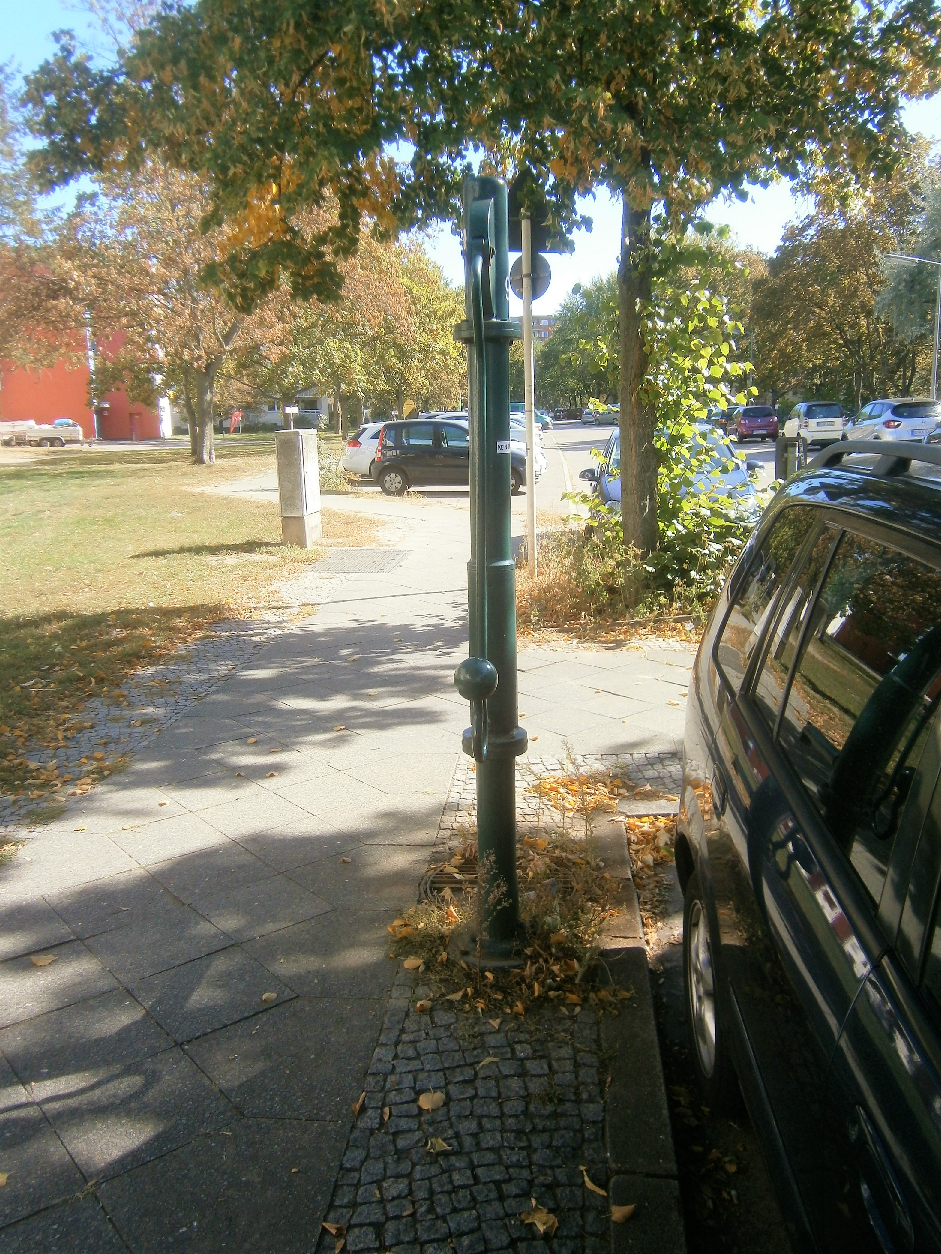
Deutsch: 2008 stand neben dem Überweg ein gelber Schliephacke-Brunnen auf dem gepflasterten Gehwegrand mit Austritt und Schwengel parallel zum Bordstein. (siehe StreetView 2008) Der neu gesetzte FSH-Brunnen wurde dabei[1] auf eine neue Quellbohrung gesetzt, die etwa 5 m in Richtung zum Überweg (Ecke des Pflasterrandes) versetzt ist. Bei diesem Austausch wurde auch der Straßeneinlass unter dem Austrittsrohr gesetzt. Letzteres ist am Ansatz einer langen Hülse der Brunnensäule angeflascht. Der Bullengraben im Bereich der Stieglake flueßt 160 Meter südlich vom Standort. Im Übrigen geht die Südekumzeile im Straßenbogen 40 Meter westlich in den Zweiwinkelweg, der Einzugsbereiche des Brunnens ist die südwestliche Louise-Schröder-Siedlung.[2] |
| Date | |
| Source | Own work |
| Author | Boonekamp (Günter Haase) |
| Camera location | | View this and other nearby images on: OpenStreetMap |
|---|
.jpg¶ms=052.530889_N_0013.146741_E_globe:Earth_type:camera__&language=en)
Licensing[edit]
.jpg&action=edit§ion=2)
I, the copyright holder of this work, hereby publish it under the following license:
This file is licensed under the Creative Commons Attribution-Share Alike 4.0 International license.
- You are free:
- to share – to copy, distribute and transmit the work
- to remix – to adapt the work
- Under the following conditions:
- attribution – You must give appropriate credit, provide a link to the license, and indicate if changes were made. You may do so in any reasonable manner, but not in any way that suggests the licensor endorses you or your use.
- share alike – If you remix, transform, or build upon the material, you must distribute your contributions under the same or compatible license as the original.
- ↑ Schwengel und Austritt liegen ebenfalls parallel zum Bordstein jedoch ist deren Lage gerade anders gerichtet.
- ↑ Karte von Berlin: Louise-Schröder-Siedlung
File history
Click on a date/time to view the file as it appeared at that time.
| Date/Time | Thumbnail | Dimensions | User | Comment | |
|---|---|---|---|---|---|
| current | 16:00, 10 October 2019 | | 3,137 × 4,181 (3.02 MB) | Boonekamp (talk | contribs) | User created page with UploadWizard |
You cannot overwrite this file.
File usage on Commons
The following page uses this file:
File usage on other wikis
The following other wikis use this file:
- Usage on de.wikipedia.org
.jpg&oldid=648689577)