File:Straßenbrunnen107 Wilhelmstadt Jäger-Weverstraße (1).jpg
Jump to navigation
Jump to search

Size of this preview: 449 × 599 pixels. Other resolutions: 180 × 240 pixels | 360 × 480 pixels | 576 × 768 pixels | 768 × 1,024 pixels | 1,536 × 2,048 pixels | 3,143 × 4,191 pixels.
Original file (3,143 × 4,191 pixels, file size: 3.25 MB, MIME type: image/jpeg)
Captions
Captions
Add a one-line explanation of what this file represents
Summary[edit]
.jpg&action=edit§ion=1)
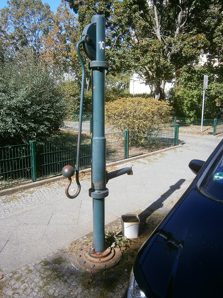
| Description | {{de|1=Der Brunnen steht (bereits 2008) auf dem westlichen Bürgersteig vor der unbebauten Grundstücksecke zur Weverstraße. Das Grundstück Weverstraße 53/54[1] (dazu gehörte Jägerstraße 22) ist durch Abriß und Neubau in den 1960er Jahren umgestaltet worden. Der Standort des Brunnens liegt 20 Meter von der Weverstraße und 15 Meter zum Hauseingang 22. Der Bunnen steht mit Schwengel und dem Austritt an einer langen Hülse parallel zum Bordstein auf dem gepflasterten Gehwegrand. Der Fußflansch ist über einen Zwischenring am Sockelrohr verschraubt. Unter dem Rohrbogen steht ein Behälter der Anwohner, der Straßeneinlass zum Wasserablauf fehlt. Einen Hinweis „Kein Trinkwasser“ gabTemplate:Zukunft es nicht. Das südliche Wilhemstadt liegt eingerahmt von Südpark(-teich) und Grimmnitzsee, zum Brunnen 300–500 Meter, wobei der Grundwasserabstand bis 5 m auf dieser Fläche liegt.}} |
| Date | |
| Source | Own work |
| Author | Boonekamp (Günter Haase) |
| Camera location | | View this and other nearby images on: OpenStreetMap |
|---|
.jpg¶ms=052.519205_N_0013.195651_E_globe:Earth_type:camera__&language=en)
Licensing[edit]
.jpg&action=edit§ion=2)
I, the copyright holder of this work, hereby publish it under the following license:
This file is licensed under the Creative Commons Attribution-Share Alike 4.0 International license.
- You are free:
- to share – to copy, distribute and transmit the work
- to remix – to adapt the work
- Under the following conditions:
- attribution – You must give appropriate credit, provide a link to the license, and indicate if changes were made. You may do so in any reasonable manner, but not in any way that suggests the licensor endorses you or your use.
- share alike – If you remix, transform, or build upon the material, you must distribute your contributions under the same or compatible license as the original.
- ↑ Die Weverstraße wurde gleichzeit neu nummriert, so befindet sich 53 und 54 nun auf der östlichen Seite von der Jägerstraße vormals 55/56. Dazu {{vergleiche Template:Berliner Adressbuch
File history
Click on a date/time to view the file as it appeared at that time.
| Date/Time | Thumbnail | Dimensions | User | Comment | |
|---|---|---|---|---|---|
| current | 09:45, 11 October 2019 | | 3,143 × 4,191 (3.25 MB) | Boonekamp (talk | contribs) | User created page with UploadWizard |
You cannot overwrite this file.
File usage on Commons
The following page uses this file:
File usage on other wikis
The following other wikis use this file:
- Usage on de.wikipedia.org
.jpg&oldid=514418455)