File:Straßenbrunnen14 Rahnsdorf Fangschleuser Püttbergeweg(3).JPG
Jump to navigation
Jump to search

Size of this preview: 528 × 600 pixels. Other resolutions: 211 × 240 pixels | 423 × 480 pixels | 676 × 768 pixels | 901 × 1,024 pixels | 2,297 × 2,609 pixels.
Original file (2,297 × 2,609 pixels, file size: 862 KB, MIME type: image/jpeg)
Captions
Captions
Add a one-line explanation of what this file represents
Summary[edit]
.JPG&action=edit§ion=1)
| Description |
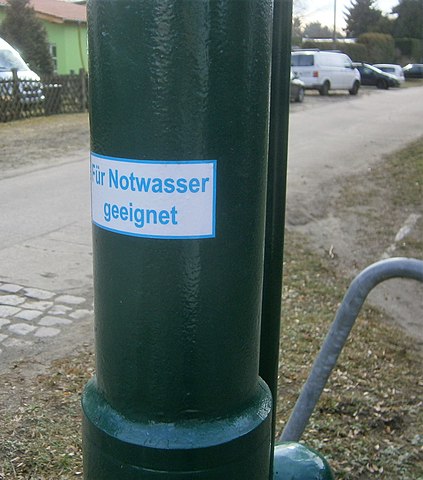
Deutsch: Der Köpenickeer Straßenbrunnen in der Rahnsdorfer Püttbergesiedlung steht an der Straßenecke Fangschleuser/ Püttbergeweg auf der dreieckigen Rasenfläche südwestlich der Fangschleuser Straße zu.[1] Der Brunnenfuß über einen Zwischenflansch am Sockelrohr befestigt steht auf einer Betonplatte, in die auch der Straßeneinlass eingebracht sit. An beiden Seiten der Platte ist der Brunnen gegen Anfahren durch Kraftfahrzeuge, die auf dem Rasenstreifen parken, geschützt. Der betriebsbereite Brunnen gibt zwar laut Schild kein Trinkwasser, aber es ist ein Schild "Für Notwasser geeignet" angebracht. |
| Date | |
| Source | Own work |
| Author | Boonekamp |
| Camera location | | View this and other nearby images on: OpenStreetMap |
|---|
.JPG¶ms=052.441333_N_0013.703532_E_globe:Earth_type:camera__&language=en)
Licensing[edit]
.JPG&action=edit§ion=2)
I, the copyright holder of this work, hereby publish it under the following license:
This file is licensed under the Creative Commons Attribution-Share Alike 4.0 International license.
- You are free:
- to share – to copy, distribute and transmit the work
- to remix – to adapt the work
- Under the following conditions:
- attribution – You must give appropriate credit, provide a link to the license, and indicate if changes were made. You may do so in any reasonable manner, but not in any way that suggests the licensor endorses you or your use.
- share alike – If you remix, transform, or build upon the material, you must distribute your contributions under the same or compatible license as the original.
File history
Click on a date/time to view the file as it appeared at that time.
| Date/Time | Thumbnail | Dimensions | User | Comment | |
|---|---|---|---|---|---|
| current | 11:53, 17 February 2020 | | 2,297 × 2,609 (862 KB) | Boonekamp (talk | contribs) | {{Information |description ={{de|1=Der Köpenickeer Straßenbrunnen in der Rahnsdorfer Püttbergesiedlung steht an der Straßenecke Fangschleuser/ Püttbergeweg auf der dreieckigen Rasenfläche südwestlich der Fangschleuser Straße zu.<ref>[https://fbinter.stadt-berlin.de/fb/index.jsp?loginkey=zoomStart&mapId=k_StraDa@senstadt&bbox=411805,5810867,411958,5810959 Straßenbefahrung 2014: Püttberge-/ Fangschleuser Weg]</ref> Der Brunnenfuß über einen Zwischenflansch am Sockelrohr befestigt steht auf ei... |
You cannot overwrite this file.
File usage on Commons
There are no pages that use this file.
File usage on other wikis
The following other wikis use this file:
- Usage on de.wikipedia.org
.JPG&oldid=845853372)