File:Straßenbrunnen40 Reindorf Waldowstraße Lindauer Allee (4).jpg
Jump to navigation
Jump to search
Size of this preview: 800 × 450 pixels. Other resolutions: 320 × 180 pixels | 640 × 360 pixels | 1,024 × 576 pixels | 1,280 × 720 pixels | 3,089 × 1,737 pixels.
Original file (3,089 × 1,737 pixels, file size: 1.52 MB, MIME type: image/jpeg)
Captions
Captions
Add a one-line explanation of what this file represents
Summary
[edit].jpg&action=edit§ion=1)
| Description |
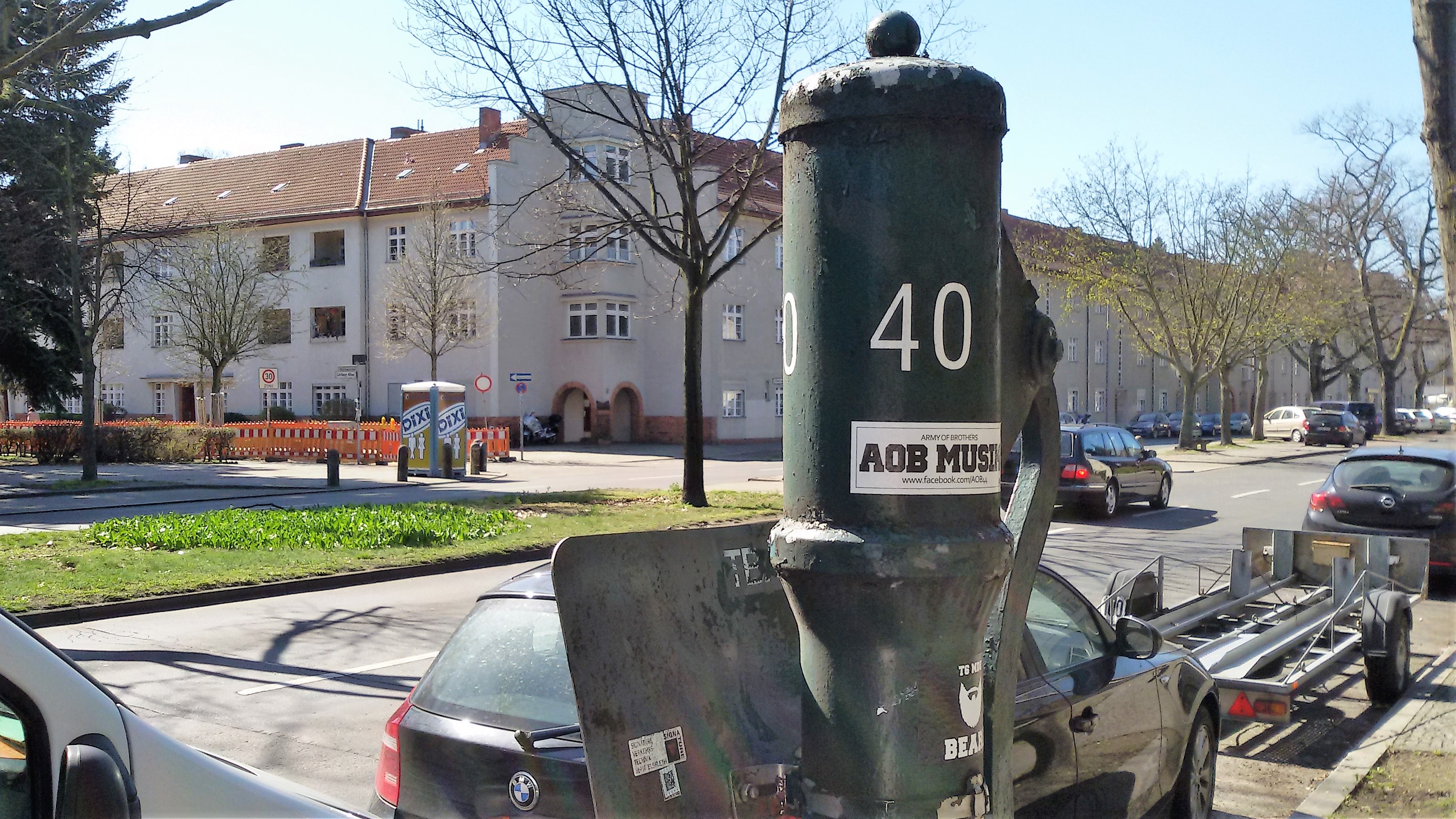
Deutsch: In der Liste der Anfrage aus dem Abgeordnetenhaus[1] ist der Brunnen Lindauer Allee 101 (PLZ: 13407) notiert. Der Brunnen steht an der Nordseite der Lindauer Allee, wobei das Wohnhaus 101 sich schtäg über die Kreuzung zum Brunnen befindet und die Hausecke gehört zu Waldowstraße 38. Die nördliche Fahrbahn der Lindauer Allee wurde erst um 1980 angelegt, der Gehweg auf dessen Pflasterrand das Sockelrohr in einem Mosaik endet wurde erst zu diesem Zeitpunkt angelegt. Die Ollenhauerstraße liegt 200 Meter nach Westen. Vom Brunnen nach Süden über den zweibahnigen Fahrdamm befindet sich die Stirnseite von Waldowstraße 32 nach Westen steht der Block Waldowstraße 37–34. Der Brunnenstandort[2] liegt zwischen Waldowstraße und 10 Meter zum Kienhorstgraben vor der Parkfläche neben der KGA ‚Einheit I‘. An der Brunnensäule sind Schwengel und Austritt quer zu einander, der Austrittsbogen endet oberhalb der Muldenplatte zum Bordstein gerichtet. Über dem Wasserrohr ist eine Markierung „Kein Trinkwasser“ und das A4-Blechschild zum Autowaschverbot angebracht. Neben der Parkspur an der Fahrbahn sind jedoch keine Anprallpfosten angebaut. |
| Date | |
| Source | Own work |
| Author | Boonekamp - das ist Günter Haase |
| Camera location | | View this and other nearby images on: OpenStreetMap |
|---|
.jpg¶ms=052.575508_N_0013.335212_E_globe:Earth_type:camera__&language=en)
Licensing
[edit].jpg&action=edit§ion=2)
I, the copyright holder of this work, hereby publish it under the following license:
This file is licensed under the Creative Commons Attribution-Share Alike 4.0 International license.
- You are free:
- to share – to copy, distribute and transmit the work
- to remix – to adapt the work
- Under the following conditions:
- attribution – You must give appropriate credit, provide a link to the license, and indicate if changes were made. You may do so in any reasonable manner, but not in any way that suggests the licensor endorses you or your use.
- share alike – If you remix, transform, or build upon the material, you must distribute your contributions under the same or compatible license as the original.
- ↑ Cite error: Invalid
<ref>tag; no text was provided for refs namedds17-15418 - ↑ Flurabstand des Grundwassers: Lindauer Allee - Roederallee bis Ollenhauer Straße
File history
Click on a date/time to view the file as it appeared at that time.
| Date/Time | Thumbnail | Dimensions | User | Comment | |
|---|---|---|---|---|---|
| current | 10:38, 3 April 2019 | | 3,089 × 1,737 (1.52 MB) | Boonekamp (talk | contribs) | User created page with UploadWizard |
You cannot overwrite this file.
File usage on Commons
There are no pages that use this file.
.jpg&oldid=823195024)