File:Straßenbrunnen 36 Gatow Alt-Gatow (9).jpg
Jump to navigation
Jump to search

Size of this preview: 450 × 600 pixels. Other resolutions: 180 × 240 pixels | 360 × 480 pixels | 576 × 768 pixels | 768 × 1,024 pixels | 1,536 × 2,048 pixels | 3,137 × 4,181 pixels.
Original file (3,137 × 4,181 pixels, file size: 2.44 MB, MIME type: image/jpeg)
Captions
Captions
Add a one-line explanation of what this file represents
Summary[edit]
.jpg&action=edit§ion=1)
| Description |
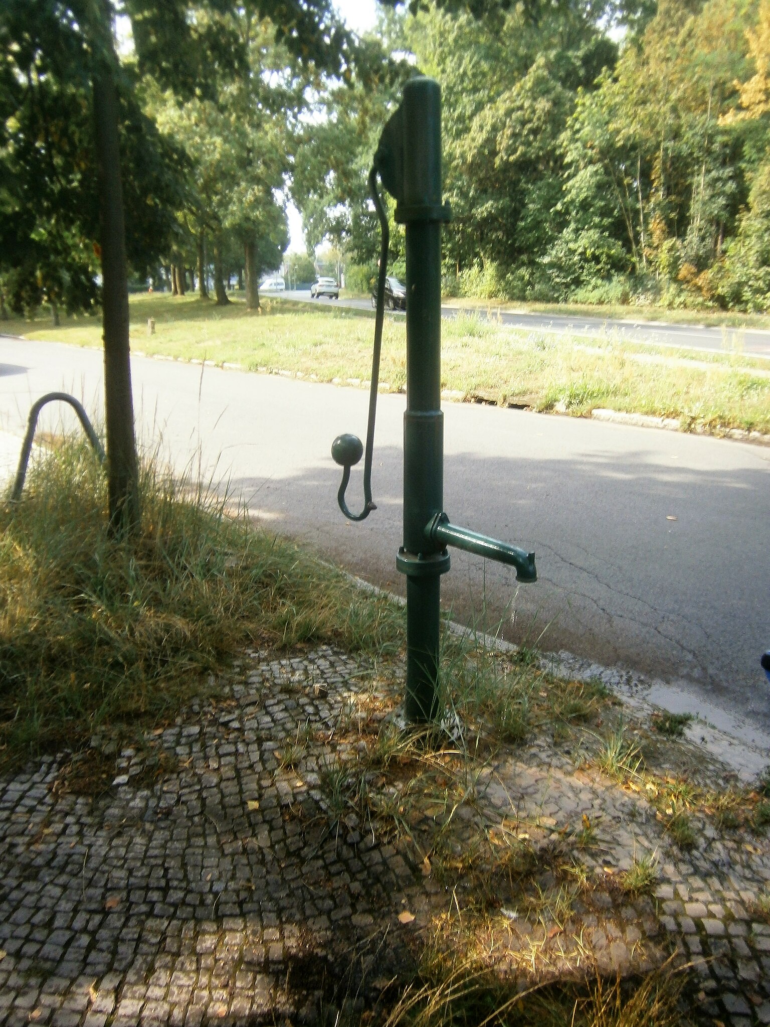
Deutsch: Der FSH-Brunnen steht (mindestens seit den 2000er Jahren[1]) am Nordende des Gatower Angers. Gegenüber auf dem Grundstück 54 an der durchgehenden Fahrbahn nach Kladow (zum Kladower Damm[2]) befindet sich das „Schülerhaus Gatow“ (Hort der Schule Am Windmühlenberg[3]). Bis in die 1970er Jahre war es das Polizeirevier 149. Das Haus 55 wurde Anfang der 1990er Jahre (statt des Vorgängerbaus) neu erbaut, das benachbarte Wohngebäude (57/59) entstand in den 1970er Jahren. Zusammen mit dem jetzigen Parkplatz 61/63 befand sich zuvor die Fürsorgestelle Gatow hier. Der Brunnen besitzt für den angeschraubten Wasseraustritt eine Länge Hülse an der Säule. Das gepumpte Wasser fließt über das Kleinpflaster am östlichen Gehsteig zum Bordstein ab, das Pumpen bringt klares Wasser - was für eine aktive Nutzung spricht. |
| Date | |
| Source | Own work |
| Author | Boonekamp * Günter Haase |
| Camera location | | View this and other nearby images on: OpenStreetMap |
|---|
.jpg¶ms=052.484922_N_0013.183479_E_globe:Earth_type:camera__&language=en)
Licensing[edit]
.jpg&action=edit§ion=2)
I, the copyright holder of this work, hereby publish it under the following license:
This file is licensed under the Creative Commons Attribution-Share Alike 4.0 International license.
- You are free:
- to share – to copy, distribute and transmit the work
- to remix – to adapt the work
- Under the following conditions:
- attribution – You must give appropriate credit, provide a link to the license, and indicate if changes were made. You may do so in any reasonable manner, but not in any way that suggests the licensor endorses you or your use.
- share alike – If you remix, transform, or build upon the material, you must distribute your contributions under the same or compatible license as the original.
- ↑ vergleiche dazu die Abbildung bei Google Street View von 7/2008. Der dort benachbarte Briefkasten wurde bis 2019 entfernt.
- ↑ Die getrennte Straßenführung der Fahrbahn direkt zum Kladower Damm wurde um 1948/1949 gestaltet. Sie führt westlich der damals zunächst noch bebauten Grundstücke 60 und 62 (und 64) weiter über die damals noch Wiesengrundstücke 66–78 zum Ortsausgang (Groß-Glienicker Weg). Der vormalige Straßenbereich von Alt-Gatow ist die von Süden nach Norden gerichtete Einbahnstraße. Grund der geänderten Straßenführung war offensichtlich die Übernahme des Flugplatzes Gatow - in Kladow – durch die British Army in Berlin.
- ↑ Schule im Grünen am Rande von Berlin
File history
Click on a date/time to view the file as it appeared at that time.
| Date/Time | Thumbnail | Dimensions | User | Comment | |
|---|---|---|---|---|---|
| current | 16:03, 2 August 2019 | | 3,137 × 4,181 (2.44 MB) | Boonekamp (talk | contribs) | User created page with UploadWizard |
You cannot overwrite this file.
File usage on Commons
The following page uses this file:
File usage on other wikis
The following other wikis use this file:
- Usage on de.wikipedia.org
.jpg&oldid=629362175)