File:Straßenbrunnen 39 Siemensstadt Rohrdamm (6).jpg
Jump to navigation
Jump to search

Size of this preview: 449 × 599 pixels. Other resolutions: 180 × 240 pixels | 360 × 480 pixels | 576 × 768 pixels | 768 × 1,024 pixels | 2,104 × 2,806 pixels.
Original file (2,104 × 2,806 pixels, file size: 1.67 MB, MIME type: image/jpeg)
Captions
Captions
Add a one-line explanation of what this file represents
Summary[edit]
.jpg&action=edit§ion=1)
| Description |
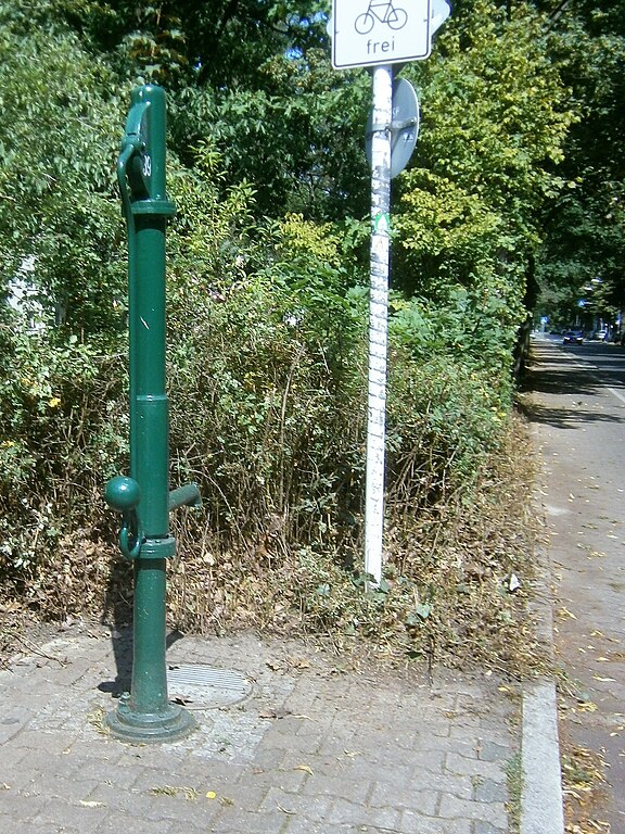
Deutsch: Die grünlackierte FSH-Säule wurde für die „Siedlung Rohrdamm“ in den 2010er Jahren an der westlichen Straßenseite des Rohrdamms gesetzt. Sie steht vor dem 20 Meter breiten Grünstreifen am Rohrdamm an der Ecke der mündenden Köttgenstraße.[1]. Die Gehwegecke ist mit Formsteinen belegt zwischen denen der Brunnenfuß mit Zwischenring am Sockelrohr von Kleinpflaster umgeben ist, dicht naneben der Straßeneinlass für den Wasserablauf. Der Gehweg nach Norden gehört zur Strauchzone des Grünstreifen, zur Fahrbahn befindet sich ein Radweg. Am gleichen Standort stand noch 2008 der gelbe Schliephacke-Brunnen aus den 1960er Jahren. Während die Wohnbebauung ösrlich vom Rohrdamm aus den 1930er Jahren stammt, wurden die Häuser westlich der „Siedlung Rohrdamm“ bei Rodung der Waldflächen der Jungfernheide in den 1960er Jahren errichtet. |
| Date | |
| Source | Own work |
| Author | Boonekamp (G. Haase) |
| Camera location | | View this and other nearby images on: OpenStreetMap |
|---|
.jpg¶ms=052.544003_N_0013.260949_E_globe:Earth_type:camera__&language=en)
Licensing[edit]
.jpg&action=edit§ion=2)
I, the copyright holder of this work, hereby publish it under the following license:
This file is licensed under the Creative Commons Attribution-Share Alike 4.0 International license.
- You are free:
- to share – to copy, distribute and transmit the work
- to remix – to adapt the work
- Under the following conditions:
- attribution – You must give appropriate credit, provide a link to the license, and indicate if changes were made. You may do so in any reasonable manner, but not in any way that suggests the licensor endorses you or your use.
- share alike – If you remix, transform, or build upon the material, you must distribute your contributions under the same or compatible license as the original.
File history
Click on a date/time to view the file as it appeared at that time.
| Date/Time | Thumbnail | Dimensions | User | Comment | |
|---|---|---|---|---|---|
| current | 12:03, 15 July 2019 | | 2,104 × 2,806 (1.67 MB) | Boonekamp (talk | contribs) | User created page with UploadWizard |
You cannot overwrite this file.
File usage on Commons
The following 2 pages use this file:
File usage on other wikis
The following other wikis use this file:
- Usage on de.wikipedia.org
.jpg&oldid=503337066)