File:Straßenbrunnen 61 FalkenhFeld Wasserwerkstraße (2).jpg
Jump to navigation
Jump to search
Size of this preview: 450 × 600 pixels. Other resolutions: 180 × 240 pixels | 360 × 480 pixels | 576 × 768 pixels | 768 × 1,024 pixels | 1,536 × 2,048 pixels | 3,216 × 4,288 pixels.
Original file (3,216 × 4,288 pixels, file size: 3.34 MB, MIME type: image/jpeg)
Captions
Captions
Add a one-line explanation of what this file represents
Summary[edit]
.jpg&action=edit§ion=1)
| Description |
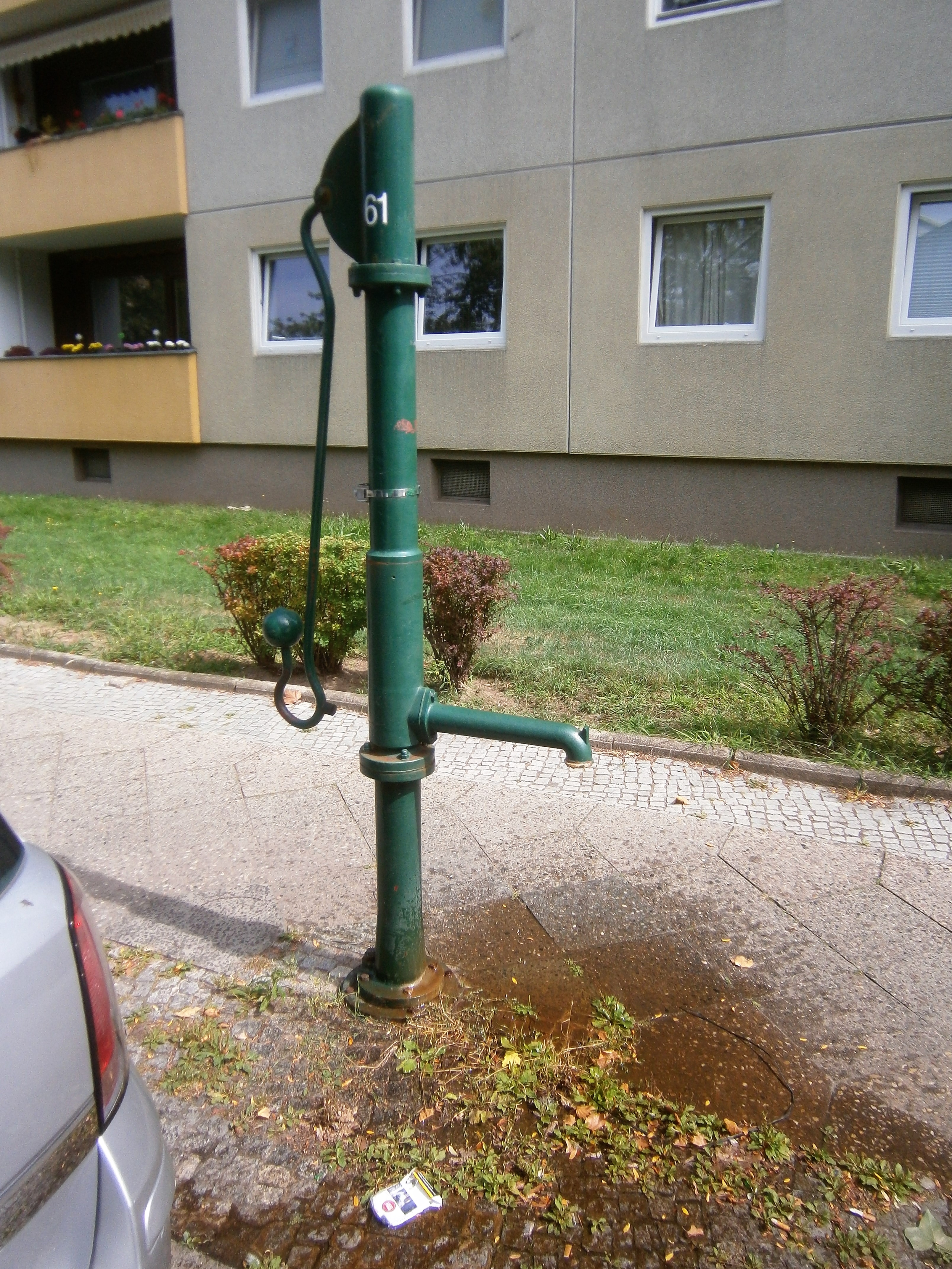
Deutsch: Der Standort des Brunnens zwischen Haakezeile und Pfefferweg ist mit Hausnummer 8 (Wohnzeile 4–8) in der Liste benannt. Ein FSH-Brunnen steht 2008 am östlichen Gehweg, allerdings vor dem viergeschossigen Wohnhaus 16 (Wohnzeile 16–20). Der (vermeintliche) Abstand beträgt dabei 60 Meter, wobei zwischen dem Haus 8 und 16 die Zufahrt zum querstehenden Block 10–14 liegt, sowie die Müll-/ Recyclingcontainer und eine Garagenreihe.[1] Die Wohnhäuser im Karree wurden in den 1960er Jahren erbaut, der Brunnenstandort könnte wohl zu diesem Zeitpunkt festgelegt sein. Der Brunnen hat für den Wasseraustritt eine lange Hülse am Schaft. Der Abfluss erfolgt unmittelbar auf den Gehsteig. Um den Brunnenfuß, der am Flansch des Sockelrohrs verschraubt ist, liegt in einer Kleinpflasterung. |
| Date | |
| Source | Own work |
| Author | Boonekamp - mithin Günter Haase |
| Camera location | | View this and other nearby images on: OpenStreetMap |
|---|
.jpg¶ms=052.552707_N_0013.166161_E_globe:Earth_type:camera__&language=en)
Licensing[edit]
.jpg&action=edit§ion=2)
I, the copyright holder of this work, hereby publish it under the following license:
This file is licensed under the Creative Commons Attribution-Share Alike 4.0 International license.
- You are free:
- to share – to copy, distribute and transmit the work
- to remix – to adapt the work
- Under the following conditions:
- attribution – You must give appropriate credit, provide a link to the license, and indicate if changes were made. You may do so in any reasonable manner, but not in any way that suggests the licensor endorses you or your use.
- share alike – If you remix, transform, or build upon the material, you must distribute your contributions under the same or compatible license as the original.
File history
Click on a date/time to view the file as it appeared at that time.
| Date/Time | Thumbnail | Dimensions | User | Comment | |
|---|---|---|---|---|---|
| current | 14:51, 21 August 2019 | | 3,216 × 4,288 (3.34 MB) | Boonekamp (talk | contribs) | User created page with UploadWizard |
You cannot overwrite this file.
File usage on Commons
The following page uses this file:
File usage on other wikis
The following other wikis use this file:
- Usage on de.wikipedia.org
.jpg&oldid=499808738)