File:Surrey UK locator map 2010.svg
Salta a la navegació
Salta a la cerca

Mida d'aquesta previsualització PNG del fitxer SVG: 494 × 600 píxels. Altres resolucions: 198 × 240 píxels | 395 × 480 píxels | 633 × 768 píxels | 843 × 1.024 píxels | 1.687 × 2.048 píxels | 1.108 × 1.345 píxels.
Fitxer original (fitxer SVG, nominalment 1.108 × 1.345 píxels, mida del fitxer: 302 Ko)
Llegendes
Llegendes
Afegeix una explicació d'una línia del que representa aquest fitxer
Resum[modifica]
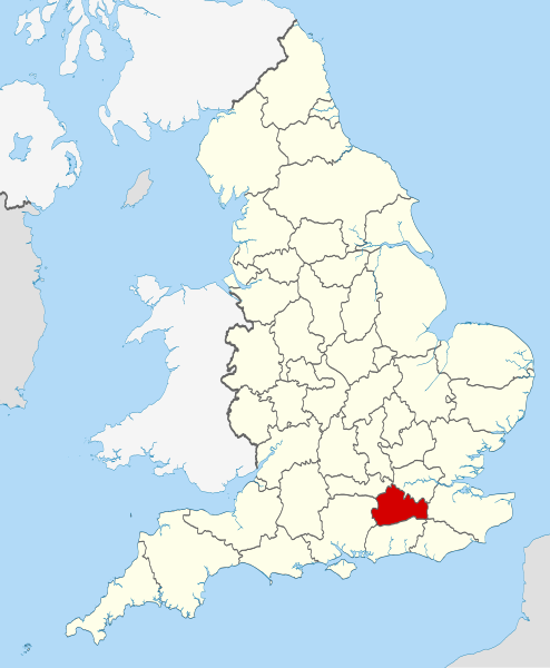
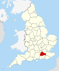
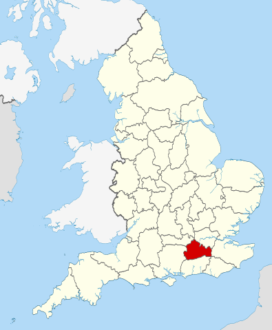
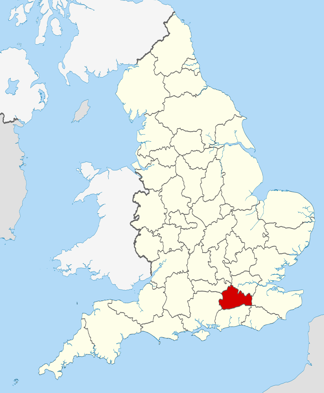
| Descripció | Location of the ceremonial county of Surrey within England. |
| Data | |
| Font |
National Geospatial-Intelligence Agency
|
| Autor | Nilfanion |
Llicència[modifica]
Jo, el titular dels drets d'autor d'aquest treball, el public sota les següents llicències:
Aquest fitxer està subjecte a la llicència de Creative Commons Reconeixement i Compartir Igual 3.0 No adaptada.
- Sou lliure de:
- compartir – copiar, distribuir i comunicar públicament l'obra
- adaptar – fer-ne obres derivades
- Amb les condicions següents:
- reconeixement – Heu de donar la informació adequada sobre l'autor, proporcionar un enllaç a la llicència i indicar si s'han realitzat canvis. Podeu fer-ho amb qualsevol mitjà raonable, però de cap manera no suggereixi que l'autor us dóna suport o aprova l'ús que en feu.
- compartir igual – Si modifiqueu, transformeu, o generareu amb el material, haureu de distribuir les vostres contribucions sota una llicència similar o una de compatible com l'original

|
S'autoritza la còpia, la distribució i la modificació d'aquest document sota els termes de la llicència de documentació lliure GNU versió 1.2 o qualsevol altra versió posterior que publiqui la Free Software Foundation; sense seccions invariants, ni textos de portada, ni textos de contraportada. S'inclou una còpia d'aquesta llicència en la secció titulada GNU Free Documentation License. |
Podeu seleccionar la llicència que vulgueu.

|
This is one of the images forming part of the Valued image set: Locator maps of the Ceremonial counties of England on Wikimedia Commons. The image set has been assessed under the valued image set criteria and is considered the most valued set on Commons within the scope:
Locator maps of the Ceremonial counties of England
You can see its nomination at Commons:Valued image candidates/Locator maps of English ceremonial counties. |
Historial del fitxer
Cliqueu una data/hora per veure el fitxer tal com era aleshores.
| Data/hora | Miniatura | Dimensions | Usuari/a | Comentari | |
|---|---|---|---|---|---|
| actual | 22:45, 23 nov 2010 | | 1.108 × 1.345 (302 Ko) | Nilfanion (discussió | contribucions) | == Summary == {{Information |Description=Location of the ceremonial county of Surrey within England. |Source=Ordnance Survey [https://www.ordnancesurvey.co.uk/opendatadownload/products.html OpenData]: *County boundaries |
No podeu sobreescriure aquest fitxer.
Ús del fitxer
Les 33 pàgines següents utilitzen aquest fitxer:
- Valued image set: Locator maps of the Ceremonial counties of England
- Commons:Valued image candidates/Locator maps of English ceremonial counties
- Category:Alumni by school in Surrey
- Category:Archaeological sites in Surrey
- Category:Births in Surrey
- Category:Bridges in Surrey
- Category:Canals in Surrey
- Category:Castles in Surrey
- Category:Cemeteries in Surrey
- Category:Deaths in Surrey
- Category:Farms in Surrey
- Category:Hospitals in Surrey
- Category:Local government in Surrey
- Category:Maps of Surrey
- Category:Meadows in Surrey
- Category:Populated places in Surrey
- Category:Rail transport in Surrey
- Category:Rivers of Surrey
- Category:Roads in Surrey
- Category:Sports in Surrey
- Category:Surrey
- Category:Surrey in the 1970s
- Category:Surrey in the 1980s
- Category:Surrey in the 1990s
- Category:Surrey in the 2000s
- Category:Surrey in the 2020s
- Category:Surrey in the 20th century
- Category:Surrey in the 21st century
- Category:Towers in Surrey
- Category:Tunnels in Surrey
- Category:Villages in Surrey
- Category:Visitor attractions in Surrey
- Category:Windmills in Surrey
Ús global del fitxer
Utilització d'aquest fitxer en altres wikis:
- Utilització a af.wikipedia.org
- Utilització a ar.wikipedia.org
- Utilització a arz.wikipedia.org
- Utilització a ast.wikipedia.org
- Utilització a azb.wikipedia.org
- Utilització a az.wikipedia.org
- Utilització a be-tarask.wikipedia.org
- Utilització a be.wikipedia.org
- Utilització a bg.wikipedia.org
- Utilització a ca.wikipedia.org
- Utilització a ceb.wikipedia.org
- Utilització a cs.wikipedia.org
- Utilització a el.wikipedia.org
- Utilització a en.wikipedia.org
- Surrey
- Winkworth Arboretum
- Witley Common
- Farley Green, Surrey
- Ribsden Holt
- Template:Surrey-geo-stub
- Winterfold Forest
- The Rye (brook)
- Savill Garden
- Wey South Path
- Ramster
- Blackheath Common
- Sandhills, Surrey
- Molesey Reservoirs
- Knight Reservoir
- Sunnyside Reservoir
- Salfords and Sidlow
- Woolmer Hill
- Frimley Lodge Park
- Grade I listed buildings in Surrey
- Coldharbour, Surrey
- Mogador, Surrey
- Haste Hill
- Penton Hook Marina
- Mole Gap Trail
- Rushmoor, Surrey
- Grade II* listed buildings in Surrey
- 1977 Surrey County Council election
- Template:Infobox English county/testcases
- Truss's Island
- Chitty's Common
- Milton Heath and The Nower
- Utilització a eo.wikipedia.org
- Utilització a es.wikipedia.org
Vegeu més usos globals d'aquest fitxer.