File:Surrey UK locator map 2010.svg
跳转到导航
跳转到搜索

此SVG文件的PNG预览的大小:494 × 600像素。 其他分辨率:198 × 240像素 | 395 × 480像素 | 633 × 768像素 | 843 × 1,024像素 | 1,687 × 2,048像素 | 1,108 × 1,345像素。
原始文件 (SVG文件,尺寸为1,108 × 1,345像素,文件大小:302 KB)
说明
说明
添加一行文字以描述该文件所表现的内容
摘要
[编辑]
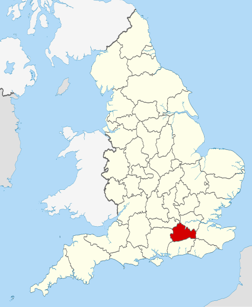
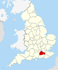
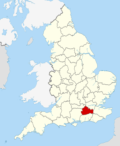
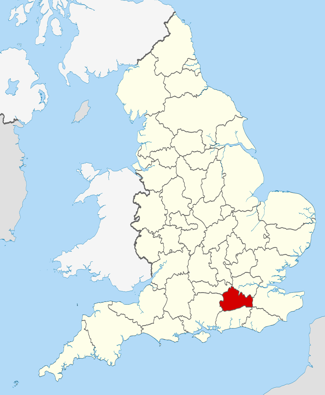
| 描述 | Location of the ceremonial county of Surrey within England. |
| 日期 | |
| 来源 |
National Geospatial-Intelligence Agency
|
| 作者 | Nilfanion |
许可协议
[编辑]
我,本作品著作权人,特此采用以下许可协议发表本作品:
本文件采用知识共享署名-相同方式共享 3.0 未本地化版本许可协议授权。
- 您可以自由地:
- 共享 – 复制、发行并传播本作品
- 修改 – 改编作品
- 惟须遵守下列条件:
- 署名 – 您必须对作品进行署名,提供授权条款的链接,并说明是否对原始内容进行了更改。您可以用任何合理的方式来署名,但不得以任何方式表明许可人认可您或您的使用。
- 相同方式共享 – 如果您再混合、转换或者基于本作品进行创作,您必须以与原先许可协议相同或相兼容的许可协议分发您贡献的作品。

|
已授权您依据自由软件基金会发行的无固定段落及封面封底文字(Invariant Sections, Front-Cover Texts, and Back-Cover Texts)的GNU自由文件许可协议1.2版或任意后续版本的条款,复制、传播和/或修改本文件。该协议的副本请见“GNU Free Documentation License”。 |
您可以选择您需要的许可协议。

|
This is one of the images forming part of the Valued image set: Locator maps of the Ceremonial counties of England on Wikimedia Commons. The image set has been assessed under the valued image set criteria and is considered the most valued set on Commons within the scope:
Locator maps of the Ceremonial counties of England
You can see its nomination at Commons:Valued image candidates/Locator maps of English ceremonial counties. |
文件历史
点击某个日期/时间查看对应时刻的文件。
| 日期/时间 | 缩略图 | 大小 | 用户 | 备注 | |
|---|---|---|---|---|---|
| 当前 | 2010年11月23日 (二) 22:45 | | 1,108 × 1,345(302 KB) | Nilfanion(留言 | 贡献) | == Summary == {{Information |Description=Location of the ceremonial county of Surrey within England. |Source=Ordnance Survey [https://www.ordnancesurvey.co.uk/opendatadownload/products.html OpenData]: *County boundaries |
您不可以覆盖此文件。
文件用途
以下33个页面使用本文件:
- Valued image set: Locator maps of the Ceremonial counties of England
- Commons:Valued image candidates/Locator maps of English ceremonial counties
- Category:Alumni by school in Surrey
- Category:Archaeological sites in Surrey
- Category:Births in Surrey
- Category:Bridges in Surrey
- Category:Canals in Surrey
- Category:Castles in Surrey
- Category:Cemeteries in Surrey
- Category:Deaths in Surrey
- Category:Farms in Surrey
- Category:Hospitals in Surrey
- Category:Local government in Surrey
- Category:Maps of Surrey
- Category:Meadows in Surrey
- Category:Populated places in Surrey
- Category:Rail transport in Surrey
- Category:Rivers of Surrey
- Category:Roads in Surrey
- Category:Sports in Surrey
- Category:Surrey
- Category:Surrey in the 1970s
- Category:Surrey in the 1980s
- Category:Surrey in the 1990s
- Category:Surrey in the 2000s
- Category:Surrey in the 2020s
- Category:Surrey in the 20th century
- Category:Surrey in the 21st century
- Category:Towers in Surrey
- Category:Tunnels in Surrey
- Category:Villages in Surrey
- Category:Visitor attractions in Surrey
- Category:Windmills in Surrey
全域文件用途
以下其他wiki使用此文件:
- af.wikipedia.org上的用途
- ar.wikipedia.org上的用途
- ast.wikipedia.org上的用途
- azb.wikipedia.org上的用途
- az.wikipedia.org上的用途
- be-tarask.wikipedia.org上的用途
- be.wikipedia.org上的用途
- bg.wikipedia.org上的用途
- ca.wikipedia.org上的用途
- ceb.wikipedia.org上的用途
- cs.wikipedia.org上的用途
- el.wikipedia.org上的用途
- en.wikipedia.org上的用途
- Surrey
- Winkworth Arboretum
- Witley Common
- Farley Green, Surrey
- Ribsden Holt
- Template:Surrey-geo-stub
- Winterfold Forest
- The Rye (brook)
- Savill Garden
- Wey South Path
- Ramster
- Blackheath Common
- Sandhills, Surrey
- Molesey Reservoirs
- Knight Reservoir
- Woolmer Hill
- Frimley Lodge Park
- Grade I listed buildings in Surrey
- Coldharbour, Surrey
- Mogador, Surrey
- Haste Hill
- Penton Hook Marina
- Mole Gap Trail
- Rushmoor, Surrey
- Grade II* listed buildings in Surrey
- 1977 Surrey County Council election
- Template:Infobox English county/testcases
- Truss's Island
- Chitty's Common
- Milton Heath and The Nower
- Mercers Lake
- eo.wikipedia.org上的用途
- es.wikipedia.org上的用途
- eu.wikipedia.org上的用途
查看此文件的更多全域用途。