File:TCDD System Map.GIF
Jump to navigation
Jump to search
Size of this preview: 800 × 368 pixels. Other resolutions: 320 × 147 pixels | 640 × 294 pixels | 1,024 × 471 pixels | 1,280 × 588 pixels | 2,828 × 1,300 pixels.
Original file (2,828 × 1,300 pixels, file size: 397 KB, MIME type: image/gif)
Captions
Captions
Add a one-line explanation of what this file represents
Summary
[edit]
| Description |
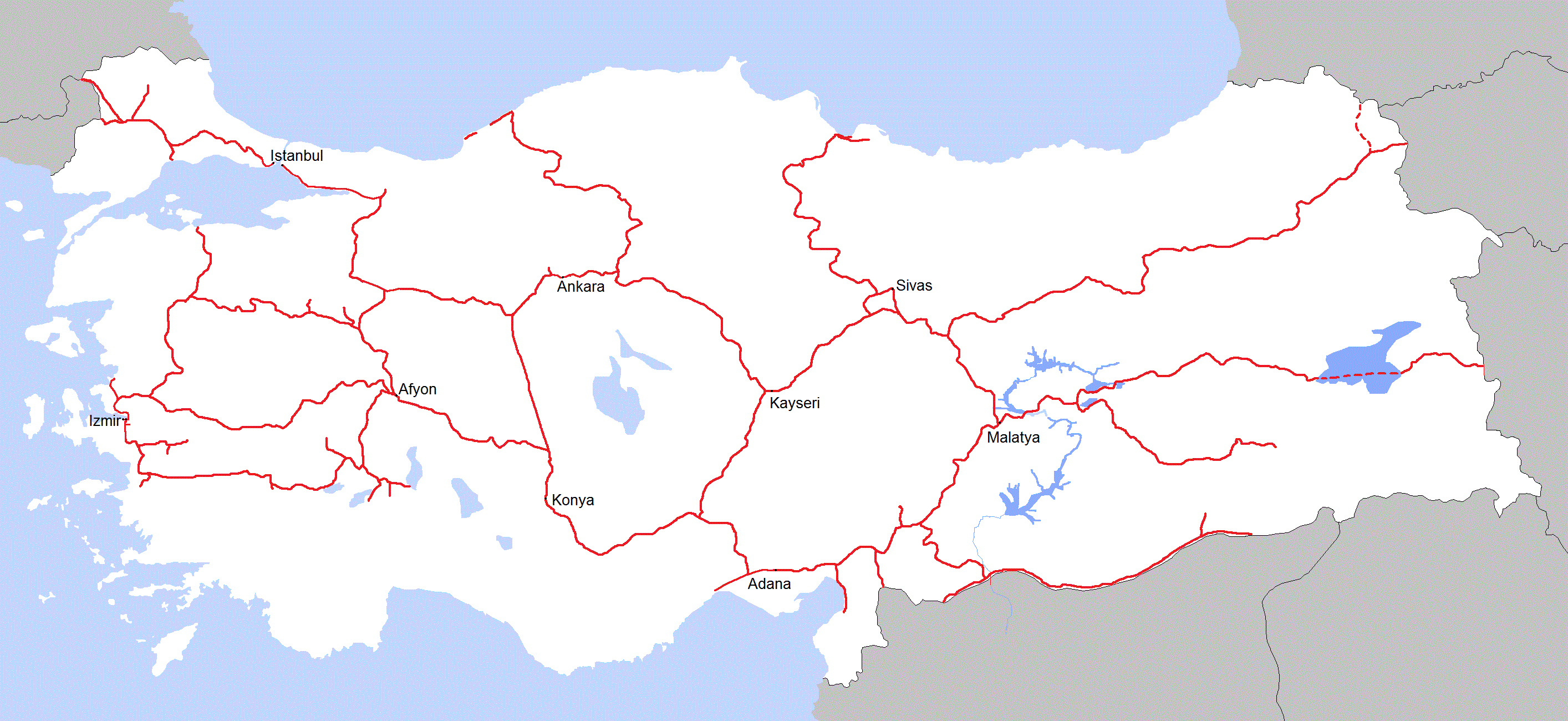
English: System map of Turkish State Railways |
| Date | |
| Source | Own work (Original text: I created this work entirely by myself.) |
| Author | Central Data Bank |
Licensing
[edit]
Central Data Bank at English Wikipedia, the copyright holder of this work, hereby publishes it under the following license:
This file is licensed under the Creative Commons Attribution 3.0 Unported license.
Attribution: Central Data Bank at English Wikipedia
- You are free:
- to share – to copy, distribute and transmit the work
- to remix – to adapt the work
- Under the following conditions:
- attribution – You must give appropriate credit, provide a link to the license, and indicate if changes were made. You may do so in any reasonable manner, but not in any way that suggests the licensor endorses you or your use.
Original upload log
[edit]
Transferred from en.wikipedia to Commons by Classical geographer.
The original description page was here. All following user names refer to en.wikipedia.
- 2010-07-09 18:33 Central Data Bank 2828×1300× (48650 bytes) {{Information |Description = |Source = I created this work entirely by myself. |Date = July 7, 2010 |Author = Central Data Bank |other_versions = }}
File history
Click on a date/time to view the file as it appeared at that time.
| Date/Time | Thumbnail | Dimensions | User | Comment | |
|---|---|---|---|---|---|
| current | 21:40, 19 November 2011 | | 2,828 × 1,300 (397 KB) | Central Data Bank~commonswiki (talk | contribs) | Changed colors and edited borders. |
| 15:59, 10 September 2011 |  | 2,828 × 1,300 (149 KB) | Central Data Bank~commonswiki (talk | contribs) | Chnaged the districts and added new routes. | |
| 08:31, 23 July 2010 |  | 2,828 × 1,300 (48 KB) | Classical geographer (talk | contribs) | {{Information |Description={{en|''no original description''}} |Source=Transferred from [http://en.wikipedia.org en.wikipedia]; transfer was stated to be made by User:Classical geographer.<br/> (Original text : ''I created this work entirely by myself. |
You cannot overwrite this file.
File usage on Commons
There are no pages that use this file.
File usage on other wikis
The following other wikis use this file:
- Usage on de.wikipedia.org
- Usage on en.wikipedia.org