File:THE WEST SIDE OF MANHATTAN, NEW YORK. THE NEW YORK, NEW JERSEY METROPOLITAN REGION IS ONE THE MOST CONGESTED URBAN... - NARA - 555742 (Corrected).jpg
Jump to navigation
Jump to search
Size of this preview: 800 × 539 pixels. Other resolutions: 320 × 216 pixels | 640 × 431 pixels | 1,024 × 690 pixels | 1,280 × 863 pixels | 3,000 × 2,022 pixels.
Original file (3,000 × 2,022 pixels, file size: 1.56 MB, MIME type: image/jpeg)
Captions
Captions
Add a one-line explanation of what this file represents
Summary[edit]
.jpg&action=edit§ion=1)
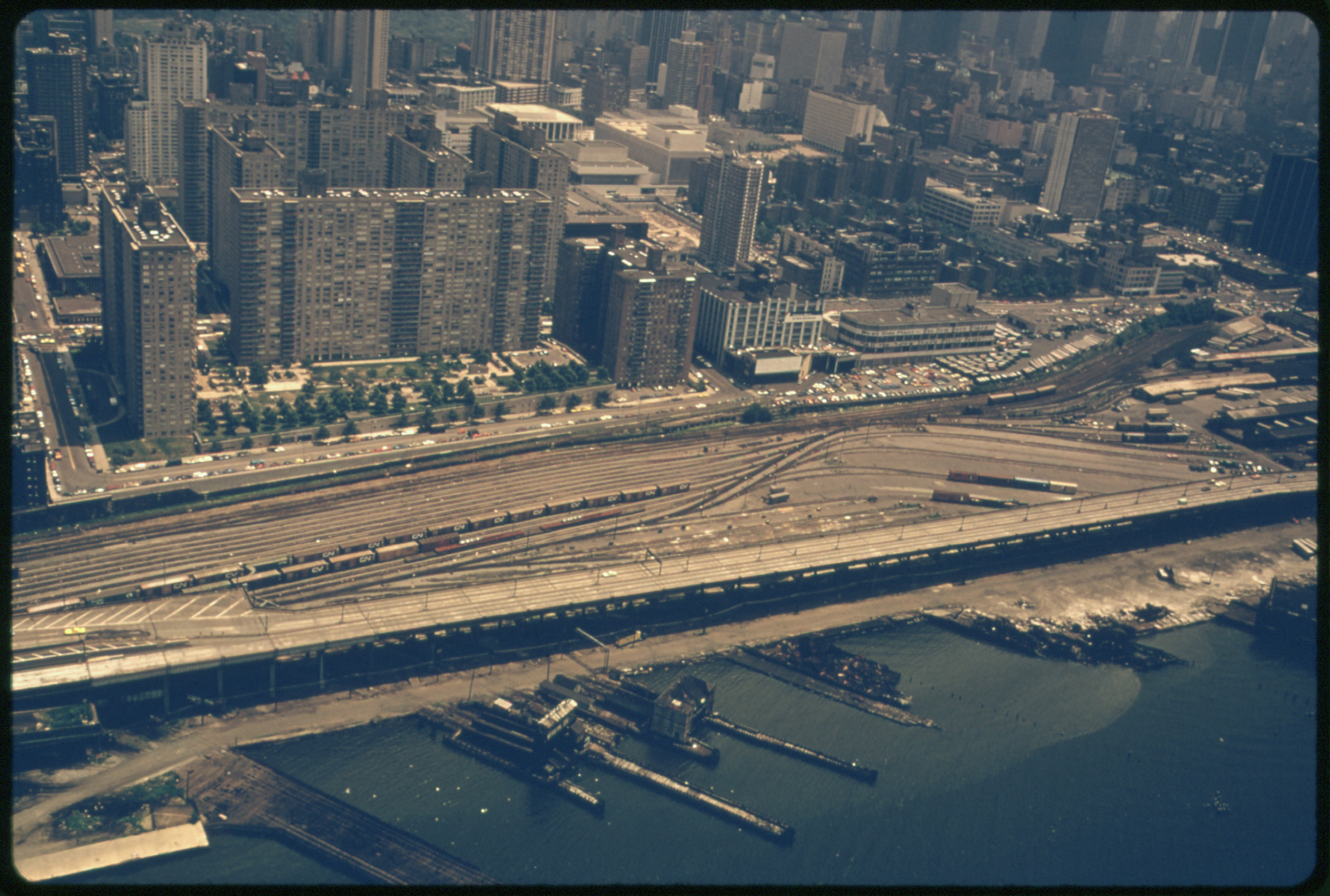
| Description | The West Side of Manhattan, New York. The New York, New Jersey metropolitan region is one of the most congested urban and industrial areas of the world. It creates stress factors for the bight including air and water pollution, destruction of wetlands which are nurseries for marine life, coastal overdevelopment, and ocean dumping of municipal and industrial wastes. |
| Date | (UTC) |
| Source |
This file was derived from: THE WEST SIDE OF MANHATTAN, NEW YORK. THE NEW YORK, NEW JERSEY METROPOLITAN REGION IS ONE THE MOST CONGESTED URBAN... - NARA - 555742.jpg: |
| Author |
|
| This is a retouched picture, which means that it has been digitally altered from its original version. Modifications: Color correction. The original can be viewed here: THE WEST SIDE OF MANHATTAN, NEW YORK. THE NEW YORK, NEW JERSEY METROPOLITAN REGION IS ONE THE MOST CONGESTED URBAN... - NARA - 555742.jpg:
|
Licensing[edit]
.jpg&action=edit§ion=2)
This image (or other media) is a work of an Environmental Protection Agency employee, taken or made as part of that person's official duties. As works of the U.S. federal government, all EPA images are in the public domain.
|
||
| Annotations | This image is annotated: View the annotations at Commons |
.jpg)
.jpg¶ms=040.775400_N_-073.988400_E_globe:Earth_class:object_type:landmark_region:US-NY_&language=en)
Original upload log[edit]
.jpg&action=edit§ion=3)
This image is a derivative work of the following images:
- File:THE WEST SIDE OF MANHATTAN, NEW YORK. THE NEW YORK, NEW JERSEY METROPOLITAN REGION IS ONE THE MOST CONGESTED URBAN... - NARA - 555742.jpg licensed with PD-USGov-EPA
- 2011-10-08T01:43:21Z US National Archives bot 3000x2022 (1255570 Bytes) == {{int:filedesc}} == {{NARA-image-full | Title = THE WEST SIDE OF MANHATTAN, NEW YORK. THE NEW YORK, NEW JERSEY METROPOLITAN REGION IS ONE THE MOST CONGESTED URBAN AND INDUSTRIAL AREAS OF THE WORLD. IT C
Uploaded with derivativeFX
File history
Click on a date/time to view the file as it appeared at that time.
| Date/Time | Thumbnail | Dimensions | User | Comment | |
|---|---|---|---|---|---|
| current | 05:39, 11 October 2022 | | 3,000 × 2,022 (1.56 MB) | Jbh10a (talk | contribs) | == {{int:filedesc}} == {{Information |Description=The West Side of Manhattan, New York. The New York, New Jersey metropolitan region is one of the most congested urban and industrial areas of the world. It creates stress factors for the bight including air and water pollution, destruction of wetlands which are nurseries for marine life, coastal overdevelopment, and ocean dumping of municipal and industrial wastes. |Source={{Derived from|THE WEST SIDE OF MANHATTAN, NEW YORK. THE NEW YORK, NEW... |
You cannot overwrite this file.
File usage on Commons
There are no pages that use this file.
File usage on other wikis
The following other wikis use this file:
- Usage on en.wikipedia.org
.jpg&oldid=798851162)