File:Taichung City Map by US Army.jpg
Jump to navigation
Jump to search
Size of this preview: 450 × 599 pixels. Other resolutions: 180 × 240 pixels | 360 × 480 pixels | 577 × 768 pixels | 769 × 1,024 pixels | 1,538 × 2,048 pixels | 5,048 × 6,723 pixels.
Original file (5,048 × 6,723 pixels, file size: 7.9 MB, MIME type: image/jpeg)
Captions
Captions
Add a one-line explanation of what this file represents
Summary
[edit]
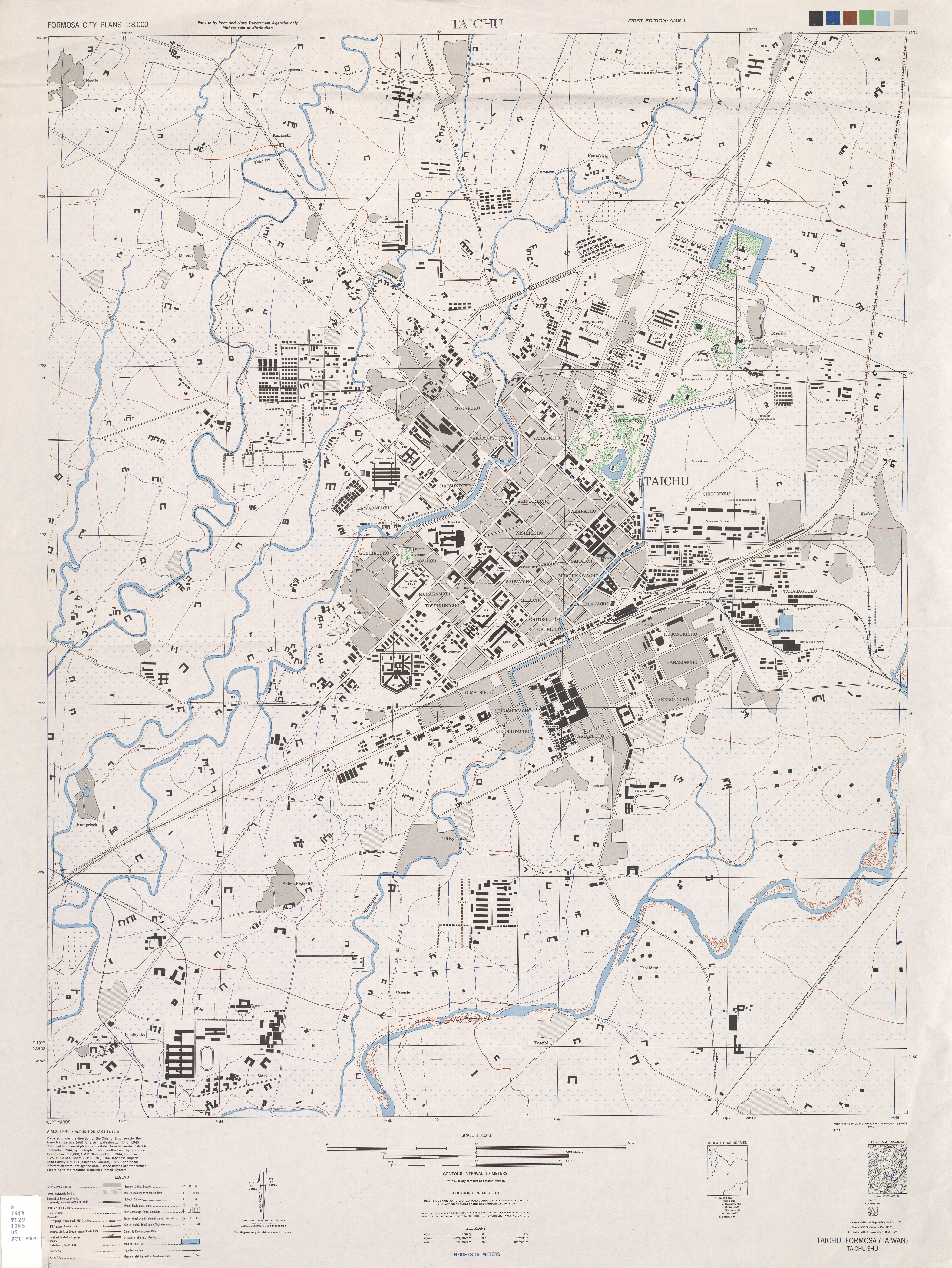
| Description | A map of Taichung City in 1940s. It's made by the U.S. Army./美軍於太平洋戰爭時期,所繪的台中市地圖。 |
| Date | 1944-1945 A.D. |
| Source | Original from http://www.lib.utexas.edu/maps/ams/formosa_city_plans/index.html(in the website of the University of Texas)/來自放在德州大學的,關於美軍測繪台灣城市之地圖的網頁,下載點:http://www.lib.utexas.edu/maps/ams/formosa_city_plans/index.html 。 |
| Author | the US Army |
Licensing
[edit]
This file is a work of a U.S. Army soldier or employee, taken or made as part of that person's official duties. As a work of the U.S. federal government, it is in the public domain in the United States.
|
 |
File history
Click on a date/time to view the file as it appeared at that time.
| Date/Time | Thumbnail | Dimensions | User | Comment | |
|---|---|---|---|---|---|
| current | 14:16, 30 January 2008 | | 5,048 × 6,723 (7.9 MB) | Yoxem (talk | contribs) | {{Information |Description=A map of Taichung City in 1940s. It's made by the U.S. Army. |Source=Original from http://www.lib.utexas.edu/maps(the website of the university of Texas) |Date=1944-1945 A.D. |Author=the US Army |Permission=See below |other_vers |
You cannot overwrite this file.
File usage on Commons
There are no pages that use this file.