File:Tambon 8504.svg
Jump to navigation
Jump to search

Size of this PNG preview of this SVG file: 605 × 599 pixels. Other resolutions: 242 × 240 pixels | 484 × 480 pixels | 775 × 768 pixels | 1,033 × 1,024 pixels | 2,067 × 2,048 pixels | 871 × 863 pixels.
Original file (SVG file, nominally 871 × 863 pixels, file size: 231 KB)
Captions
Captions
Add a one-line explanation of what this file represents
Summary
[edit]
| Description |
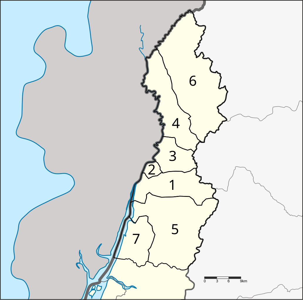
English: Map of Kraburi district, Ranong province, with the communes (tambon) numbered
|
| Date | |
| Source | Based on the map File:Amphoe 8504.svg by User:Hdamm. |
| Author | Ahoerstemeier |
This W3C-unspecified vector image was created with Inkscape .
Licensing
[edit]
I, the copyright holder of this work, hereby publish it under the following license:
This file is licensed under the Creative Commons Attribution 3.0 Unported license.
- You are free:
- to share – to copy, distribute and transmit the work
- to remix – to adapt the work
- Under the following conditions:
- attribution – You must give appropriate credit, provide a link to the license, and indicate if changes were made. You may do so in any reasonable manner, but not in any way that suggests the licensor endorses you or your use.
File history
Click on a date/time to view the file as it appeared at that time.
| Date/Time | Thumbnail | Dimensions | User | Comment | |
|---|---|---|---|---|---|
| current | 12:29, 18 February 2015 | | 871 × 863 (231 KB) | Ahoerstemeier (talk | contribs) | {{Information |Description ={{en|1=Map of Kraburi district, Ranong province, with the communes (tambon) numbered #Namchuet (น้ำจืด) #Namchuet Noi (น้ำจืดน้อย) #Ma Mu (มะมุ) #Pak Chan (ปากจั่น) #... |
You cannot overwrite this file.
File usage on Commons
There are no pages that use this file.