File:Tashkent City districts.png
Jump to navigation
Jump to search

Size of this preview: 764 × 600 pixels. Other resolutions: 306 × 240 pixels | 611 × 480 pixels | 978 × 768 pixels | 1,280 × 1,005 pixels.
Original file (1,280 × 1,005 pixels, file size: 120 KB, MIME type: image/png)
Captions
Captions
Add a one-line explanation of what this file represents
Summary[edit]
| Description |
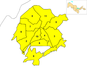
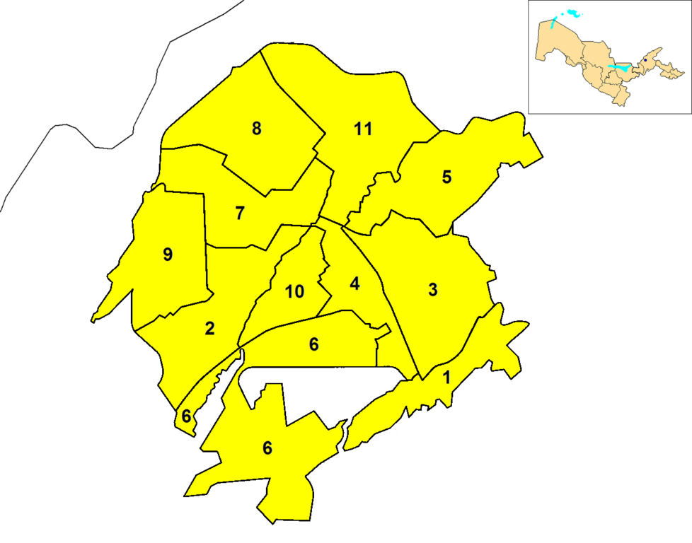
English: Map of the districts (tuman) of the province (viloyat) of Tashkent City in Uzbekistan. A map of Uzbekistan, highlighting Tashkent (blue dot), is shown in the upper right corner. |
| Date | |
| Source | Own work |
| Author | Rarelibra |
Licensing[edit]
| I, the copyright holder of this work, release this work into the public domain. This applies worldwide. In some countries this may not be legally possible; if so: I grant anyone the right to use this work for any purpose, without any conditions, unless such conditions are required by law. |
File history
Click on a date/time to view the file as it appeared at that time.
| Date/Time | Thumbnail | Dimensions | User | Comment | |
|---|---|---|---|---|---|
| current | 05:23, 10 October 2014 | | 1,280 × 1,005 (120 KB) | Carpodacus (talk | contribs) | Delete fragment of incorrect border in the old version |
| 13:08, 9 October 2014 |  | 1,280 × 1,005 (120 KB) | Carpodacus (talk | contribs) | Correct borders | |
| 15:19, 23 December 2011 |  | 1,576 × 1,237 (66 KB) | DerBorg (talk | contribs) | new version (highlighting quarter map, removed white external frame) | |
| 17:59, 20 October 2008 |  | 2,112 × 1,632 (42 KB) | Rarelibra (talk | contribs) | {{Information |Description={{en|1=Map of the districts (tuman) of the province (viloyat) of Tashkent City in Uzbekistan.}} |Source=Own work by uploader |Author=Rarelibra |Date=10/20/2008 |Permission= |other_versions= }} <!--{{ImageUplo |
You cannot overwrite this file.
File usage on Commons
There are no pages that use this file.
File usage on other wikis
The following other wikis use this file:
- Usage on ar.wikipedia.org
- Usage on ast.wikipedia.org
- Usage on azb.wikipedia.org
- Usage on de.wikipedia.org
- Usage on en.wikipedia.org
- Usage on es.wikipedia.org
- Usage on fa.wikipedia.org
- Usage on fr.wikipedia.org
- Usage on ja.wikipedia.org
- Usage on kk.wikipedia.org
- Usage on ko.wikipedia.org
- Usage on mn.wikipedia.org
- Usage on pnb.wikipedia.org
- Usage on ru.wikipedia.org
- Usage on ug.wikipedia.org
- Usage on ur.wikipedia.org
- Usage on uz.wikipedia.org
View more global usage of this file.