File:The Carolinas (MODIS 2016-05-18).jpg

Original file (2,184 × 1,824 pixels, file size: 625 KB, MIME type: image/jpeg)
Captions
Captions
Summary[edit]
.jpg&action=edit§ion=1)
| Description |
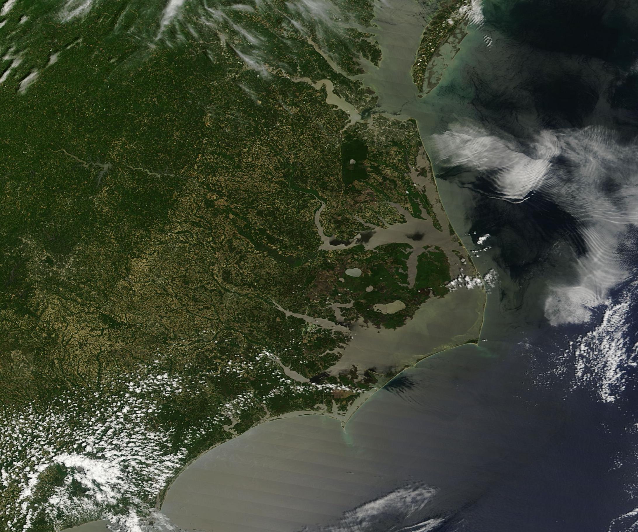
English: Kp> On May 14, 2016, NASA�s Terra satellite flew over the southeastern United States allowing the Moderate Resolution Imaging Spectroradiometer (MODIS) to capture a true-color image focused on the Carolinas.
In 1663, King Charles II of England granted the Charter of Carolina to eight �right trusty, and right well beloved� men, making them the Lord Proprietors of Carolina. Over time differences emerged in the new land, particularly in methods of agriculture and regional dependency on slavery. In 1712 a formal split occurred in the colony, creating North Carolina and South Carolina. A small bit of Virginia can be seen at the north of this image, including the mouth of the Chesapeake Bay in the northeast. Near the mouth of the Chesapeake Bay the muddiness of the James River in Virginia attests to the rainy spring weather experienced across the region. A ribbon of islands outlines the eastern coast of North Carolina. Known as the Outer Banks, this strip of barrier islands are a popular tourist destination. Although vulnerable to erosion, winds, and storms, the wide expanses of beachfront have long drawn people to them. Kitty Hawk, the site of the Wright brother�s first flight, is located on the Outer Banks, as is the Lost Colony (Roanoke Colony), where the first English baby was born in America. Cape Hatteras sits at the eastern-most point on the outer banks. The Outer Banks are separated from mainland North Carolina by two major sounds: the Albemarle Sound in the north and the larger Pamlico Sound in the south. A �sound� is a term for a salt-water lagoon. The Pamlico Sound is about 80 mi (129 km) long and 15-20 mi (24-32 km) wide. Three inlets feed the Pamlico Sound, cutting across the Outer Banks communicating with the Atlantic Ocean. While the Atlantic Ocean just offshore of the Banks can drop to 20 � 50 feet (6-15 m) depth, the Pamlico Sound has an average depth of only about 5-6 feet (1.5 to 1.8 m). South Carolina sits south of North Carolina, with a less complex coastline. The Savannah River (south of this image) marks the boundary of South Carolina and Georgia. |
||
| Date | Taken on 14 May 2016 | ||
| Source |
|
||
| Author | Jeff Schmaltz, MODIS Land Rapid Response Team, NASA GSFC |
| This media is a product of the Terra mission Credit and attribution belongs to the mission team, if not already specified in the "author" row |
Licensing[edit]
.jpg&action=edit§ion=2)
| This file is in the public domain in the United States because it was solely created by NASA. NASA copyright policy states that "NASA material is not protected by copyright unless noted". (See Template:PD-USGov, NASA copyright policy page or JPL Image Use Policy.) | ||
 |
Warnings:
|
File history
Click on a date/time to view the file as it appeared at that time.
| Date/Time | Thumbnail | Dimensions | User | Comment | |
|---|---|---|---|---|---|
| current | 19:34, 15 February 2024 | | 2,184 × 1,824 (625 KB) | OptimusPrimeBot (talk | contribs) | #Spacemedia - Upload of http://modis.gsfc.nasa.gov/gallery/images/image05182016_250m.jpg via Commons:Spacemedia |
You cannot overwrite this file.
File usage on Commons
There are no pages that use this file.
.jpg&oldid=880924060)