File:The Congo River (MODIS 2021-05-15).jpg
Jump to navigation
Jump to search

Size of this preview: 722 × 599 pixels. Other resolutions: 289 × 240 pixels | 578 × 480 pixels | 925 × 768 pixels | 1,234 × 1,024 pixels | 1,701 × 1,412 pixels.
Original file (1,701 × 1,412 pixels, file size: 227 KB, MIME type: image/jpeg)
Captions
Captions
Add a one-line explanation of what this file represents
Summary[edit]
.jpg&action=edit§ion=1)
| Description |
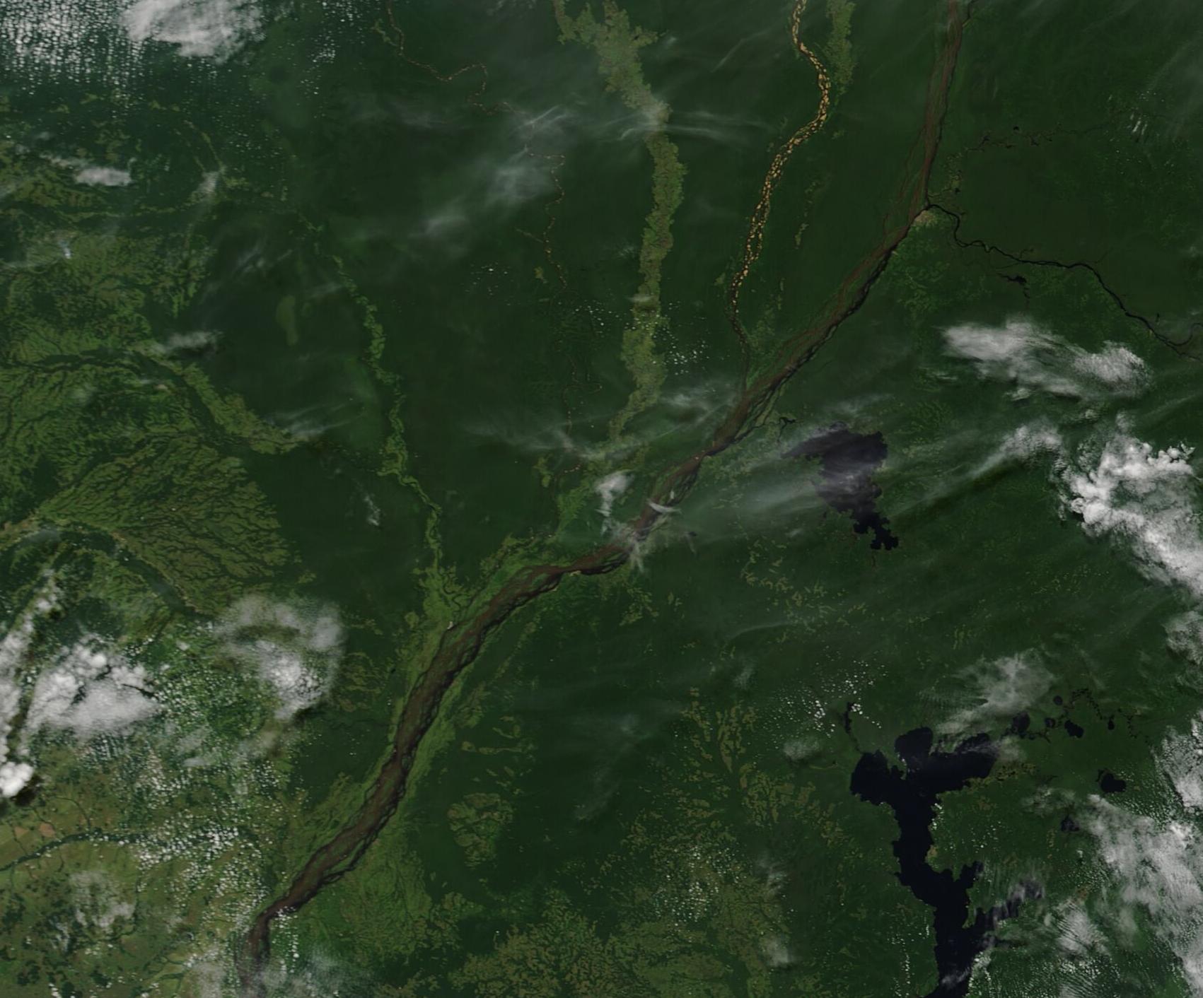
English: On May 11, 2021, the Moderate Resolution Imaging Spectroradiometer aboard NASA’s Aqua satellite acquired a true-color image of the Congo River, Lake Tumba, Lake Mai-Ndombe and the green lands of the Republic of the Congo (west) and the Democratic Republic of the Congo (east).
The Congo River cuts through clouds, cities, and jungles on its 2,718-mile (4,374-km) journey from the origins in Zambia to the outlet in the Atlantic Ocean. The longest river in Central Africa and the second-longest river in all of Africa (second only to the Nile), the Congo River Basin includes all of the Democratic Republic of the Congo (DRC), and parts of Burundi, Zambia, Angola, Rwanda, Central African Republic, Cameroon, and the Republic of the Congo, thus also earning the title of the African river with the largest basin. Lake Tumba, combined with the small Lake Tele (located in the Republic of the Congo north of this image), are part of the world’s largest swamp forest and the worlds second-largest wetland area, according to the World Wildlife Fund. This region, spanning about 126,440 square kilometers (48,820 square miles), consists of marshes, seasonally-flooded forests, and meadows. The elongated Lake Mai-Ndombe sits south of Lake Tumba. This long, shallow freshwater lake spans about 2,300 square kilometers (890 square miles) in the dry season, but during the rainy season the lake floods. Seasonal flooding can cause Lake Mai-Ndombe to triple its dry-season size. |
||
| Date | Taken on 11 May 2021 | ||
| Source |
|
||
| Author | MODIS Land Rapid Response Team, NASA GSFC |
| This media is a product of the Terra mission Credit and attribution belongs to the mission team, if not already specified in the "author" row |
Licensing[edit]
.jpg&action=edit§ion=2)
| This file is in the public domain in the United States because it was solely created by NASA. NASA copyright policy states that "NASA material is not protected by copyright unless noted". (See Template:PD-USGov, NASA copyright policy page or JPL Image Use Policy.) | ||
 |
Warnings:
|
File history
Click on a date/time to view the file as it appeared at that time.
| Date/Time | Thumbnail | Dimensions | User | Comment | |
|---|---|---|---|---|---|
| current | 17:47, 30 January 2024 | | 1,701 × 1,412 (227 KB) | OptimusPrimeBot (talk | contribs) | #Spacemedia - Upload of http://modis.gsfc.nasa.gov/gallery/images/image05152021_250m.jpg via Commons:Spacemedia |
You cannot overwrite this file.
File usage on Commons
The following page uses this file:
.jpg&oldid=865156793)