File:The Ghan route map.png
Jump to navigation
Jump to search

Size of this preview: 650 × 600 pixels. Other resolutions: 260 × 240 pixels | 520 × 480 pixels | 832 × 768 pixels | 1,109 × 1,024 pixels | 1,300 × 1,200 pixels.
Original file (1,300 × 1,200 pixels, file size: 285 KB, MIME type: image/png)
Captions
Captions
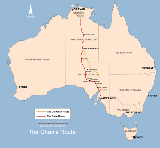
Map of the Adelaide–Darwin railway (since 1980) and the former Central Australian Railway, on which The Ghan passenger train operates.
Summary[edit]
| Description |
English: The Ghan route map created by Bidgee based on other Ghan route maps on the internet which are low resolution and are not free to use . |
| Date | |
| Source | Own work |
| Author | Bidgee |
| Other versions |
 |
Licensing[edit]
I, the copyright holder of this work, hereby publish it under the following license:
This file is licensed under the Creative Commons Attribution 3.0 Unported license.
- You are free:
- to share – to copy, distribute and transmit the work
- to remix – to adapt the work
- Under the following conditions:
- attribution – You must give appropriate credit, provide a link to the license, and indicate if changes were made. You may do so in any reasonable manner, but not in any way that suggests the licensor endorses you or your use.
File history
Click on a date/time to view the file as it appeared at that time.
| Date/Time | Thumbnail | Dimensions | User | Comment | |
|---|---|---|---|---|---|
| current | 11:38, 2 December 2008 | | 1,300 × 1,200 (285 KB) | Bidgee (talk | contribs) | Fix scale (Upload take 42) |
| 11:36, 2 December 2008 |  | 1,300 × 1,200 (288 KB) | Bidgee (talk | contribs) | Reverted to version as of 19:22, 13 June 2008 | |
| 10:57, 2 December 2008 | No thumbnail | (285 KB) | Bidgee (talk | contribs) | Fix scale. | |
| 19:22, 13 June 2008 |  | 1,300 × 1,200 (288 KB) | Bidgee (talk | contribs) | Update {{ImageUpload|basic}} | |
| 09:39, 20 May 2008 |  | 1,200 × 1,121 (491 KB) | Bidgee (talk | contribs) | Correcting font sizes | |
| 09:06, 20 May 2008 |  | 1,200 × 1,121 (486 KB) | Bidgee (talk | contribs) | fix state and territory borders. | |
| 08:15, 20 May 2008 |  | 1,200 × 1,121 (415 KB) | Bidgee (talk | contribs) | Image fix | |
| 07:55, 20 May 2008 |  | 1,200 × 1,121 (415 KB) | Bidgee (talk | contribs) | {{Information |Description=The Ghan route map created by Bidgee based on other Ghan route maps on the internet which are low resolution and are not free to use. |Source=self-made |Date=20th May 2008 |Author= Bidgee |Permiss |
You cannot overwrite this file.
File usage on Commons
The following 2 pages use this file:
File usage on other wikis
The following other wikis use this file:
- Usage on ca.wikipedia.org
- Usage on en.wikipedia.org
- Usage on en.wikivoyage.org
- Usage on es.wikipedia.org
- Usage on fi.wikipedia.org
- Usage on fr.wikipedia.org
- Usage on hi.wikipedia.org
- Usage on hu.wikipedia.org
- Usage on it.wikipedia.org
- Usage on ja.wikipedia.org
- Usage on ko.wikipedia.org
- Usage on ml.wikipedia.org
- Usage on nl.wikipedia.org
- Usage on pl.wikipedia.org
- Usage on simple.wikipedia.org
- Usage on sv.wikipedia.org
- Usage on www.wikidata.org
- Usage on zh.wikipedia.org