File:The map of Europe by treaty - Austria Italy 1866.jpg
Jump to navigation
Jump to search
Size of this preview: 556 × 600 pixels. Other resolutions: 222 × 240 pixels | 445 × 480 pixels | 1,000 × 1,079 pixels.
Original file (1,000 × 1,079 pixels, file size: 260 KB, MIME type: image/jpeg)
Captions
Captions
Add a one-line explanation of what this file represents
Summary[edit]
| Description |
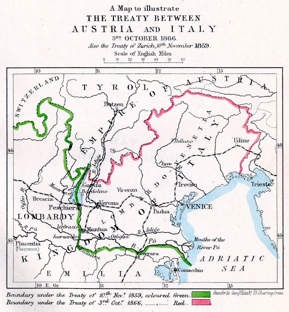
Italiano: Mappa che illustra il trattato del 3 ottobre 1866 tra Austra e Italia |
| Date | |
| Source | E. Hertslet, The Map of Europe by Treaty, vol. III, 1875 |
| Author | E. Hertslet |
Licensing[edit]
|
This work is in the public domain in its country of origin and other countries and areas where the copyright term is the author's life plus 70 years or fewer. This work is in the public domain in the United States because it was published (or registered with the U.S. Copyright Office) before January 1, 1929. | |
| This file has been identified as being free of known restrictions under copyright law, including all related and neighboring rights. | |
File history
Click on a date/time to view the file as it appeared at that time.
| Date/Time | Thumbnail | Dimensions | User | Comment | |
|---|---|---|---|---|---|
| current | 18:46, 18 October 2016 | | 1,000 × 1,079 (260 KB) | M.casanova (talk | contribs) | User created page with UploadWizard |
You cannot overwrite this file.
File usage on Commons
The following page uses this file:
File usage on other wikis
The following other wikis use this file:
- Usage on en.wikipedia.org
- Usage on nl.wikipedia.org