File:Tirol 1918.png
Jump to navigation
Jump to search
Size of this preview: 796 × 600 pixels. Other resolutions: 319 × 240 pixels | 637 × 480 pixels | 1,019 × 768 pixels | 1,280 × 965 pixels | 1,502 × 1,132 pixels.
Original file (1,502 × 1,132 pixels, file size: 193 KB, MIME type: image/png)
Captions
Captions
Add a one-line explanation of what this file represents
Summary
[edit]| Description |
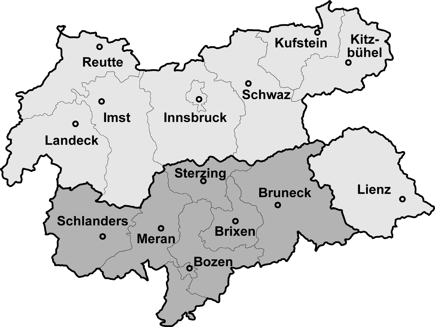
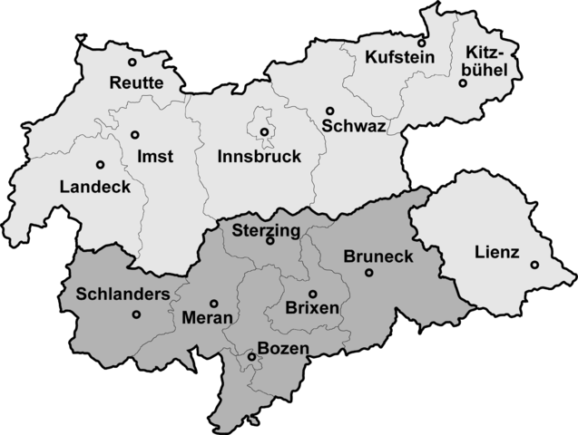
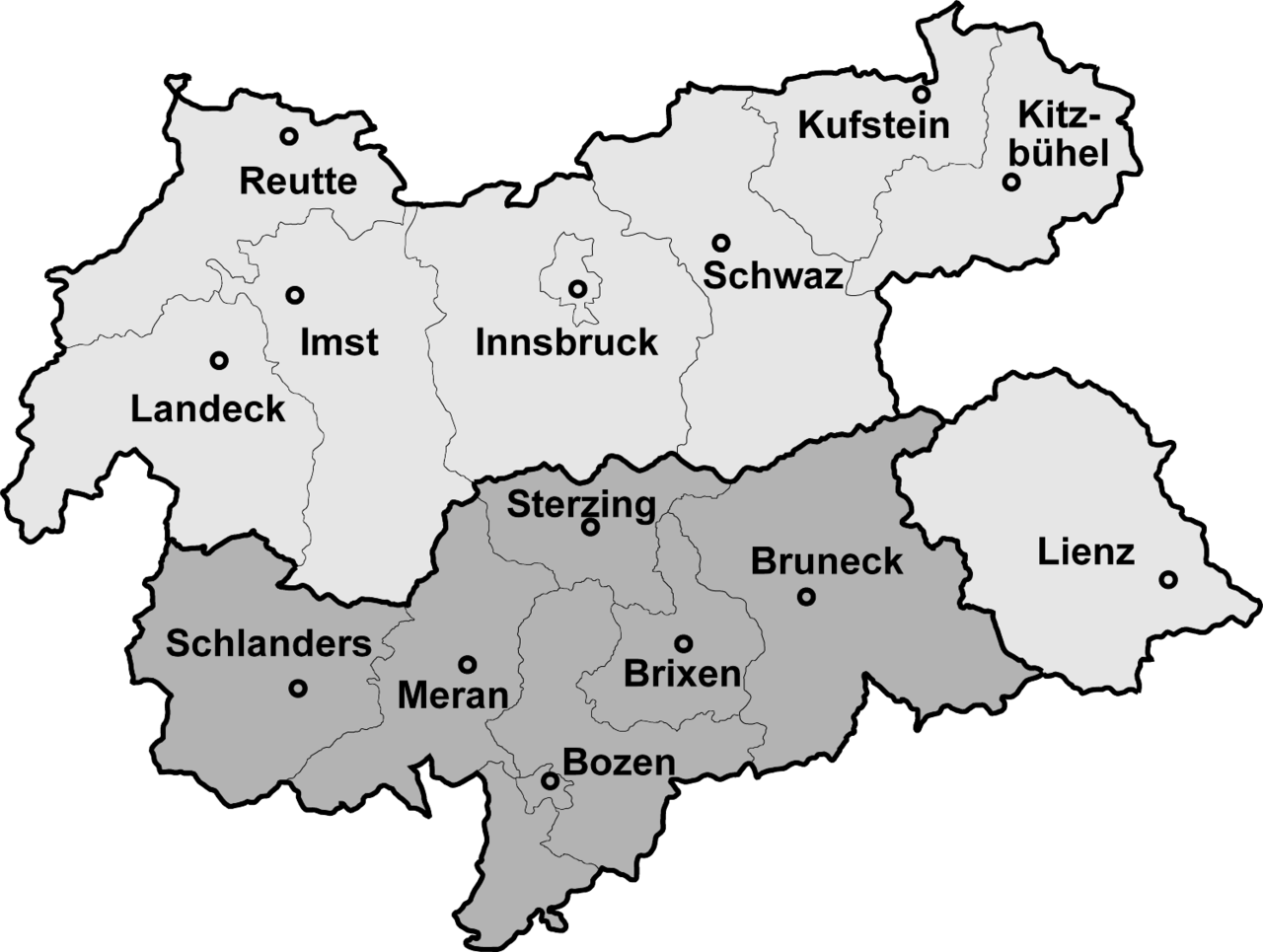
Map of North, South and Eastern Tirol with district borders Deutsch: Isolierte Lage des Bezirks Lienz (Osttirol) nach der Abtrennung Südtirols (dunkelgrau) 1918
English: Tyrol after 1918, the southern part is now a part of Italy
Português: Mapa do Tirol com a divisão de 1918 que o dividiu entre Áustria (parte setentrional) e Itália (parte meridional) |
|||
| Date | 4 February 2006 (upload date) | |||
| Source | Map drawn by (Geiserich77) | |||
| Author | Geiserich77 | |||
| Other versions |
|


|
Permission is granted to copy, distribute and/or modify this document under the terms of the GNU Free Documentation License, Version 1.2 or any later version published by the Free Software Foundation; with no Invariant Sections, no Front-Cover Texts, and no Back-Cover Texts. A copy of the license is included in the section entitled GNU Free Documentation License. |
| This file is licensed under the Creative Commons Attribution-Share Alike 3.0 Unported license. | ||
| ||
| This licensing tag was added to this file as part of the GFDL licensing update. |
File history
Click on a date/time to view the file as it appeared at that time.
| Date/Time | Thumbnail | Dimensions | User | Comment | |
|---|---|---|---|---|---|
| current | 12:10, 4 February 2006 | | 1,502 × 1,132 (193 KB) | Geiserich77 (talk | contribs) | == Beschreibung == {{Information| |Description = Map of North, South and Eastern Tirol with district borders |Source = Map drawn by (Geiserich77) |Date = 29.01.2006 |Author = Geiserich77 |Permission = GNU FDL |oth |
| 13:49, 29 January 2006 |  | 1,598 × 1,248 (197 KB) | Geiserich77 (talk | contribs) | {{Information| |Description = Map of North, South and Eastern Tirol with district borders |Source = Map drawn by (Geiserich77) |Date = 29.01.2006 |Author = Geiserich77 |Permission = GNU FDL |other_versions = - }} |
You cannot overwrite this file.
File usage on Commons
The following 2 pages use this file:
File usage on other wikis
The following other wikis use this file:
- Usage on an.wikipedia.org
- Usage on ast.wikipedia.org
- Usage on br.wikipedia.org
- Usage on cs.wikipedia.org
- Usage on eo.wikipedia.org
- Usage on es.wikipedia.org
- Usage on fi.wikipedia.org
- Usage on hu.wikipedia.org
- Usage on is.wikipedia.org
- Usage on ja.wikipedia.org
- Usage on lmo.wikipedia.org
- Usage on nds-nl.wikipedia.org
- Usage on nl.wikipedia.org