File:Tree at Stones River National Cemetery (a5e8c8f5-7c8e-4beb-b894-e5d4eea0c3b9).jpg

Original file (2,016 × 1,512 pixels, file size: 1.74 MB, MIME type: image/jpeg)
Captions
Captions

|
The categories of this image need checking. You can do so here.
|
.jpg&action=edit&withJS=MediaWiki:Catcheck.js)
Summary
[edit].jpg&action=edit§ion=1)
| English: Tree at Stones River National Cemetery | ||||
|---|---|---|---|---|
| Photographer |
English: NPS |
|||
| Title |
English: Tree at Stones River National Cemetery |
|||
| Description |
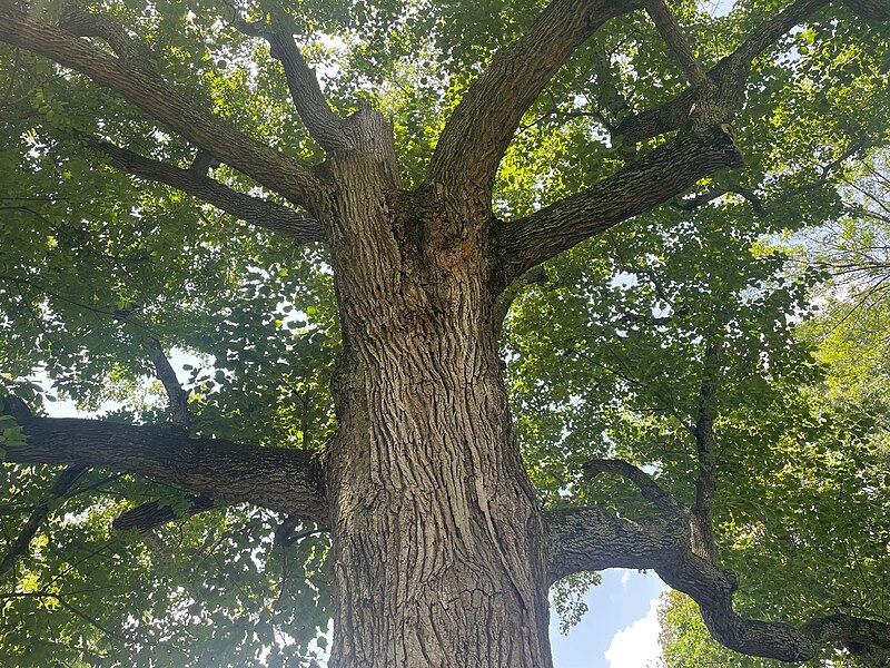
English: View up to the ridged trunk of a mature tree with thick, curving branches and broad, leafy canopy. When Stones River National Cemetery was first laid out by Captain Means in 1865, the burial grounds were devoid of trees. As burials were added, the variety of plantings increased. New evergreens were established along the avenues and deciduous trees were provided a canopy above the lawn panels that surrounded the burial grounds. In the 1970s, the NPS undertook an extensive planting campaign in the burial grounds area. While they were unable to locate the original planting plans from 1864, they did locate the as-built plan from 1892 that included trees that had likely survived from plantings installed circa 1865. The planting campaign matched the patterns indicated in the plan. *Subject: National Cemeteries
|
|||
| Depicted place |
English: Stones River National Battlefield, Rutherford County, Tennessee |
|||
| Date | Taken on 15 June 2022 | |||
| Accession number | ||||
| Source |
English: NPGallery |
|||
| Permission (Reusing this file) |
|
|||
| Contacts | English: Person: Susan Dolan Organization: Park Cultural Landscapes Program Role: Manager |
|||
| NPS Unit Code | STRI, SRNC | |||
| Album(s) | English: Stones River National Cemetery |
|||
File history
Click on a date/time to view the file as it appeared at that time.
| Date/Time | Thumbnail | Dimensions | User | Comment | |
|---|---|---|---|---|---|
| current | 05:27, 14 May 2024 | | 2,016 × 1,512 (1.74 MB) | BMacZeroBot (talk | contribs) | Batch upload (Commons:Batch uploading/NPGallery) |
You cannot overwrite this file.
File usage on Commons
The following page uses this file:
.jpg)
.jpg&oldid=922562137)