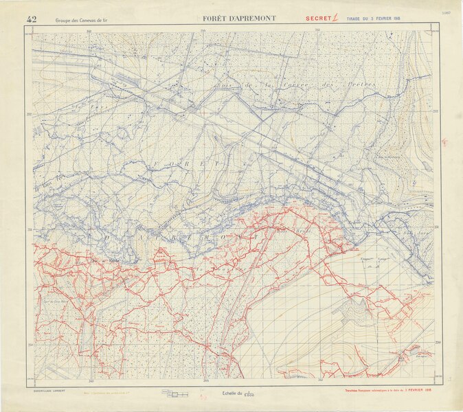
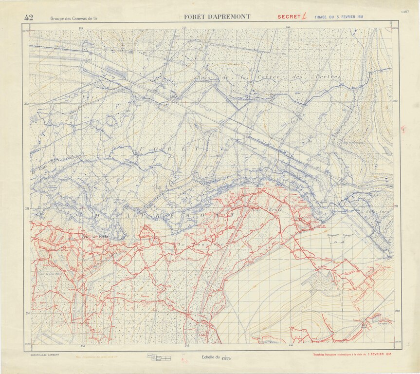
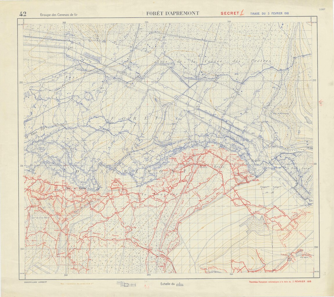
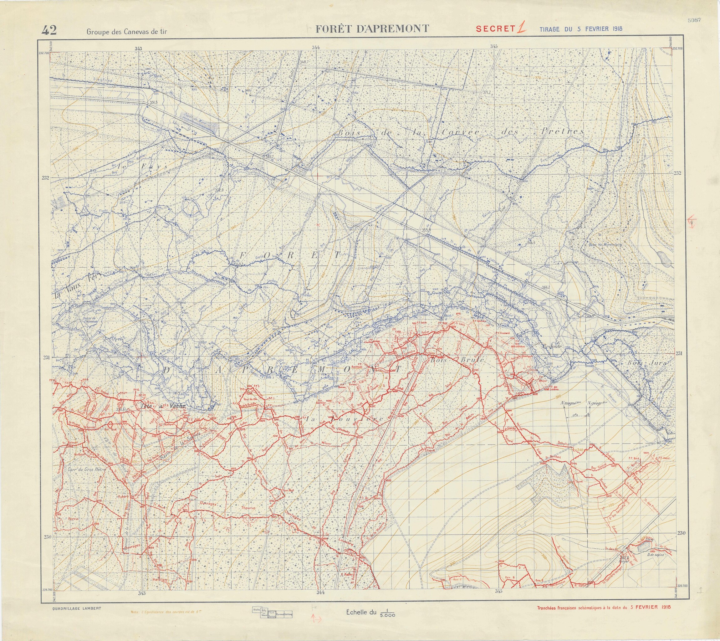
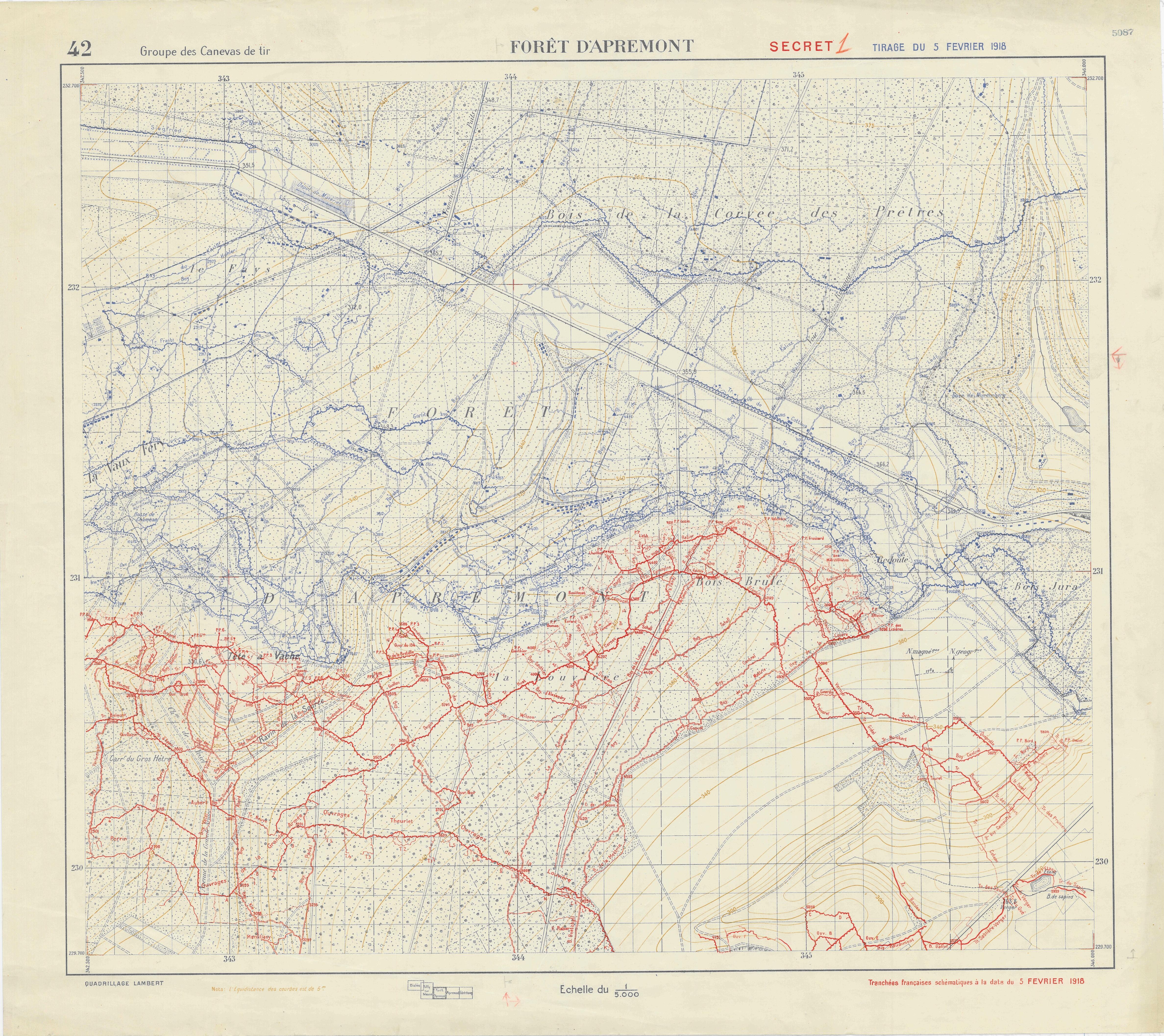
File:Trench Map, Foret D'Apremont - DPLA - 5cdfc21feb939c6d13998bd9906e9281 (page 2).pdf
Tools
Actions
General
Print/export
In other projects
Appearance
From Wikimedia Commons, the free media repository
Size of the above preview of this PDF file: 960 × 854 pixels. Other resolutions: 330 × 294 pixels | 1,280 × 1,139 pixels | 3,840 × 3,417 pixels.
Original file (4,750 × 4,227 pixels, file size: 7.69 MB, MIME type: application/pdf)
File information
Structured data
Captions
Captions
Add a one-line explanation of what this file represents
Summary
[edit]| Trench Map, Foret D'Apremont
( |
||||||||||||||
|---|---|---|---|---|---|---|---|---|---|---|---|---|---|---|
| Creator InfoField | War Department. American Expeditionary Forces. Office of the Assistant Chief of Staff Second Section (G-2). Topographical, Map Supply, and Sound and Flash Ranging Division. 2/16/1918-6/1919 | |||||||||||||
| Title |
Trench Map, Foret D'Apremont |
|||||||||||||
| Date |
5 February 1918 date QS:P571,+1918-02-05T00:00:00Z/11 |
|||||||||||||
| Collection |
institution QS:P195,Q59661038 |
|||||||||||||
| Source/Photographer |
|
|||||||||||||
| Permission (Reusing this file) |
|
|||||||||||||
| Standardized rights statement InfoField |
|
|||||||||||||
File history
Click on a date/time to view the file as it appeared at that time.
| Date/Time | Thumbnail | Dimensions | User | Comment | |
|---|---|---|---|---|---|
| current | 18:18, 9 November 2022 | 4,750 × 4,227 (7.69 MB) | DPLA bot (talk | contribs) | Uploading DPLA ID 5cdfc21feb939c6d13998bd9906e9281 |
You cannot overwrite this file.
File usage on Commons
The following page uses this file:
Metadata
This file contains additional information such as Exif metadata which may have been added by the digital camera, scanner, or software program used to create or digitize it. If the file has been modified from its original state, some details such as the timestamp may not fully reflect those of the original file. The timestamp is only as accurate as the clock in the camera, and it may be completely wrong.
| File change date and time | 03:56, 19 December 2012 |
|---|---|
| Date and time of digitizing | 03:56, 19 December 2012 |
| Date metadata was last modified | 03:56, 19 December 2012 |
| Software used | FreeFlow Accxes, Version: 15.0 Build: 294 |
| Conversion program | FreeFlow Accxes, Version: 15.0 Build: 294 |
| Encrypted | no |
| Page size | 2280 x 2029 pts |
| Version of PDF format | 1.4 |
Structured data
Items portrayed in this file
depicts
some value
author name string: War Department. American Expeditionary Forces. Office of the Assistant Chief of Staff Second Section (G-2). Topographical, Map Supply, and Sound and Flash Ranging Division. 2/16/1918-6/1919
Trench Map, Foret D'Apremont (English)
Hidden categories:
- Media contributed by the Digital Public Library of America
- Media contributed by the National Archives and Records Administration
- Media contributed by National Archives at College Park - Cartographic
- PD US
- Artworks without Wikidata item
- US National Archives series: Maps of the French Artillery Survey Group, 1917 - ca. 1919
- DPLA uploaded pdf with one page