File:Tropical Cyclone 07A (MODIS).jpg

Original file (6,561 × 4,807 pixels, file size: 3.54 MB, MIME type: image/jpeg)
Captions
Captions
Summary
[edit].jpg&action=edit§ion=1)
| Description |
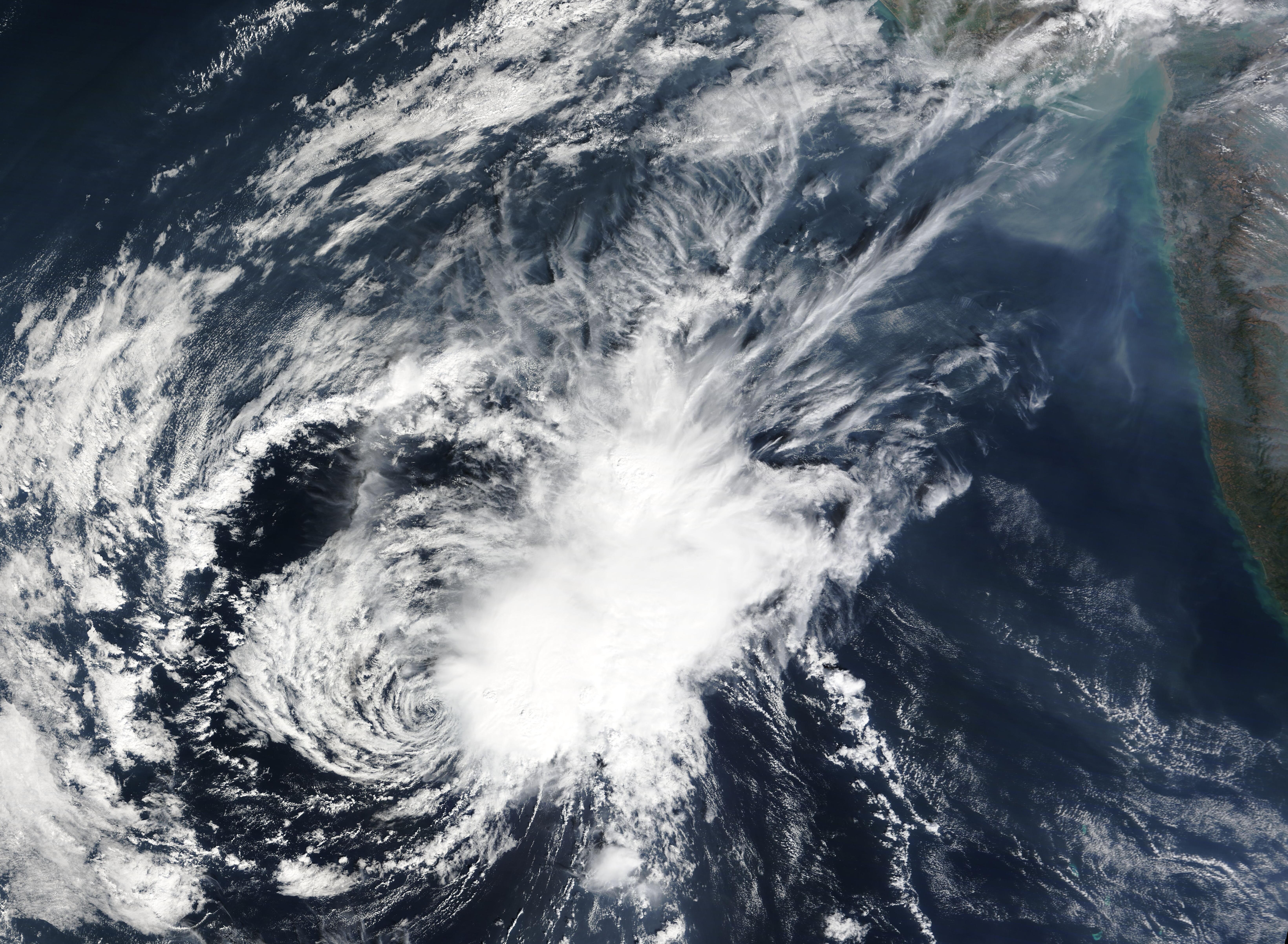
English: On December 16, 2022, the Moderate Resolution Imaging Spectroradiometer (MODIS) on board NASA’s Terra satellite acquired a true-color image of a short-lived cyclone losing the struggle to strengthen over the Arabian Sea off the western coast of India.
Tropical Cyclone 07A formed from the remnants of Tropical Cyclone Mandous, which made landfall on December 9 near the town of Mamallapuram in the state of Tamil Nadu, on the southeast coast of India. Mandous carried maximum sustained winds of 50 mph (80.5 km/h) shortly prior to landfall and quickly weakened to a depression after moving over the coast. The depression continued moving westward and once it moved across the western Indian coast on December 12, the rag-tag remnants began to coalesce, becoming a tropical depression with maximum sustained winds of 15 mph (24 km/h). By December 14, 07A achieved Tropical Cyclone status with maximum sustained winds of 50 mph (80.5 km/h). On the evening of December 16, the Joint Typhoon Warning Center issued its last advisory on Tropical Cyclone 07A. At that time, the system was located about 602 miles (969 km) southeast of Masirah Island with maximum sustained winds of 40 mph (64 km/h). The system was moving westward and facing strong vertical windshear. According to the advisory, the unfavorable conditions expected going forward mean that it is “not long for this world”. The advisory expected that 07A would continue to weaken, and would dissipate slowly over open ocean. |
||
| Date | Taken on 16 December 2022 | ||
| Source |
Tropical Cyclone 07A (direct link)
|
||
| Author | MODIS Land Rapid Response Team, NASA GSFC |
| This media is a product of the Terra mission Credit and attribution belongs to the mission team, if not already specified in the "author" row |
Licensing
[edit].jpg&action=edit§ion=2)
| This file is in the public domain in the United States because it was solely created by NASA. NASA copyright policy states that "NASA material is not protected by copyright unless noted". (See Template:PD-USGov, NASA copyright policy page or JPL Image Use Policy.) | ||
 |
Warnings:
|
File history
Click on a date/time to view the file as it appeared at that time.
| Date/Time | Thumbnail | Dimensions | User | Comment | |
|---|---|---|---|---|---|
| current | 15:07, 9 August 2023 | | 6,561 × 4,807 (3.54 MB) | OptimusPrimeBot (talk | contribs) | #Spacemedia - Upload of http://modis.gsfc.nasa.gov/gallery/images/image12172022_250m.jpg via Commons:Spacemedia |
You cannot overwrite this file.
File usage on Commons
There are no pages that use this file.
.jpg&oldid=909385161)