File:Tropical Cyclone Asani (MODIS 2022-05-11).jpg

Original file (6,243 × 5,015 pixels, file size: 1.9 MB, MIME type: image/jpeg)
Captions
Captions
Summary[edit]
.jpg&action=edit§ion=1)
| Description |
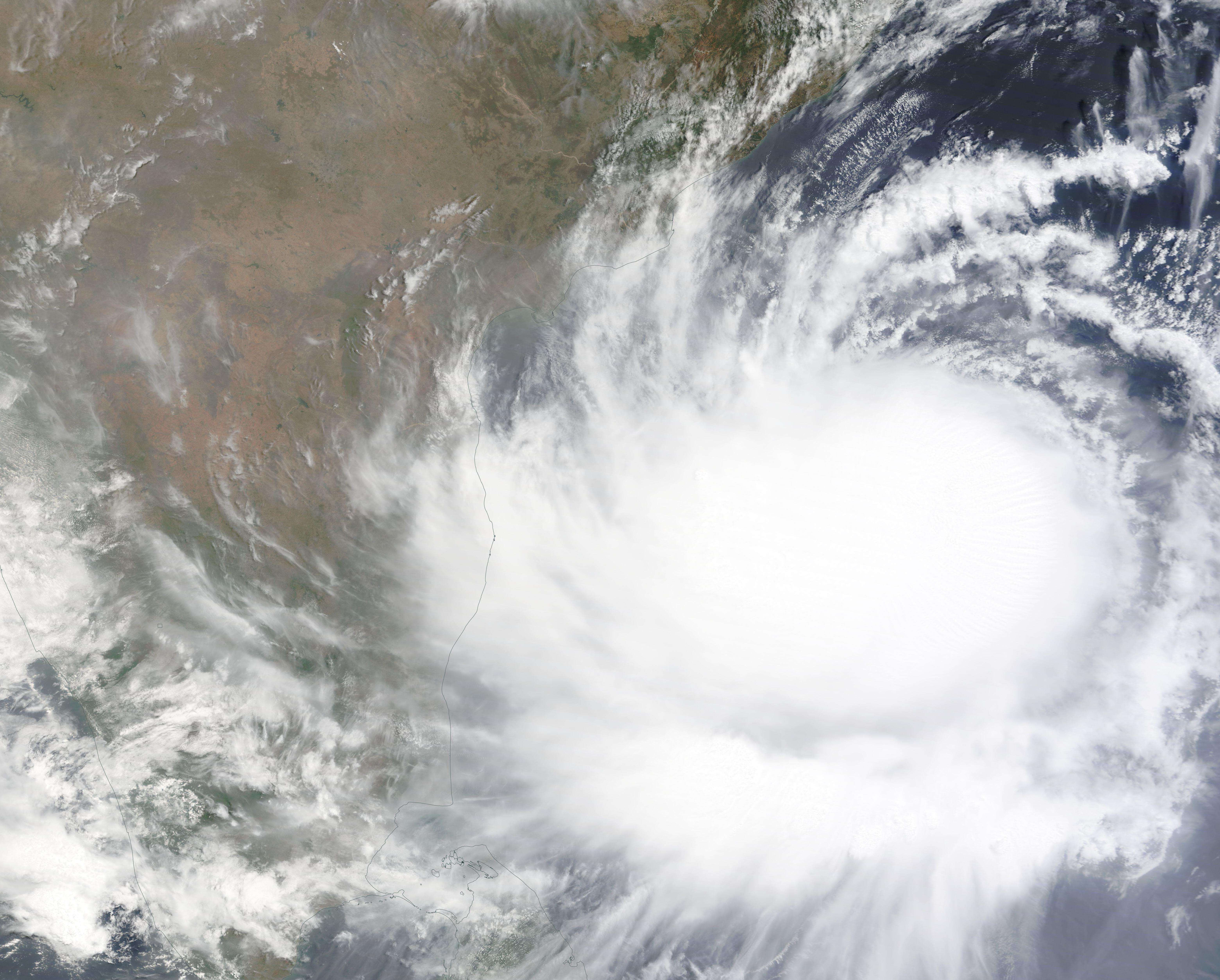
English: On May 9, 2022, the Moderate Resolution Imaging Spectroradiometer on NASA’s Terra satellite acquired a true-color image of Tropical Cyclone Asani spinning over the southern Indian Ocean. At that time, the large cyclone sported a large cloud-filled eye with weak circulation evident. The western edge of the convective bands hung over southeastern India. Some bands also crossed over Sri Lanka.
Tropical Cyclone Asani formed over the southern Bay of Bengal on May 7 and moved northwest towards the eastern central coast of India. On May 10 at 0000 UTC (May 9 at 8:00 p.m.) Asani was located about 260 km southeast of Kakinada City, a city on the northern coast of the state of Andhra Pradesh. It was packing maximum sustained winds of 120 km/h (75 mph), placing it at the lowest strength of a Category 1 storm on the Saffir Simpson Hurricane Wind Scale. Although still offshore, Tropical Cyclone Asani is bringing heavy rainfall and strong storm surge to Andhra Pradesh, triggering cancellations of airline flights and triggering placement of rescue and relief teams in preparation for landfall. By May 10 at 0900 UTC (5:00 AM UTC) Tropical Storm Asani had retained its strength as it approached the Indian coastline as a minimal Category 1 storm. At that time, it was located about 664 miles (1,070 km) southwest of Kolkata, India. The Joint Typhoon Warning Center (JTWC) forecasts that Asani will gradually weaken and turn northward and will make landfall near Gudivada on the eastern Indian coast late on May 10 or early May 11. It is expected to return to the Bay of Bengal, exiting the coast near Vishakhapatnam, likely on May 13. The storm is not expected to regenerate over the Bay of Bengal, despite warm sea surface temperatures, due to strong wind shear, but will continue to weaken as it drifts northward across the Bay of Bengal. |
||
| Date | Taken on 9 May 2022 | ||
| Source |
Tropical Cyclone Asani (direct link)
|
||
| Author | MODIS Land Rapid Response Team, NASA GSFC |
| This media is a product of the Terra mission Credit and attribution belongs to the mission team, if not already specified in the "author" row |
Licensing[edit]
.jpg&action=edit§ion=2)
| This file is in the public domain in the United States because it was solely created by NASA. NASA copyright policy states that "NASA material is not protected by copyright unless noted". (See Template:PD-USGov, NASA copyright policy page or JPL Image Use Policy.) | ||
 |
Warnings:
|
File history
Click on a date/time to view the file as it appeared at that time.
| Date/Time | Thumbnail | Dimensions | User | Comment | |
|---|---|---|---|---|---|
| current | 22:05, 9 January 2024 | | 6,243 × 5,015 (1.9 MB) | OptimusPrimeBot (talk | contribs) | #Spacemedia - Upload of http://modis.gsfc.nasa.gov/gallery/images/image05112022_250m.jpg via Commons:Spacemedia |
You cannot overwrite this file.
File usage on Commons
There are no pages that use this file.
.jpg&oldid=840283849)