File:Tropical Cyclone Vongfong (MODIS 2020-05-14).jpg

Original file (7,930 × 6,805 pixels, file size: 5.35 MB, MIME type: image/jpeg)
Captions
Captions
Summary[edit]
.jpg&action=edit§ion=1)
| Description |
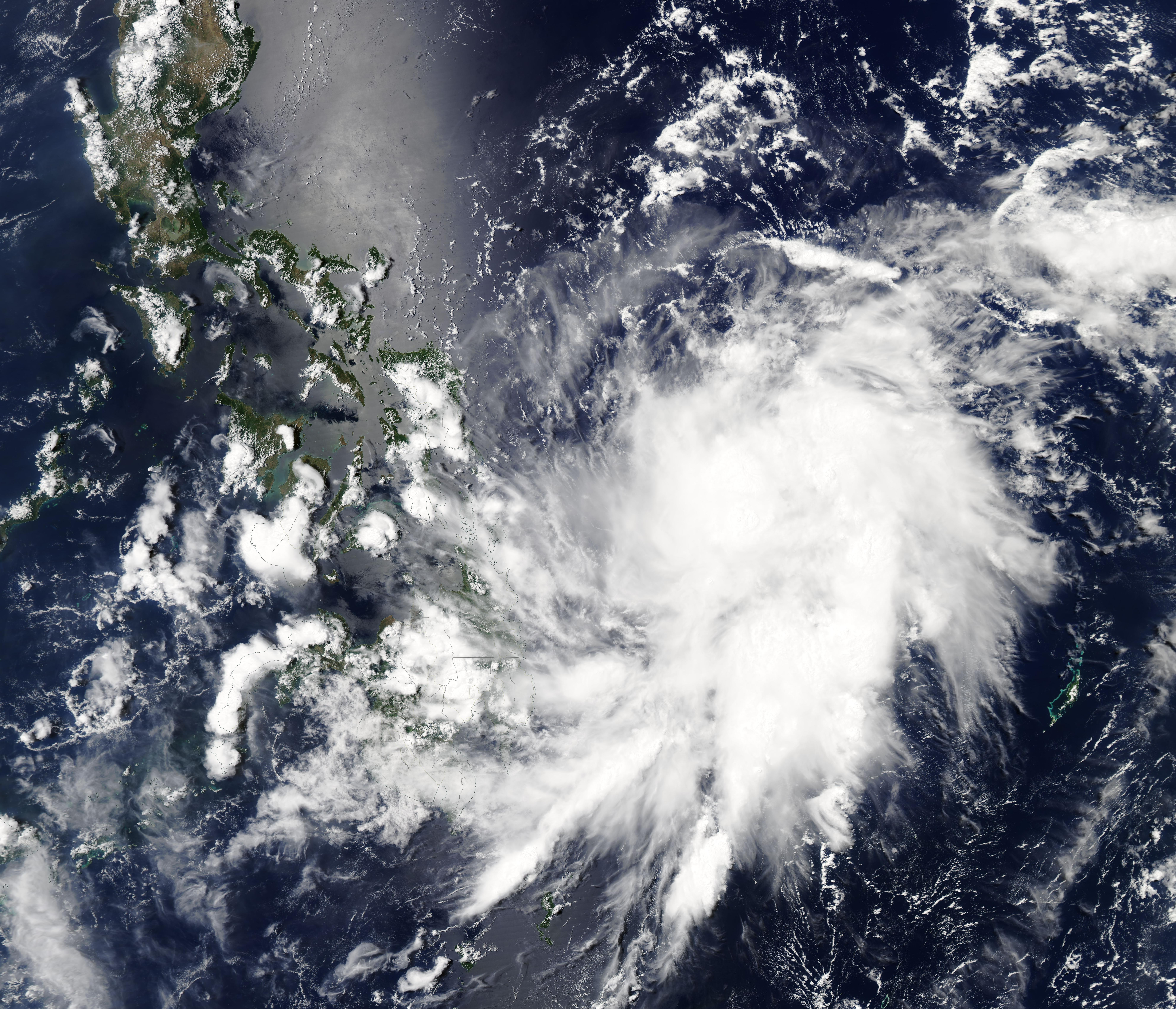
English: The first named storm of the 2020 West Pacific Typhoon season formed on May 12 southeast of the Philippines and has quickly intensified. Typhoon Vongfong (Ambo in the Philippines) has taken aim at the island nation, threatening to make a potentially disastrous landfall over Catanduanes Islands on May 15 carrying maximum sustained winds of 180 km/h (112 mph). That would be the equivalent of a Category 2 storm on the Saffir-Simpson Hurricane Wind Scale.
On March 13 at 2100 UTC (5:00 p.m. EDT) the Joint Typhoon Warning Center (JTWC) reported that Typhoon Vongfong was located about 381 nautical miles east-southeast of Manila, Philippines and was tracking westward at about 10 mph (16 km/h). The storm was carrying maximum sustained winds of about 121 mph (195 km/h). According to the JTWC, satellite imagery indicates the rapid intensification trend has continued over the past 6 hours, with the typhoon now maintaining an eye that measures roughly 8 nautical miles. Typhoon Vongfong appeared to be beginning an eyewall replacement cycle, which may cause intensity to decrease at least temporarily. The environment remains very favorable for potential additional intensification after the replacement cycle completes. On May 12, 2020, the Moderate Resolution Imaging Spectroradiometer (MODIS) on NASA’s Aqua satellite acquired a true-color image of newly-formed and intensifying Typhoon Vongfong. At the time the image was acquired, the large storm was beginning to take on a circular form and sported a consolidated center. |
||
| Date | Taken on 12 May 2020 | ||
| Source |
Tropical Cyclone Vongfong (direct link)
|
||
| Author | MODIS Land Rapid Response Team, NASA GSFC |
| This media is a product of the Aqua mission Credit and attribution belongs to the mission team, if not already specified in the "author" row |
Licensing[edit]
.jpg&action=edit§ion=2)
| This file is in the public domain in the United States because it was solely created by NASA. NASA copyright policy states that "NASA material is not protected by copyright unless noted". (See Template:PD-USGov, NASA copyright policy page or JPL Image Use Policy.) | ||
 |
Warnings:
|
File history
Click on a date/time to view the file as it appeared at that time.
| Date/Time | Thumbnail | Dimensions | User | Comment | |
|---|---|---|---|---|---|
| current | 03:06, 17 February 2024 | | 7,930 × 6,805 (5.35 MB) | OptimusPrimeBot (talk | contribs) | #Spacemedia - Upload of http://modis.gsfc.nasa.gov/gallery/images/image05142020_250m.jpg via Commons:Spacemedia |
You cannot overwrite this file.
File usage on Commons
There are no pages that use this file.
.jpg&oldid=852933156)