File:Tropical Storm Bill (MODIS 2021-06-16).jpg
Jump to navigation
Jump to search

Size of this preview: 767 × 600 pixels. Other resolutions: 307 × 240 pixels | 614 × 480 pixels | 982 × 768 pixels | 1,280 × 1,001 pixels | 2,560 × 2,002 pixels | 5,115 × 4,000 pixels.
Original file (5,115 × 4,000 pixels, file size: 2.65 MB, MIME type: image/jpeg)
Captions
Captions
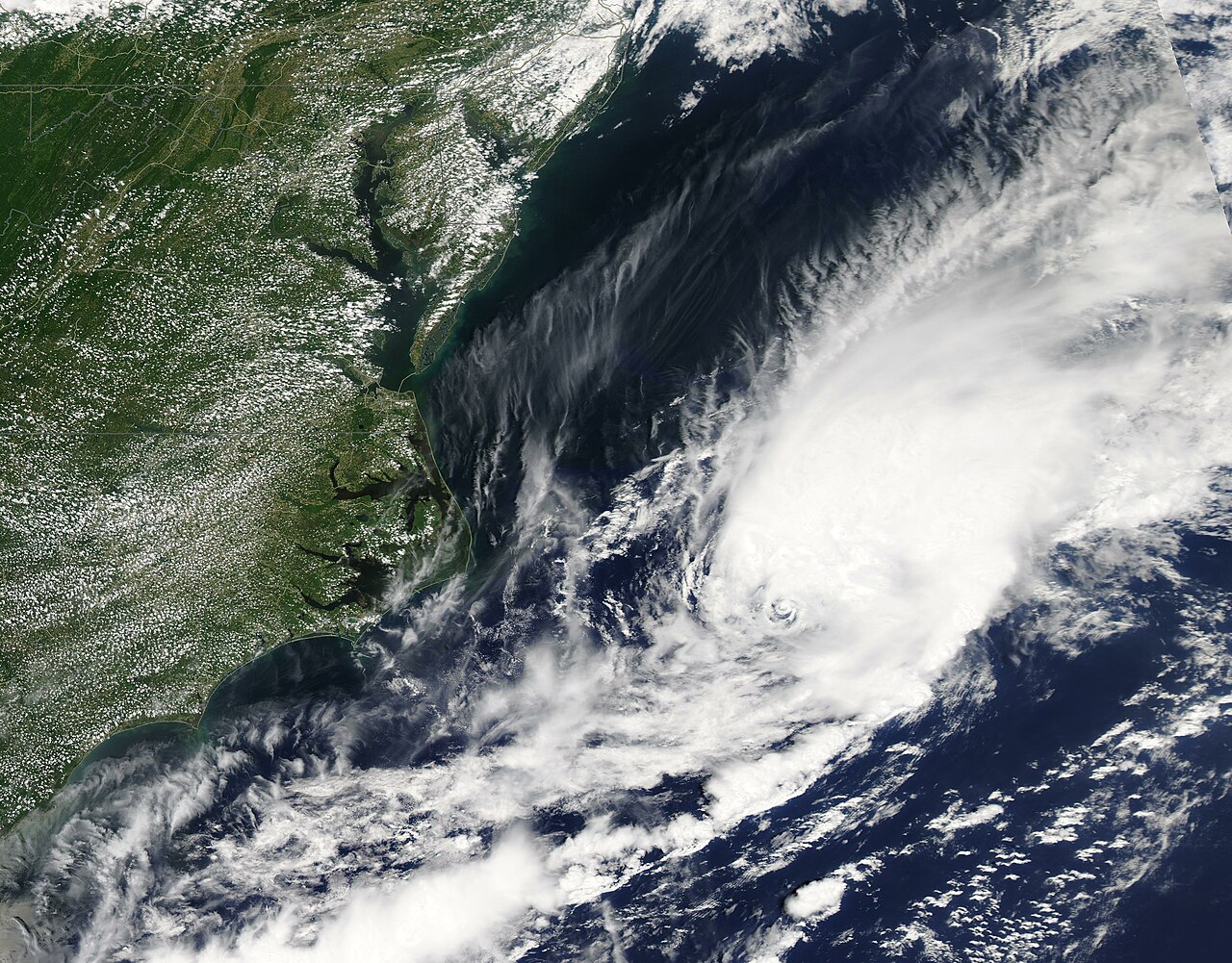
The Moderate Resolution Imaging Spectroradiometer (MODIS) on board NASA’s Aqua satellite acquired a true-color image of the nascent Tropical Storm Bill on that same day.
Summary
[edit].jpg&action=edit§ion=1)
| Description |
English: A depression sitting off the coast of North Carolina strengthened on June 14 to form the second named tropical storm of the 2021 Atlantic hurricane season. The Moderate Resolution Imaging Spectroradiometer (MODIS) on board NASA’s Aqua satellite acquired a true-color image of the nascent Tropical Storm Bill on that same day. When the image was acquired, the system had a distinct center of circulation with convection and banding features.
According to the National Hurricane Center (NHC), Tropical Storm Bill formed at 11:00 p.m. EDT (0300 UTC) on June 14 about 335 miles (540 km) east-northeast of Cape Hatteras, North Carolina. At that time, the system’s maximum sustained winds were 45 mph (75 km/h) and it was moving northeast at 23 mph (37 km). This movement has taken it away from land and out into the Atlantic Ocean. At 11:00 p.m. EDT (0300) on June 15, the NHC issued its last advisory of Bill, as the system had become extra-tropical. At that time, Bill sported maximum sustained winds of 50 mph (85 km/h) and continued to move quickly to the northeast. It was located about 335 miles (540 km) of Halifax, Nova Scotia and 290 miles (470 km) southwest of Cape Race, Newfoundland. No hazards to land are expected. |
||
| Date | Taken on 14 June 2021 | ||
| Source |
Tropical Storm Bill (direct link)
|
||
| Author | MODIS Land Rapid Response Team, NASA GSFC |
| This media is a product of the Aqua mission Credit and attribution belongs to the mission team, if not already specified in the "author" row |
Licensing
[edit].jpg&action=edit§ion=2)
| This file is in the public domain in the United States because it was solely created by NASA. NASA copyright policy states that "NASA material is not protected by copyright unless noted". (See Template:PD-USGov, NASA copyright policy page or JPL Image Use Policy.) | ||
 |
Warnings:
|
File history
Click on a date/time to view the file as it appeared at that time.
| Date/Time | Thumbnail | Dimensions | User | Comment | |
|---|---|---|---|---|---|
| current | 17:42, 30 January 2024 | | 5,115 × 4,000 (2.65 MB) | OptimusPrimeBot (talk | contribs) | #Spacemedia - Upload of http://modis.gsfc.nasa.gov/gallery/images/image06162021_250m.jpg via Commons:Spacemedia |
You cannot overwrite this file.
File usage on Commons
There are no pages that use this file.
.jpg&oldid=847284105)