File:Tularosa-Basin-NM-USGS-map opaque.gif
跳转到导航
跳转到搜索
本预览的尺寸:447 × 599像素。 其他分辨率:179 × 240像素 | 624 × 836像素。
原始文件 (624 × 836像素,文件大小:59 KB,MIME类型:image/gif)
说明
说明
添加一行文字以描述该文件所表现的内容
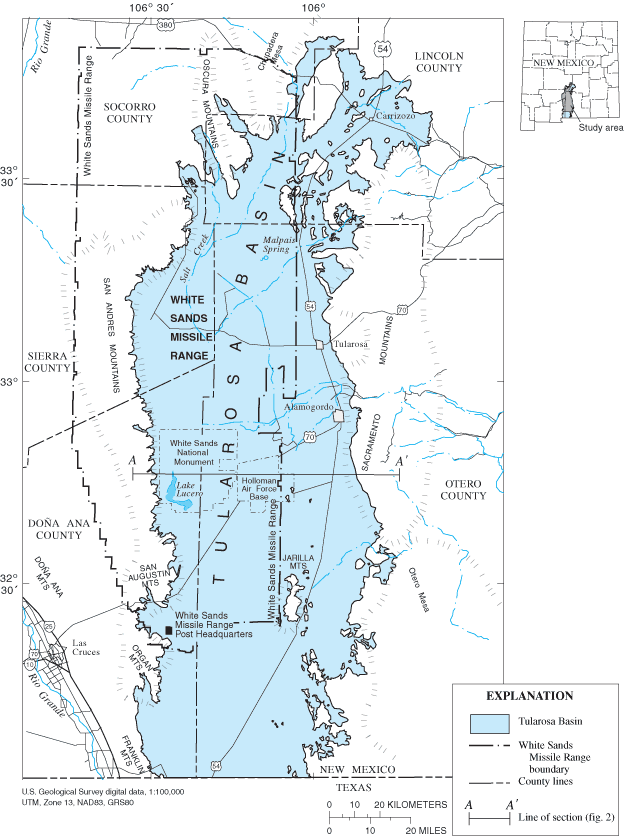
Map of Tularosa Basin
| 描述 | Location map of Tularosa Basin 2004. Huff, Glenn F. (2005) "Simulation of Ground-Water Flow in the Basin-Fill Aquifer of the Tularosa Basin, South-Central New Mexico, Predevelopment through 2040" Scientific Investigations Report 2004-5197, United States Geological Survey, Washongton, D.C., fig. 1. | |||
| 日期 | ||||
| 来源 |
USGS (https://pubs.er.usgs.gov/usgspubs/sir/sir20045197) http://pubs.usgs.gov/sir/2004/5197/ http://pubs.usgs.gov/sir/2004/5197/images/fig1.gif |
|||
| 作者 | Huff, Glenn F. (United States Geological Survey) | |||
| 授权 (二次使用本文件) |
|
|||
| 其他版本 | Image:Tularosa-Basin-NM-USGS-map.gif (transparent version) |
文件历史
点击某个日期/时间查看对应时刻的文件。
| 日期/时间 | 缩略图 | 大小 | 用户 | 备注 | |
|---|---|---|---|---|---|
| 当前 | 2007年12月11日 (二) 12:50 | | 624 × 836(59 KB) | AnonMoos(留言 | 贡献) | actual opaque version |
| 2007年10月7日 (日) 05:55 |  | 624 × 836(61 KB) | Balmung0731(留言 | 贡献) | {{Information |Description=Location map of Tularosa Basin 2004. Huff, Glenn F. (2005) "Simulation of Ground-Water Flow in the Basin-Fill Aquifer of the Tularosa Basin, South-Central New Mexico, Predevelopment through 2040" Scientific Investigations Report |
您不可以覆盖此文件。
文件用途
以下页面使用本文件:
全域文件用途
以下其他wiki使用此文件:
- bg.wikipedia.org上的用途
- en.wikipedia.org上的用途
- fa.wikipedia.org上的用途
- fr.wikipedia.org上的用途
- he.wikipedia.org上的用途
- hu.wikipedia.org上的用途
- ko.wikipedia.org上的用途
- ru.wikipedia.org上的用途
- sv.wikipedia.org上的用途
- uk.wikipedia.org上的用途
- vi.wikipedia.org上的用途
- www.wikidata.org上的用途
- zh.wikipedia.org上的用途